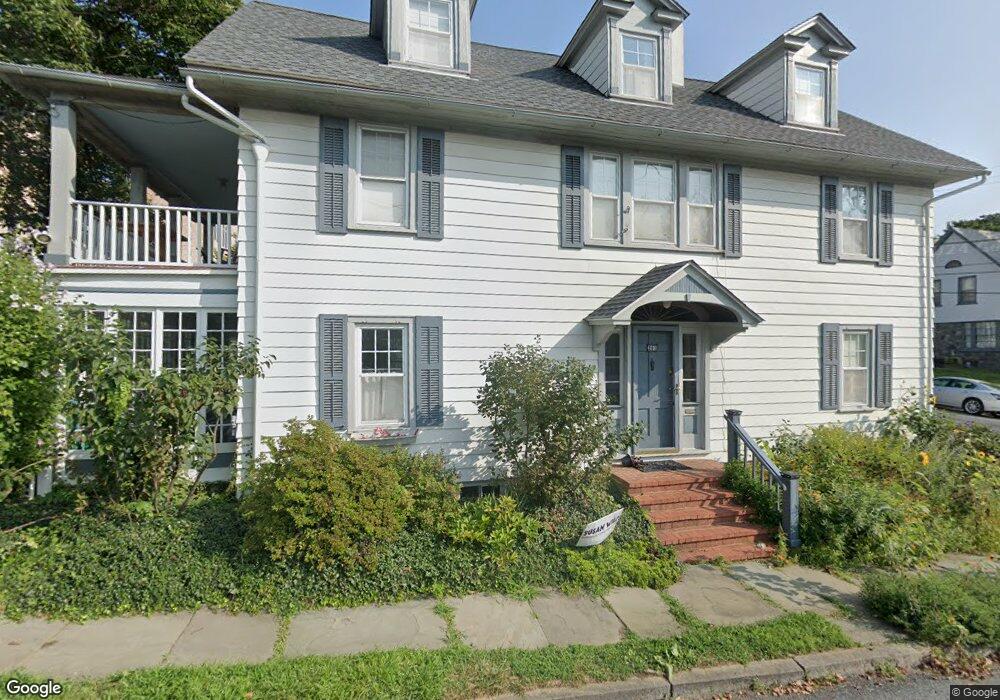
201 Parsons St Easton, PA 18042
College Hill NeighborhoodEstimated Value: $388,465 - $640,000
6
Beds
2
Baths
2,794
Sq Ft
$175/Sq Ft
Est. Value
About This Home
This home is located at 201 Parsons St, Easton, PA 18042 and is currently estimated at $489,616, approximately $175 per square foot. 201 Parsons St is a home located in Northampton County with nearby schools including Francis A. March Elementary School, Easton Area Middle School, and Easton Area High School.
Ownership History
Date
Name
Owned For
Owner Type
Purchase Details
Closed on
Jun 15, 2015
Sold by
Gerard Jonathan H and Rosenberg Pearl M
Bought by
Nicodemus Anne G and Nicodemus Julia F
Current Estimated Value
Home Financials for this Owner
Home Financials are based on the most recent Mortgage that was taken out on this home.
Original Mortgage
$261,000
Outstanding Balance
$202,727
Interest Rate
3.83%
Mortgage Type
New Conventional
Estimated Equity
$286,889
Purchase Details
Closed on
Jun 1, 1995
Bought by
Gerard Jonathan H and Rosenberg Pear
Purchase Details
Closed on
Mar 1, 1987
Bought by
Not Provided
Create a Home Valuation Report for This Property
The Home Valuation Report is an in-depth analysis detailing your home's value as well as a comparison with similar homes in the area
Home Values in the Area
Average Home Value in this Area
Purchase History
| Date | Buyer | Sale Price | Title Company |
|---|---|---|---|
| Nicodemus Anne G | $240,000 | None Available | |
| Gerard Jonathan H | $136,000 | -- | |
| Not Provided | $91,500 | -- |
Source: Public Records
Mortgage History
| Date | Status | Borrower | Loan Amount |
|---|---|---|---|
| Open | Nicodemus Anne G | $261,000 |
Source: Public Records
Tax History Compared to Growth
Tax History
| Year | Tax Paid | Tax Assessment Tax Assessment Total Assessment is a certain percentage of the fair market value that is determined by local assessors to be the total taxable value of land and additions on the property. | Land | Improvement |
|---|---|---|---|---|
| 2025 | $703 | $65,100 | $18,800 | $46,300 |
| 2024 | $6,753 | $65,100 | $18,800 | $46,300 |
| 2023 | $6,753 | $65,100 | $18,800 | $46,300 |
| 2022 | $6,668 | $65,100 | $18,800 | $46,300 |
| 2021 | $6,650 | $65,100 | $18,800 | $46,300 |
| 2020 | $6,647 | $65,100 | $18,800 | $46,300 |
| 2019 | $6,568 | $65,100 | $18,800 | $46,300 |
| 2018 | $6,475 | $65,100 | $18,800 | $46,300 |
| 2017 | $6,347 | $65,100 | $18,800 | $46,300 |
| 2016 | -- | $65,100 | $18,800 | $46,300 |
| 2015 | -- | $65,100 | $18,800 | $46,300 |
| 2014 | -- | $65,100 | $18,800 | $46,300 |
Source: Public Records
Map
Nearby Homes
- 408 Brodhead St
- 410 Brodhead St
- 412 Brodhead St
- 330 Brodhead St
- 328 Brodhead St
- 326 Brodhead St
- 129 Parsons St
- 341 Reeder St
- 132 Parsons St
- 324 Brodhead St
- 130 Parsons St
- 333 Reeder St
- 323 Brodhead St
- 128 Parsons St
- 123 Parsons St
- 124 Parsons St
- 322 Brodhead St
- 425 Brodhead St
- 425 Brodhead St
- 122 Parsons St