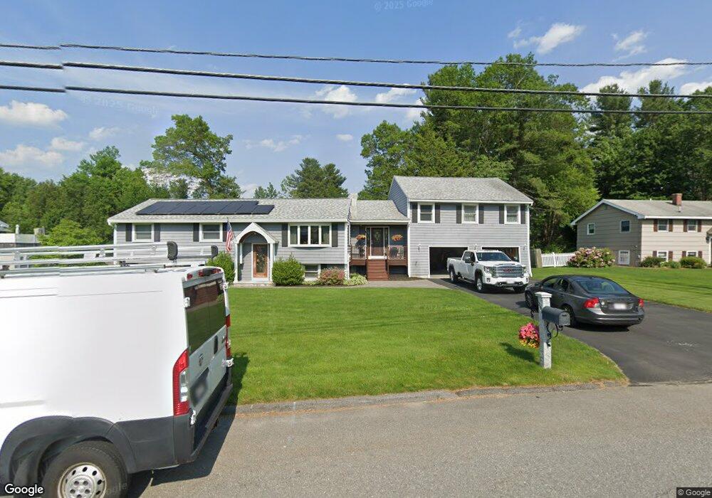
201 Patricia Ln Dracut, MA 01826
Estimated Value: $649,000 - $748,000
4
Beds
4
Baths
2,198
Sq Ft
$319/Sq Ft
Est. Value
About This Home
This home is located at 201 Patricia Ln, Dracut, MA 01826 and is currently estimated at $700,124, approximately $318 per square foot. 201 Patricia Ln is a home located in Middlesex County with nearby schools including George H. Englesby Elementary School, Richardson Middle School, and Dracut Senior High School.
Ownership History
Date
Name
Owned For
Owner Type
Purchase Details
Closed on
Mar 1, 2022
Sold by
Macdonald John A and Macdonald Diane C
Bought by
Macdonald Ft
Current Estimated Value
Purchase Details
Closed on
Feb 28, 1994
Sold by
Ash Timothy
Bought by
Macdonald John and Macdonald Diane
Home Financials for this Owner
Home Financials are based on the most recent Mortgage that was taken out on this home.
Original Mortgage
$107,900
Interest Rate
6.96%
Mortgage Type
Purchase Money Mortgage
Purchase Details
Closed on
Jul 16, 1991
Sold by
Wells Fargo Credit Co
Bought by
Ash Timothy P
Purchase Details
Closed on
Apr 24, 1991
Sold by
Jussaume Roland R
Bought by
Wells Fargo Credit Co
Create a Home Valuation Report for This Property
The Home Valuation Report is an in-depth analysis detailing your home's value as well as a comparison with similar homes in the area
Home Values in the Area
Average Home Value in this Area
Purchase History
| Date | Buyer | Sale Price | Title Company |
|---|---|---|---|
| Macdonald Ft | -- | None Available | |
| Macdonald John | $119,900 | -- | |
| Ash Timothy P | $79,900 | -- | |
| Wells Fargo Credit Co | $101,500 | -- |
Source: Public Records
Mortgage History
| Date | Status | Borrower | Loan Amount |
|---|---|---|---|
| Previous Owner | Wells Fargo Credit Co | $200,000 | |
| Previous Owner | Wells Fargo Credit Co | $20,000 | |
| Previous Owner | Wells Fargo Credit Co | $107,900 |
Source: Public Records
Tax History Compared to Growth
Tax History
| Year | Tax Paid | Tax Assessment Tax Assessment Total Assessment is a certain percentage of the fair market value that is determined by local assessors to be the total taxable value of land and additions on the property. | Land | Improvement |
|---|---|---|---|---|
| 2025 | $6,220 | $614,600 | $210,600 | $404,000 |
| 2024 | $6,368 | $609,400 | $200,500 | $408,900 |
| 2023 | $6,398 | $552,500 | $174,400 | $378,100 |
| 2022 | $5,948 | $484,000 | $158,500 | $325,500 |
| 2021 | $5,748 | $441,800 | $144,000 | $297,800 |
| 2020 | $5,678 | $425,300 | $139,700 | $285,600 |
| 2019 | $5,719 | $415,900 | $133,000 | $282,900 |
| 2018 | $5,551 | $383,400 | $133,000 | $250,400 |
| 2017 | $5,162 | $383,400 | $133,000 | $250,400 |
| 2016 | $4,816 | $324,500 | $127,800 | $196,700 |
| 2015 | $4,467 | $299,200 | $127,800 | $171,400 |
| 2014 | $4,135 | $285,400 | $127,800 | $157,600 |
Source: Public Records
Map
Nearby Homes
- 35 Camilla Ave
- 50 Stephen Ave
- 1905 Lakeview Ave
- 10 Edwards St
- 17 Spare St
- 83 Turgeon Ave
- 9 Cornstalk Ln
- 53 Vinal St
- 97 Passaconaway Dr
- 999 Hildreth St
- 29 Mill St Unit B
- 73 Mammoth Rd Unit A&B
- 73 Mammoth Rd
- 73 A&B Mammoth Rd
- 74 Tennis Plaza Rd Unit 34
- 124 Tennis Plaza Rd Unit 22
- 94 Tennis Plaza Rd Unit 10
- 84 Tennis Plaza Rd Unit 64
- 29 Wimbledon Crossing
- 53 4th St
- 191 Patricia Ln
- 211 Patricia Ln
- 5 Quincy Ave
- 181 Patricia Ln
- 200 Patricia Ln
- 60 Kings Field Rd
- 60 Kingsfield Rd
- 234 Patricia Ln
- 225 Patricia Ln
- 52 Kings Field Rd
- 190 Patricia Ln
- 15 Quincy Ave
- 171 Patricia Ln
- 22 Quincy Ave
- 8 Mullen Ln
- 69 Kings Field Rd
- 180 Patricia Ln
- 61 Kings Field Rd
- 22 Mullen Ln
- 235 Patricia Ln