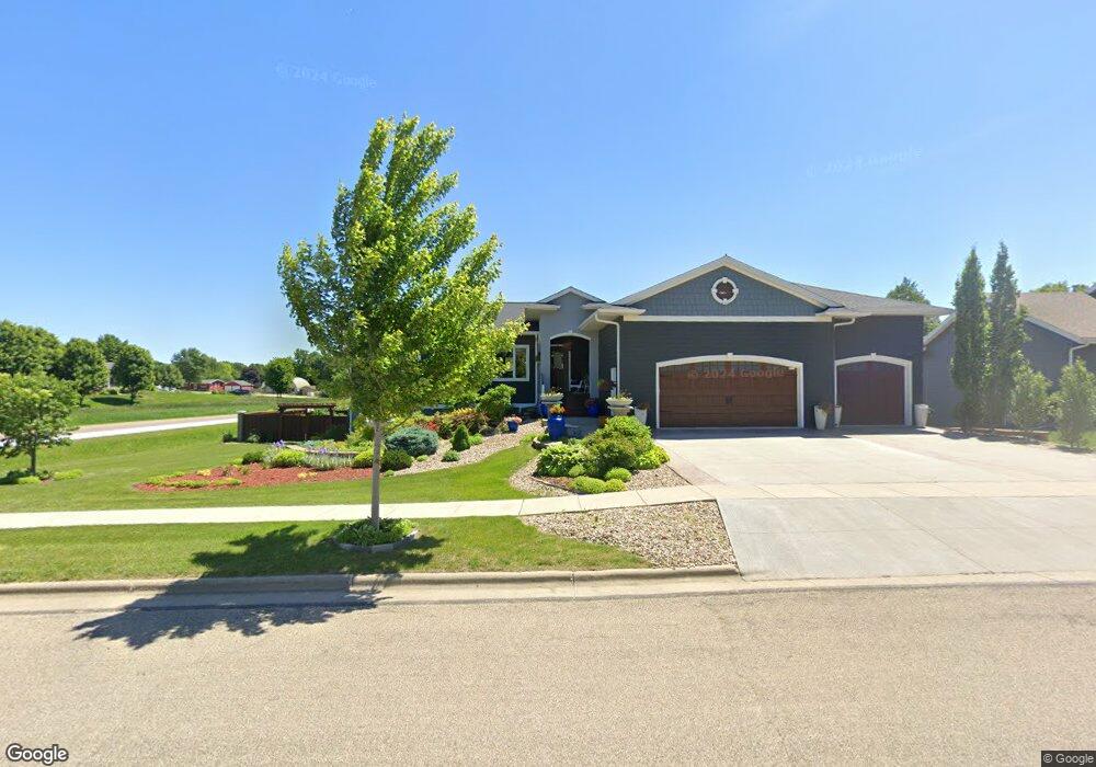
201 Pine Dr Luverne, MN 56156
Estimated Value: $352,000 - $517,000
6
Beds
4
Baths
2,972
Sq Ft
$156/Sq Ft
Est. Value
About This Home
This home is located at 201 Pine Dr, Luverne, MN 56156 and is currently estimated at $462,290, approximately $155 per square foot. 201 Pine Dr is a home located in Rock County with nearby schools including Luverne Elementary School and Luverne Senior High School.
Ownership History
Date
Name
Owned For
Owner Type
Purchase Details
Closed on
Aug 13, 2024
Sold by
Tingle Lori Ann and Winter Lori Ann
Bought by
Nelson-Bullerman Susan and Bullerman Travis Vernon
Current Estimated Value
Home Financials for this Owner
Home Financials are based on the most recent Mortgage that was taken out on this home.
Original Mortgage
$385,000
Outstanding Balance
$380,660
Interest Rate
6.89%
Mortgage Type
New Conventional
Estimated Equity
$81,630
Purchase Details
Closed on
Sep 16, 2019
Sold by
Tingle David
Bought by
Tingle Lori
Purchase Details
Closed on
Aug 22, 2017
Sold by
Leda
Bought by
Tingle David A and Tingle Lori A
Purchase Details
Closed on
May 5, 2011
Sold by
Mc Clure Construction
Bought by
Luverne Economic Development Authority
Purchase Details
Closed on
Dec 20, 2006
Sold by
Luverne Economic Development Authority
Bought by
Mc Clure Construction Inc
Create a Home Valuation Report for This Property
The Home Valuation Report is an in-depth analysis detailing your home's value as well as a comparison with similar homes in the area
Home Values in the Area
Average Home Value in this Area
Purchase History
| Date | Buyer | Sale Price | Title Company |
|---|---|---|---|
| Nelson-Bullerman Susan | $450,000 | None Listed On Document | |
| Tingle Lori | -- | None Available | |
| Tingle David A | -- | -- | |
| Luverne Economic Development Authority | -- | None Available | |
| Mc Clure Construction Inc | $600 | None Available |
Source: Public Records
Mortgage History
| Date | Status | Borrower | Loan Amount |
|---|---|---|---|
| Open | Nelson-Bullerman Susan | $385,000 |
Source: Public Records
Tax History Compared to Growth
Tax History
| Year | Tax Paid | Tax Assessment Tax Assessment Total Assessment is a certain percentage of the fair market value that is determined by local assessors to be the total taxable value of land and additions on the property. | Land | Improvement |
|---|---|---|---|---|
| 2025 | $4,570 | $466,600 | $19,300 | $447,300 |
| 2024 | $4,570 | $411,300 | $16,600 | $394,700 |
| 2023 | $4,038 | $363,700 | $16,600 | $347,100 |
| 2022 | $3,752 | $322,300 | $12,700 | $309,600 |
| 2021 | $3,320 | $301,500 | $12,700 | $288,800 |
| 2020 | $3,276 | $272,700 | $12,700 | $260,000 |
| 2019 | $1,378 | $270,000 | $12,700 | $257,300 |
| 2018 | $0 | $130,000 | $12,700 | $117,300 |
| 2017 | $0 | $12,700 | $12,700 | $0 |
| 2016 | -- | $11,500 | $11,500 | $0 |
| 2015 | -- | $0 | $0 | $0 |
| 2014 | -- | $0 | $0 | $0 |
Source: Public Records
Map
Nearby Homes
- 102 S Walnut Ave
- 604 W Warren St
- 111 S Donaldson St
- 320 SW Park St
- 717 Tallgrass Cir
- 511 W Crawford St
- 719 Tallgrass Cir
- 323 W Lincoln St
- 207 N Kniss Ave
- 518 NE Park St
- 200 S Freeman Ave Unit 206
- 109 E Luverne St Unit 337
- 109 E Luverne St Unit 220
- 614 N Estey St
- 414 N Freeman Ave
- 501 Central Ln
- 613 N Cedar St
- 742 N Freeman Ave
- 201 E Adams Ave
- 703 N Spring St