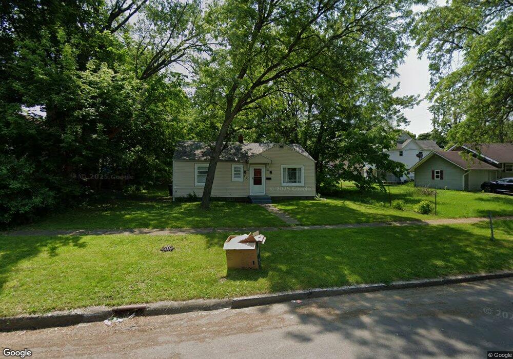
201 Rittenhouse Ave W Battle Creek, MI 49037
Central Battle Creek NeighborhoodEstimated Value: $74,000 - $124,000
3
Beds
1
Bath
936
Sq Ft
$98/Sq Ft
Est. Value
About This Home
This home is located at 201 Rittenhouse Ave W, Battle Creek, MI 49037 and is currently estimated at $91,339, approximately $97 per square foot. 201 Rittenhouse Ave W is a home located in Calhoun County with nearby schools including Ann J. Kellogg School, Springfield Middle School, and Battle Creek Central High School.
Ownership History
Date
Name
Owned For
Owner Type
Purchase Details
Closed on
Feb 19, 2025
Sold by
Moore Sidney Arnold
Bought by
Sidney Arnold Moore Revocable Living Trust and Moore
Current Estimated Value
Purchase Details
Closed on
Apr 29, 2021
Sold by
Moore Sidney
Bought by
Sami Investments Llc
Purchase Details
Closed on
Jul 29, 2002
Sold by
Moore Sidney A and Moore Sue A
Bought by
Moore Sidney A and Moore Sue A
Purchase Details
Closed on
Jul 19, 2002
Sold by
Boody Clifford R and Boody Anna M
Bought by
Moore Sue
Purchase Details
Closed on
Jun 4, 1998
Sold by
Boody Anna M
Bought by
Boody
Create a Home Valuation Report for This Property
The Home Valuation Report is an in-depth analysis detailing your home's value as well as a comparison with similar homes in the area
Home Values in the Area
Average Home Value in this Area
Purchase History
| Date | Buyer | Sale Price | Title Company |
|---|---|---|---|
| Sidney Arnold Moore Revocable Living Trust | -- | None Listed On Document | |
| Sidney Arnold Moore Revocable Living Trust | -- | None Listed On Document | |
| Sami Investments Llc | $408,266 | None Available | |
| Moore Sidney A | -- | -- | |
| Moore Sue | $24,000 | -- | |
| Boody | -- | -- |
Source: Public Records
Tax History Compared to Growth
Tax History
| Year | Tax Paid | Tax Assessment Tax Assessment Total Assessment is a certain percentage of the fair market value that is determined by local assessors to be the total taxable value of land and additions on the property. | Land | Improvement |
|---|---|---|---|---|
| 2025 | -- | $29,900 | $0 | $0 |
| 2024 | $1,001 | $24,808 | $0 | $0 |
| 2023 | $1,475 | $23,546 | $0 | $0 |
| 2022 | $1,106 | $19,270 | $0 | $0 |
| 2021 | $954 | $17,871 | $0 | $0 |
| 2020 | $944 | $19,152 | $0 | $0 |
| 2019 | $894 | $19,188 | $0 | $0 |
| 2018 | $894 | $17,013 | $660 | $16,353 |
| 2017 | $870 | $16,343 | $0 | $0 |
| 2016 | $956 | $15,075 | $0 | $0 |
| 2015 | $914 | $18,124 | $3,275 | $14,849 |
| 2014 | $914 | $18,562 | $3,275 | $15,287 |
Source: Public Records
Map
Nearby Homes
- 30 Harris St
- 210 Battle Creek Ave
- 21 Spring St
- 39 Harris St
- 171 Goguac St W
- 212 Goguac St W
- 96 Battle Creek Ave
- 131 Spring St
- 180 Upton Ave
- 207 Upton Ave Unit V/L
- 178 Webber St
- 211 Upton Ave Unit V/L
- 57 Boulder St
- 133 Harris St
- 64 E Grand Circle Ave
- 71 Burnham St W
- 324 Goguac St W
- 111 Burnham St W
- 17 Tennyson Ave
- 100 Eldred St
- 197 Rittenhouse Ave W
- 193 Rittenhouse Ave W
- 129 Meachem Ave
- 189 Rittenhouse Ave W
- 125 Meachem Ave
- 186 Battle Creek Ave
- 190 Battle Creek Ave
- 185 Rittenhouse Ave W
- 178 Battle Creek Ave
- 137 Meachem Ave
- 174 Battle Creek Ave
- 105 Meachem Ave
- 181 Rittenhouse Ave W
- 200 Rittenhouse Ave W
- 198 Rittenhouse Ave W
- 170 Battle Creek Ave
- 196 Rittenhouse Ave W
- 130 Meachem Ave
- 122 Meachem Ave
- 177 Rittenhouse Ave W