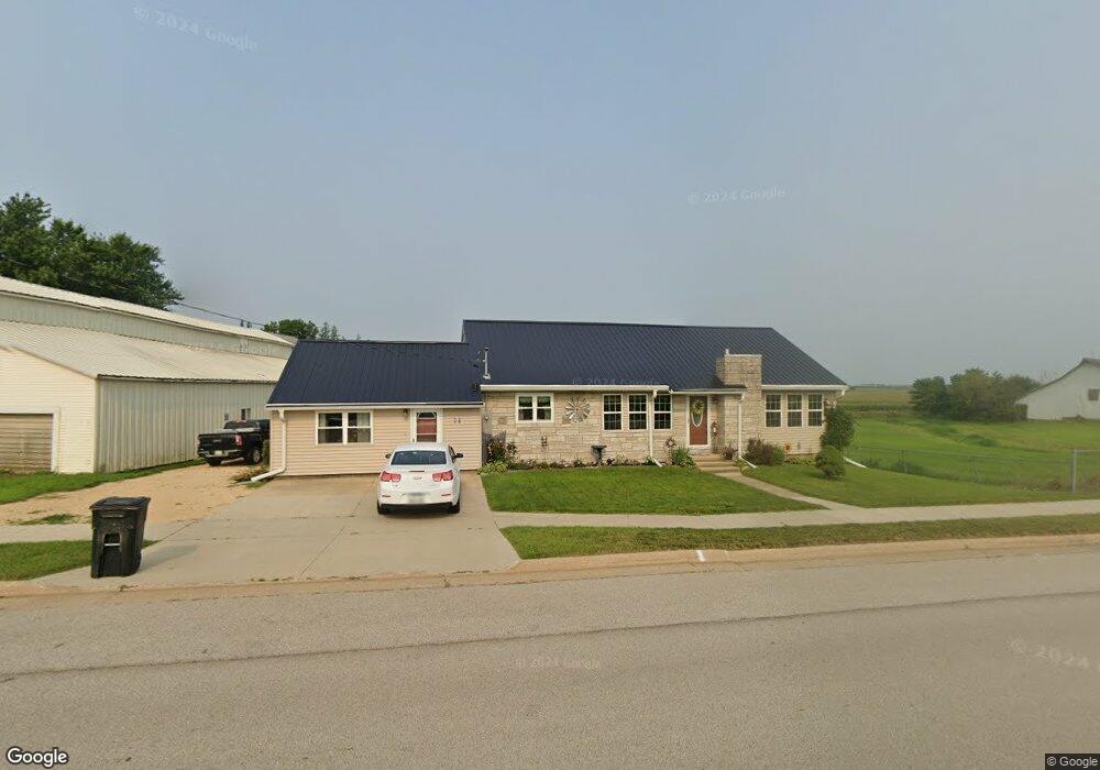
201 S Main St Onslow, IA 52321
Estimated Value: $76,000 - $117,000
3
Beds
1
Bath
1,029
Sq Ft
$96/Sq Ft
Est. Value
About This Home
This home is located at 201 S Main St, Onslow, IA 52321 and is currently estimated at $99,146, approximately $96 per square foot. 201 S Main St is a home with nearby schools including Midland Elementary School and Midland Middle/High School.
Ownership History
Date
Name
Owned For
Owner Type
Purchase Details
Closed on
Aug 16, 2021
Sold by
Benke Russell A and Benke Denise A
Bought by
Rich Jerimiah Manuel James and Rich Dinia Mavel
Current Estimated Value
Home Financials for this Owner
Home Financials are based on the most recent Mortgage that was taken out on this home.
Original Mortgage
$30,000
Outstanding Balance
$27,238
Interest Rate
2.8%
Mortgage Type
New Conventional
Estimated Equity
$71,908
Purchase Details
Closed on
Sep 2, 2009
Sold by
Miller Vernon E and Miller Frances M
Bought by
Benke Russell A and Benke Denise A
Create a Home Valuation Report for This Property
The Home Valuation Report is an in-depth analysis detailing your home's value as well as a comparison with similar homes in the area
Home Values in the Area
Average Home Value in this Area
Purchase History
| Date | Buyer | Sale Price | Title Company |
|---|---|---|---|
| Rich Jerimiah Manuel James | $40,000 | None Listed On Document | |
| Benke Russell A | $25,000 | None Available |
Source: Public Records
Mortgage History
| Date | Status | Borrower | Loan Amount |
|---|---|---|---|
| Open | Rich Jerimiah Manuel James | $30,000 |
Source: Public Records
Tax History Compared to Growth
Tax History
| Year | Tax Paid | Tax Assessment Tax Assessment Total Assessment is a certain percentage of the fair market value that is determined by local assessors to be the total taxable value of land and additions on the property. | Land | Improvement |
|---|---|---|---|---|
| 2025 | $1,030 | $62,110 | $4,260 | $57,850 |
| 2024 | $1,030 | $54,010 | $4,260 | $49,750 |
| 2023 | $878 | $54,010 | $4,260 | $49,750 |
| 2022 | $762 | $45,480 | $4,260 | $41,220 |
| 2021 | $762 | $45,480 | $4,260 | $41,220 |
| 2020 | $780 | $42,540 | $4,260 | $38,280 |
| 2019 | $632 | $32,540 | $0 | $0 |
| 2018 | $620 | $32,540 | $0 | $0 |
| 2017 | $620 | $32,540 | $0 | $0 |
| 2016 | $610 | $32,540 | $0 | $0 |
| 2015 | $610 | $30,710 | $0 | $0 |
| 2014 | $612 | $30,710 | $0 | $0 |
| 2013 | $518 | $30,710 | $5,530 | $25,180 |
Source: Public Records
Map
Nearby Homes
- 305 N Main St
- 8212 98th St
- 8133 98th St
- 201 N Maple St
- 305 W Main St
- 511 E Webster St
- 000 30th Ave
- 3000 150th St
- 406 Broadway St
- 00 110th Ave
- 4993 151st St
- 000 50th Ave
- 302 Walnut St
- 9162 Richland Rd
- 108 Wood Ridge Rd
- 823 Timberline Rd
- 128 Woodridge Rd
- 439 Council St
- 1611 Breca Ridge Dr Unit 4
- 0 W Buckeye St