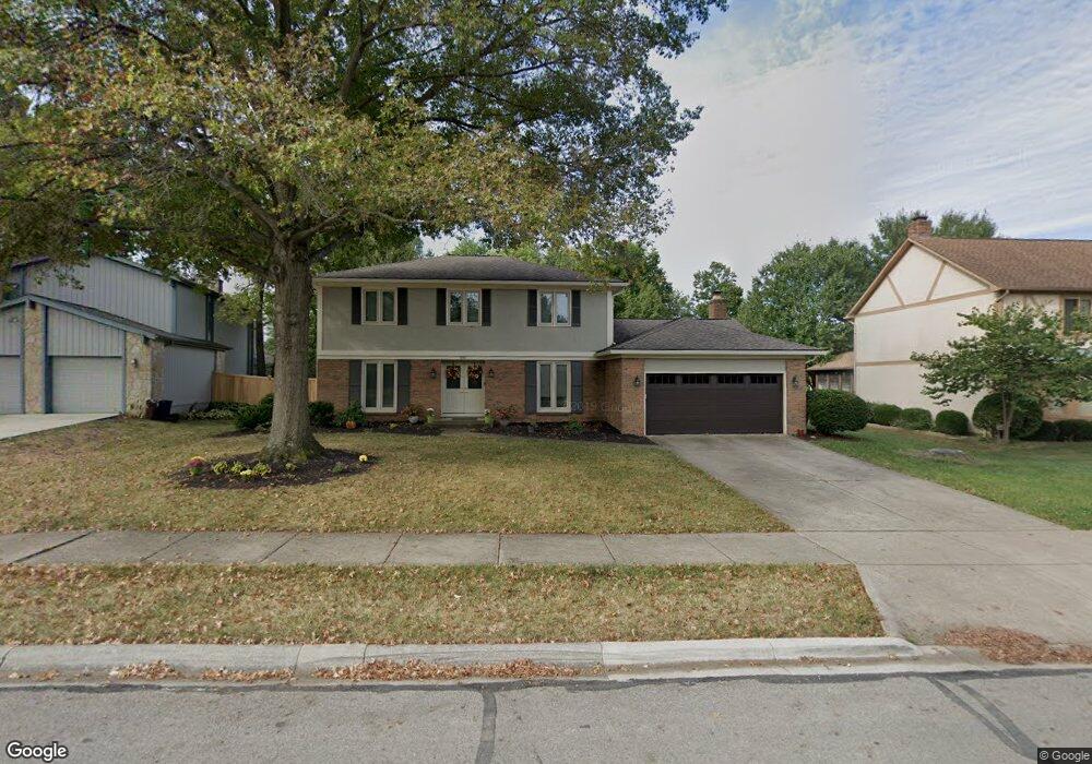
201 Shagbark Dr Westerville, OH 43081
Estimated Value: $451,709 - $518,000
4
Beds
3
Baths
2,240
Sq Ft
$214/Sq Ft
Est. Value
About This Home
This home is located at 201 Shagbark Dr, Westerville, OH 43081 and is currently estimated at $479,427, approximately $214 per square foot. 201 Shagbark Dr is a home located in Franklin County with nearby schools including Mcvay Elementary School, Walnut Springs Middle School, and Westerville-North High School.
Ownership History
Date
Name
Owned For
Owner Type
Purchase Details
Closed on
May 8, 2025
Sold by
Graves Stephen B and Graves Elizabeth A
Bought by
Graves Stephen B and Graves Elizabeth A
Current Estimated Value
Purchase Details
Closed on
Jul 23, 2011
Sold by
Ennis Joseph F and Ennis Kathleen M
Bought by
Graves Stephen B and Graves Elizabeth A
Home Financials for this Owner
Home Financials are based on the most recent Mortgage that was taken out on this home.
Original Mortgage
$209,549
Interest Rate
4.25%
Mortgage Type
FHA
Purchase Details
Closed on
Jul 3, 1990
Bought by
Ennis Joseph F
Purchase Details
Closed on
Jun 1, 1987
Purchase Details
Closed on
Jan 1, 1978
Create a Home Valuation Report for This Property
The Home Valuation Report is an in-depth analysis detailing your home's value as well as a comparison with similar homes in the area
Home Values in the Area
Average Home Value in this Area
Purchase History
| Date | Buyer | Sale Price | Title Company |
|---|---|---|---|
| Graves Stephen B | -- | None Listed On Document | |
| Graves Stephen B | $215,000 | Stewart Tit | |
| Ennis Joseph F | $145,000 | -- | |
| -- | -- | -- | |
| -- | $72,500 | -- |
Source: Public Records
Mortgage History
| Date | Status | Borrower | Loan Amount |
|---|---|---|---|
| Previous Owner | Graves Stephen B | $209,549 |
Source: Public Records
Tax History Compared to Growth
Tax History
| Year | Tax Paid | Tax Assessment Tax Assessment Total Assessment is a certain percentage of the fair market value that is determined by local assessors to be the total taxable value of land and additions on the property. | Land | Improvement |
|---|---|---|---|---|
| 2024 | $7,843 | $138,010 | $33,250 | $104,760 |
| 2023 | $7,677 | $138,010 | $33,250 | $104,760 |
| 2022 | $7,286 | $100,000 | $26,010 | $73,990 |
| 2021 | $7,347 | $100,000 | $26,010 | $73,990 |
| 2020 | $7,326 | $100,000 | $26,010 | $73,990 |
| 2019 | $6,391 | $82,360 | $21,670 | $60,690 |
| 2018 | $6,054 | $82,360 | $21,670 | $60,690 |
| 2017 | $6,286 | $82,360 | $21,670 | $60,690 |
| 2016 | $6,033 | $71,960 | $22,960 | $49,000 |
| 2015 | $5,843 | $71,960 | $22,960 | $49,000 |
| 2014 | $5,848 | $71,960 | $22,960 | $49,000 |
| 2013 | $2,781 | $68,530 | $21,875 | $46,655 |
Source: Public Records
Map
Nearby Homes
- 1368 Nutmeg Ct
- 969 Farrington Dr
- 613 Valley Wood Ct
- 857 E Walnut St
- 1003 Autumn Meadows Dr
- 858 Knebworth Ct
- 1203 Autumn Creek Cir
- 1015 Autumn Woods Dr
- 1114 Melinda Dr
- 994 Autumn Lake Ct
- 192 Buckeye Ct
- 187 Bernadine Ct
- 283 Apache Cir
- 768 Collingwood Dr
- 539 Cherrington Rd
- 615 Vancouver Dr
- 430 Electric Ave
- 1166 Wedgewood Terrace
- 4540 Central College Rd
- 6553 Bowery Peak Ln
- 195 Shagbark Dr
- 207 Shagbark Dr
- 1358 Goldsmith Dr
- 187 Shagbark Dr
- 1312 Blackoak Cir
- 1350 Goldsmith Dr
- 198 Shagbark Dr
- 206 Shagbark Dr
- 0 Black Oak Cr Cir
- 173 Shagbark Dr
- 192 Shagbark Dr
- 1365 Goldsmith Dr
- 1305 Blackoak Cir
- 1342 Goldsmith Dr
- 1306 Blackoak Cir
- 1355 Goldsmith Dr
- 161 Shagbark Dr
- 176 Shagbark Dr
- 1378 Goldsmith Dr
- 1367 Sugarberry Ct