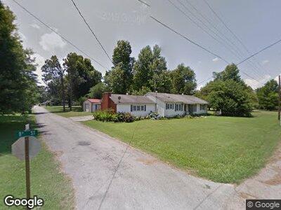
201 W 8th St Leachville, AR 72438
Estimated Value: $136,758 - $186,000
--
Bed
1
Bath
2,100
Sq Ft
$76/Sq Ft
Est. Value
About This Home
This home is located at 201 W 8th St, Leachville, AR 72438 and is currently estimated at $159,440, approximately $75 per square foot. 201 W 8th St is a home located in Mississippi County with nearby schools including Buffalo Is. Central Junior High School and Buffalo Island Central High School.
Ownership History
Date
Name
Owned For
Owner Type
Purchase Details
Closed on
Jan 2, 2006
Sold by
Hurst James B and Hurst Shelly K
Bought by
Guge Samuel and Jacobs Joann
Current Estimated Value
Purchase Details
Closed on
Jan 1, 2006
Sold by
Hurst James B and Hurst Shelly K
Bought by
Guge Samuel and Jacobs Joann
Purchase Details
Closed on
Jan 2, 1998
Sold by
Duffel Peggy Lee
Bought by
Hurst James B and Hurst Shelly K
Purchase Details
Closed on
Jan 1, 1998
Sold by
Duffel Peggy Lee
Bought by
Hurst James B and Hurst Shelly K
Purchase Details
Closed on
Jan 2, 1994
Bought by
Duffel Peggy Lee
Purchase Details
Closed on
Jan 1, 1994
Bought by
Duffel Peggy Lee
Create a Home Valuation Report for This Property
The Home Valuation Report is an in-depth analysis detailing your home's value as well as a comparison with similar homes in the area
Home Values in the Area
Average Home Value in this Area
Purchase History
| Date | Buyer | Sale Price | Title Company |
|---|---|---|---|
| Guge Samuel | $80,000 | -- | |
| Guge Samuel | $80,000 | -- | |
| Hurst James B | $50,000 | -- | |
| Hurst James B | $50,000 | -- | |
| Duffel Peggy Lee | -- | -- | |
| Duffel Peggy Lee | -- | -- |
Source: Public Records
Tax History Compared to Growth
Tax History
| Year | Tax Paid | Tax Assessment Tax Assessment Total Assessment is a certain percentage of the fair market value that is determined by local assessors to be the total taxable value of land and additions on the property. | Land | Improvement |
|---|---|---|---|---|
| 2024 | $812 | $19,959 | $3,200 | $16,759 |
| 2023 | $812 | $19,959 | $3,200 | $16,759 |
| 2022 | $775 | $19,959 | $3,200 | $16,759 |
| 2021 | $518 | $15,485 | $2,000 | $13,485 |
| 2020 | -- | $15,485 | $2,000 | $13,485 |
| 2019 | -- | -- | $2,000 | $13,485 |
| 2018 | -- | -- | $2,000 | $13,485 |
| 2017 | -- | -- | $1,300 | $12,262 |
| 2015 | -- | -- | $1,300 | $12,262 |
| 2013 | -- | -- | $1,300 | $12,505 |
Source: Public Records
Map
Nearby Homes
- 701 S Main St
- 602 Nelson St
- 1008 Lange St
- 110 Ryerson St
- 1206 S Main St
- 500 Thurmond St
- 501 Hollis St
- 401 Hollis St
- 20730 Highway 18 E
- 102 Reinhart Ln
- 104 Maple Dr
- 102 Maple Dr
- 807-A N Byron St
- 807 Byron Ln
- 213 Pintail Pointe
- 164 Pintail Pointe
- 308 E Drew Ave
- 160 Pintail Pointe
- 147 Pintail Pointe
- 101 Pintail Pointe