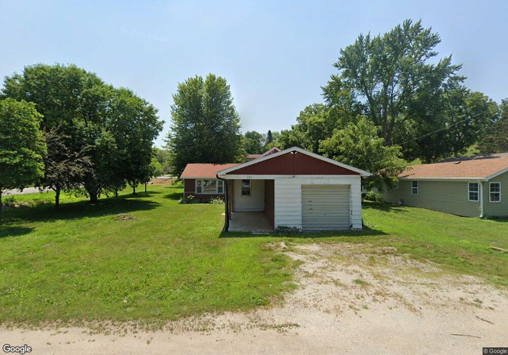
201 W High St Colfax, IA 50054
Estimated Value: $86,000 - $202,000
2
Beds
1
Bath
1,266
Sq Ft
$110/Sq Ft
Est. Value
About This Home
This home is located at 201 W High St, Colfax, IA 50054 and is currently estimated at $139,544, approximately $110 per square foot. 201 W High St is a home located in Jasper County with nearby schools including Colfax-Mingo Elementary School and Colfax-Mingo High School.
Ownership History
Date
Name
Owned For
Owner Type
Purchase Details
Closed on
Mar 18, 2016
Sold by
Alborn Karla A
Bought by
Perry Zachary
Current Estimated Value
Home Financials for this Owner
Home Financials are based on the most recent Mortgage that was taken out on this home.
Original Mortgage
$59,500
Outstanding Balance
$47,219
Interest Rate
3.73%
Estimated Equity
$92,325
Create a Home Valuation Report for This Property
The Home Valuation Report is an in-depth analysis detailing your home's value as well as a comparison with similar homes in the area
Purchase History
| Date | Buyer | Sale Price | Title Company |
|---|---|---|---|
| Perry Zachary | -- | -- |
Source: Public Records
Mortgage History
| Date | Status | Borrower | Loan Amount |
|---|---|---|---|
| Open | Perry Zachary | $59,500 | |
| Closed | Perry Zachary | -- |
Source: Public Records
Tax History
| Year | Tax Paid | Tax Assessment Tax Assessment Total Assessment is a certain percentage of the fair market value that is determined by local assessors to be the total taxable value of land and additions on the property. | Land | Improvement |
|---|---|---|---|---|
| 2025 | $1,948 | $112,920 | $21,260 | $91,660 |
| 2024 | $1,948 | $102,340 | $21,260 | $81,080 |
| 2023 | $730 | $38,100 | $21,260 | $16,840 |
| 2022 | $780 | $35,900 | $21,260 | $14,640 |
| 2021 | $1,634 | $34,740 | $21,260 | $13,480 |
| 2020 | $1,634 | $68,460 | $14,880 | $53,580 |
| 2019 | $1,490 | $59,070 | $0 | $0 |
| 2018 | $1,490 | $59,070 | $0 | $0 |
| 2017 | $1,470 | $59,070 | $0 | $0 |
| 2016 | $1,470 | $59,070 | $0 | $0 |
| 2015 | $1,162 | $59,070 | $0 | $0 |
| 2014 | $1,108 | $59,070 | $0 | $0 |
Source: Public Records
Map
Nearby Homes
- 215 W Spring St
- 238 S Walnut St
- 110 W Broadway St
- 501 W Broadway St
- 221 Cherry St
- 500 W Washington St
- 222 E Broadway St
- 226 S Iowa St
- 17 S Kelly St
- 205 E Division St
- 214 S Lincoln St
- 200 Jefferson St
- 400 S Goodrich St
- 300 E Front St
- 1161 S Goodrich St
- 10114 S 34th Ave W
- 1132 S Goodrich St
- 655 E Division St
- 000 College Ave
- 11213 Orchard Ave
- 211 W High St
- 213 W High St
- 607 S West St Unit 621
- 129 W High St
- 624 S West St
- 217 W High St
- 525 S West St
- 528 S West St
- 127 W High St
- 620 S Montgomery St
- 534 S West St
- 530 S Montgomery St
- 530 S Montgomery St Unit A
- 524 S West St
- 664 S West St
- 505 S West St
- 301 W High St
- 128 W High St
- 123 W High St
- 223 W Pleasant St
Your Personal Tour Guide
Ask me questions while you tour the home.