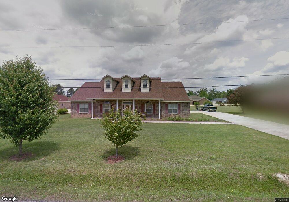
201 Wilson Dr Columbus, MS 39702
Estimated Value: $283,000 - $347,000
4
Beds
3
Baths
2,540
Sq Ft
$121/Sq Ft
Est. Value
About This Home
This home is located at 201 Wilson Dr, Columbus, MS 39702 and is currently estimated at $307,084, approximately $120 per square foot. 201 Wilson Dr is a home located in Lowndes County.
Ownership History
Date
Name
Owned For
Owner Type
Purchase Details
Closed on
Jan 31, 2023
Sold by
Smith Nathan and Smith Mary W
Bought by
Stokes Marcus Dante and Stokes Shalonda
Current Estimated Value
Home Financials for this Owner
Home Financials are based on the most recent Mortgage that was taken out on this home.
Original Mortgage
$269,000
Outstanding Balance
$255,504
Interest Rate
4%
Mortgage Type
VA
Estimated Equity
$51,580
Purchase Details
Closed on
Dec 5, 2006
Sold by
Res Real Estate Llc
Bought by
Smith Nathan and Smith Mary W
Home Financials for this Owner
Home Financials are based on the most recent Mortgage that was taken out on this home.
Original Mortgage
$160,000
Interest Rate
6.29%
Create a Home Valuation Report for This Property
The Home Valuation Report is an in-depth analysis detailing your home's value as well as a comparison with similar homes in the area
Purchase History
| Date | Buyer | Sale Price | Title Company |
|---|---|---|---|
| Stokes Marcus Dante | -- | -- | |
| Smith Nathan | -- | -- |
Source: Public Records
Mortgage History
| Date | Status | Borrower | Loan Amount |
|---|---|---|---|
| Open | Stokes Marcus Dante | $269,000 | |
| Previous Owner | Smith Nathan | $160,000 |
Source: Public Records
Tax History
| Year | Tax Paid | Tax Assessment Tax Assessment Total Assessment is a certain percentage of the fair market value that is determined by local assessors to be the total taxable value of land and additions on the property. | Land | Improvement |
|---|---|---|---|---|
| 2025 | $1,644 | $19,869 | $0 | $0 |
| 2024 | $1,628 | $19,869 | $0 | $0 |
| 2023 | $0 | $17,279 | $0 | $0 |
| 2022 | $0 | $17,279 | $0 | $0 |
| 2021 | $0 | $17,279 | $0 | $0 |
| 2020 | $0 | $17,279 | $0 | $0 |
| 2019 | $0 | $17,125 | $0 | $0 |
| 2018 | $0 | $17,224 | $0 | $0 |
| 2017 | $0 | $17,224 | $0 | $0 |
| 2016 | $0 | $17,224 | $0 | $0 |
| 2015 | -- | $17,671 | $0 | $0 |
| 2014 | $882 | $17,671 | $0 | $0 |
Source: Public Records
Map
Nearby Homes
- 59 Savannah St
- 9 Monticello Cir
- 479 Bryant Rd
- 1553 Hildreth Rd
- Ms-69
- 0 0 Hwy 69 S
- 836 Oswalt Rd
- 338 Rogers Way
- 178 Rogers Way
- 732 Thornton Dr
- 17 Paige Cove
- 2654 Yorkville Rd E
- 76 Richardson Rd
- 394 Pickensville Rd
- 262 Center Rd
- 0 Yorkville Rd E
- 364 Pinewood Dr
- 20 Stokes Rd
- 805 Timber Creek Dr
- 220 Woodridge Place
Your Personal Tour Guide
Ask me questions while you tour the home.