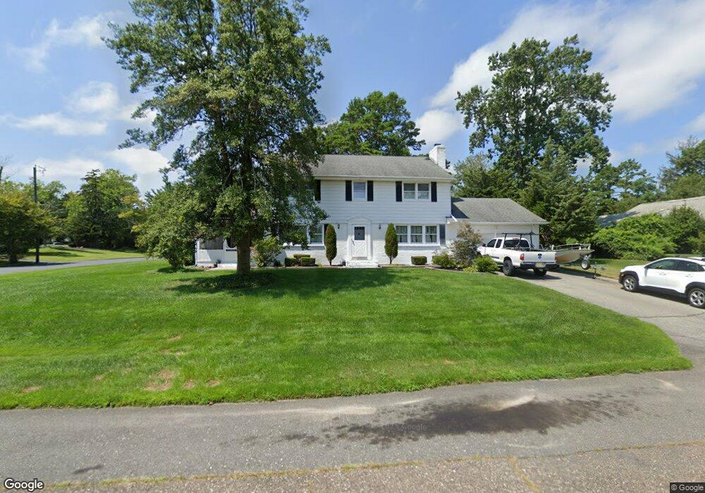
201 Wynnewood Dr Absecon, NJ 08201
Estimated Value: $383,288 - $519,000
--
Bed
--
Bath
2,629
Sq Ft
$181/Sq Ft
Est. Value
About This Home
This home is located at 201 Wynnewood Dr, Absecon, NJ 08201 and is currently estimated at $476,822, approximately $181 per square foot. 201 Wynnewood Dr is a home located in Atlantic County with nearby schools including Emma C. Attales Middle School, Life Point Academy/ Life Point Church, and Holy Spirit High School.
Ownership History
Date
Name
Owned For
Owner Type
Purchase Details
Closed on
Jun 28, 2002
Sold by
Ehrhardt Fred W
Bought by
Elias Andrew and Elias April M
Current Estimated Value
Home Financials for this Owner
Home Financials are based on the most recent Mortgage that was taken out on this home.
Original Mortgage
$145,000
Outstanding Balance
$61,948
Interest Rate
6.82%
Mortgage Type
Purchase Money Mortgage
Estimated Equity
$414,874
Purchase Details
Closed on
Sep 2, 1999
Sold by
Ehrhardt Frederick J and Ehrhardt Elizabeth S
Bought by
Ehrhardt Frederick J
Create a Home Valuation Report for This Property
The Home Valuation Report is an in-depth analysis detailing your home's value as well as a comparison with similar homes in the area
Home Values in the Area
Average Home Value in this Area
Purchase History
| Date | Buyer | Sale Price | Title Company |
|---|---|---|---|
| Elias Andrew | $185,000 | Commonwealth Land Title Ins | |
| Ehrhardt Frederick J | -- | -- |
Source: Public Records
Mortgage History
| Date | Status | Borrower | Loan Amount |
|---|---|---|---|
| Open | Elias Andrew | $145,000 |
Source: Public Records
Tax History Compared to Growth
Tax History
| Year | Tax Paid | Tax Assessment Tax Assessment Total Assessment is a certain percentage of the fair market value that is determined by local assessors to be the total taxable value of land and additions on the property. | Land | Improvement |
|---|---|---|---|---|
| 2025 | $7,676 | $229,400 | $92,400 | $137,000 |
| 2024 | $7,676 | $229,400 | $92,400 | $137,000 |
| 2023 | $7,584 | $229,400 | $92,400 | $137,000 |
| 2022 | $7,584 | $229,400 | $92,400 | $137,000 |
| 2021 | $7,561 | $229,400 | $92,400 | $137,000 |
| 2020 | $7,575 | $229,400 | $92,400 | $137,000 |
| 2019 | $7,520 | $229,400 | $92,400 | $137,000 |
| 2018 | $7,552 | $229,400 | $92,400 | $137,000 |
| 2017 | $7,497 | $229,400 | $92,400 | $137,000 |
| 2016 | $7,286 | $229,400 | $92,400 | $137,000 |
| 2015 | $7,192 | $229,400 | $92,400 | $137,000 |
| 2014 | $7,093 | $229,400 | $92,400 | $137,000 |
Source: Public Records
Map
Nearby Homes
- 202 Burning Tree Blvd
- 111 Woods Rd
- 40 N Shore Rd
- 19 W Illinois Ave
- 194 N Shore Rd
- 15 W Bolton Ave
- 1508 7th Ave
- 107 W Church St
- 120 Pitney Rd
- 1 Mechanic St Unit 108
- 00 California Ave
- 125 Meadowview Ave
- 506 Lazy Ln
- 399 Pitney Rd
- 117 E Wyoming Ave
- 236 E Wyoming Ave
- 244 E Wyoming Ave
- 0 E Absecon Blvd Unit BILLBOARD 204
- 243 Pennsylvania Ave
- 625 N Shore Rd
- 203 Wynnewood Dr
- 200 Briarcliff Place
- 202 Wynnewood Dr
- 204 Briarcliff Place
- 107 Wynnewood Dr
- 204 Wynnewood Dr
- 200 Park Ave
- 205 Wynnewood Dr
- 106 Wynnewood Dr
- 262 Park Ave
- 201 Cynwyd Dr
- 206 Briarcliff Place
- 201 Briarcliff Place
- 272 Park Ave
- 203 Cynwyd Dr
- 206 Wynnewood Dr
- 278 Park Ave
- 280 Park Ave
- 105 Wynnewood Dr
- 203 Briarcliff Place