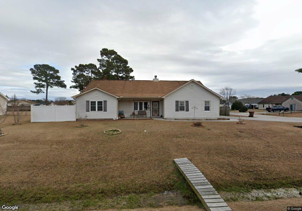
201 Zachary Ln Hubert, NC 28539
Hubert NeighborhoodEstimated Value: $256,000 - $260,000
3
Beds
2
Baths
1,608
Sq Ft
$160/Sq Ft
Est. Value
About This Home
This home is located at 201 Zachary Ln, Hubert, NC 28539 and is currently estimated at $257,505, approximately $160 per square foot. 201 Zachary Ln is a home located in Onslow County with nearby schools including Sand Ridge Elementary School, Swansboro Middle School, and Swansboro High School.
Ownership History
Date
Name
Owned For
Owner Type
Purchase Details
Closed on
Mar 11, 2024
Sold by
Harper Susan Marcia
Bought by
Caouette Heidi
Current Estimated Value
Purchase Details
Closed on
Sep 24, 2007
Sold by
Flint Steed Michael and Flint Michelle
Bought by
Harper Susan Marcia
Home Financials for this Owner
Home Financials are based on the most recent Mortgage that was taken out on this home.
Original Mortgage
$161,500
Interest Rate
6.57%
Mortgage Type
VA
Create a Home Valuation Report for This Property
The Home Valuation Report is an in-depth analysis detailing your home's value as well as a comparison with similar homes in the area
Home Values in the Area
Average Home Value in this Area
Purchase History
| Date | Buyer | Sale Price | Title Company |
|---|---|---|---|
| Caouette Heidi | -- | None Listed On Document | |
| Harper Susan Marcia | $161,500 | None Available |
Source: Public Records
Mortgage History
| Date | Status | Borrower | Loan Amount |
|---|---|---|---|
| Previous Owner | Harper Susan Marcia | $161,500 |
Source: Public Records
Tax History Compared to Growth
Tax History
| Year | Tax Paid | Tax Assessment Tax Assessment Total Assessment is a certain percentage of the fair market value that is determined by local assessors to be the total taxable value of land and additions on the property. | Land | Improvement |
|---|---|---|---|---|
| 2025 | $917 | $184,936 | $40,000 | $144,936 |
| 2024 | $917 | $184,936 | $40,000 | $144,936 |
| 2023 | $917 | $184,936 | $40,000 | $144,936 |
| 2022 | $917 | $184,936 | $40,000 | $144,936 |
| 2021 | $614 | $132,130 | $30,000 | $102,130 |
| 2020 | $591 | $128,830 | $30,000 | $98,830 |
| 2019 | $550 | $123,020 | $30,000 | $93,020 |
| 2018 | $591 | $128,830 | $30,000 | $98,830 |
| 2017 | $583 | $131,430 | $30,000 | $101,430 |
| 2016 | $583 | $86,430 | $0 | $0 |
| 2015 | $583 | $86,430 | $0 | $0 |
| 2014 | $583 | $86,430 | $0 | $0 |
Source: Public Records
Map
Nearby Homes
- 329 Buckhead Rd
- 302 Josie Ct
- 101 Glenwood Dr
- 0 Parnell Rd
- 604 Cannon Ct
- 208 Joey Ct
- 425 Dion Dr
- 306 Foxtrace Ln
- 500 Nutfield Dr
- 406 Foxtrace Ln
- 500 Dion Dr
- 302 Foxridge Ln
- 166 Parnell Rd
- 165 Parnell Rd
- 202 Dayrell Dr
- 773 Sand Ridge Rd
- 214 W Volant St
- 109 Foxtrail Dr
- 280 Surfside Landing Blvd Unit Lot 113
- 277 Surfside Landing Blvd Unit Lot 115