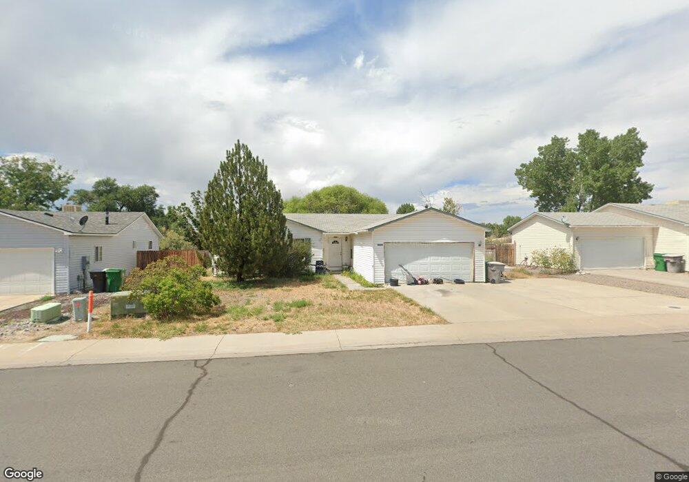
2010 Biron Rd Montrose, CO 81401
Estimated Value: $404,659 - $425,000
3
Beds
2
Baths
1,472
Sq Ft
$279/Sq Ft
Est. Value
About This Home
This home is located at 2010 Biron Rd, Montrose, CO 81401 and is currently estimated at $411,415, approximately $279 per square foot. 2010 Biron Rd is a home located in Montrose County with nearby schools including Johnson Elementary School, Centennial Middle School, and Montrose High School.
Ownership History
Date
Name
Owned For
Owner Type
Purchase Details
Closed on
Nov 7, 2006
Sold by
Todd Michael A and Todd Tammy R
Bought by
Todd Mike A and Todd Tammy R
Current Estimated Value
Home Financials for this Owner
Home Financials are based on the most recent Mortgage that was taken out on this home.
Original Mortgage
$31,000
Interest Rate
6.37%
Mortgage Type
Stand Alone Second
Purchase Details
Closed on
Oct 28, 1999
Sold by
Pearl Crest
Bought by
Todd Michael A and Todd Tammy R
Create a Home Valuation Report for This Property
The Home Valuation Report is an in-depth analysis detailing your home's value as well as a comparison with similar homes in the area
Home Values in the Area
Average Home Value in this Area
Purchase History
| Date | Buyer | Sale Price | Title Company |
|---|---|---|---|
| Todd Mike A | -- | Security Title | |
| Todd Michael A | $100,100 | -- |
Source: Public Records
Mortgage History
| Date | Status | Borrower | Loan Amount |
|---|---|---|---|
| Closed | Todd Mike A | $31,000 | |
| Open | Todd Mike A | $140,000 |
Source: Public Records
Tax History Compared to Growth
Tax History
| Year | Tax Paid | Tax Assessment Tax Assessment Total Assessment is a certain percentage of the fair market value that is determined by local assessors to be the total taxable value of land and additions on the property. | Land | Improvement |
|---|---|---|---|---|
| 2024 | $1,504 | $20,870 | $3,130 | $17,740 |
| 2023 | $1,504 | $25,480 | $3,820 | $21,660 |
| 2022 | $1,238 | $17,740 | $2,780 | $14,960 |
| 2021 | $1,275 | $18,250 | $2,860 | $15,390 |
| 2020 | $1,089 | $16,020 | $2,470 | $13,550 |
| 2019 | $1,096 | $16,020 | $2,470 | $13,550 |
| 2018 | $867 | $12,350 | $1,990 | $10,360 |
| 2017 | $860 | $12,350 | $1,990 | $10,360 |
| 2016 | $855 | $12,480 | $2,010 | $10,470 |
| 2015 | $840 | $12,480 | $2,010 | $10,470 |
| 2014 | $695 | $11,030 | $2,010 | $9,020 |
Source: Public Records
Map
Nearby Homes
- 1987 Sara E Ln
- 2869 Cimarron St
- 2710 Cirque Way
- 2717 Peyton Dr
- 2398 W Fox Park St
- 2796 Matie Ln
- 2700 Peyton Dr
- 3004 Silver Fox Dr
- TBD Lot 3 E Oak Grove Rd
- TBD Lot 2 E Oak Grove Rd
- 3208 Wheat Grass Dr
- 3208 Ravens Crest Dr
- 2648 Virginia Ln
- 1833 Estates Dr Unit A
- 3161 Silver Fox Dr
- 2132 Patriot Ct
- Lot 23 Glen Eagle Dr
- 1708 American Way
- 2224 American Way
- Lot 108B Stone Bridge Dr