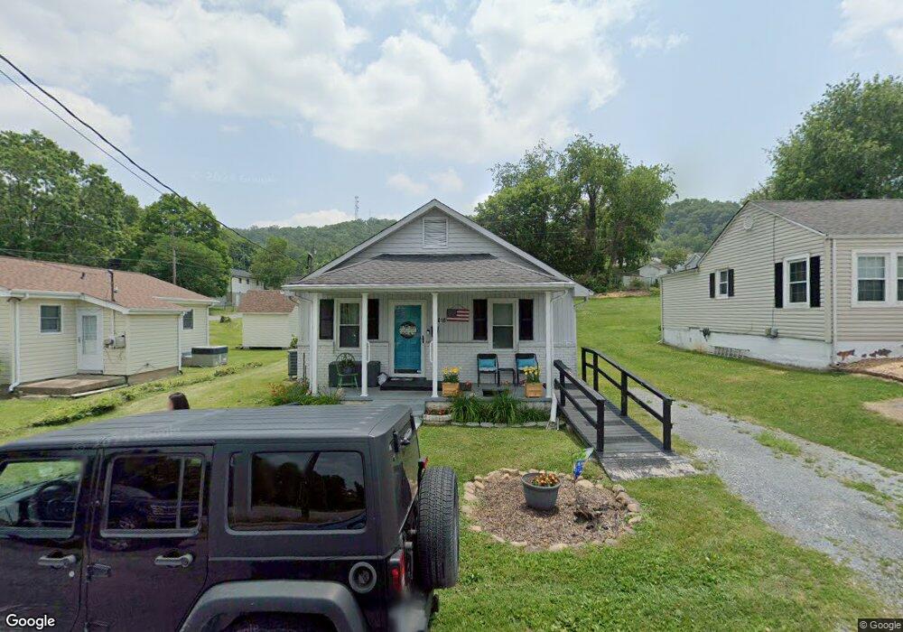
2010 Broad St Bristol, TN 37620
Estimated Value: $99,470 - $151,000
3
Beds
1
Bath
1,017
Sq Ft
$133/Sq Ft
Est. Value
About This Home
This home is located at 2010 Broad St, Bristol, TN 37620 and is currently estimated at $135,118, approximately $132 per square foot. 2010 Broad St is a home located in Sullivan County with nearby schools including Anderson Elementary School, Vance Middle School, and Tennessee High School.
Ownership History
Date
Name
Owned For
Owner Type
Purchase Details
Closed on
May 30, 2002
Sold by
Rhonda Hopson and Rhonda Christophe
Bought by
Anderson Wendy L
Current Estimated Value
Purchase Details
Closed on
Aug 15, 1996
Sold by
Minton Helen E
Bought by
Christopher Hopson
Home Financials for this Owner
Home Financials are based on the most recent Mortgage that was taken out on this home.
Original Mortgage
$49,900
Interest Rate
8.2%
Purchase Details
Closed on
Oct 10, 1994
Sold by
Jerry Hicks
Bought by
Helen Minton
Purchase Details
Closed on
Oct 7, 1994
Purchase Details
Closed on
Jul 22, 1988
Create a Home Valuation Report for This Property
The Home Valuation Report is an in-depth analysis detailing your home's value as well as a comparison with similar homes in the area
Home Values in the Area
Average Home Value in this Area
Purchase History
| Date | Buyer | Sale Price | Title Company |
|---|---|---|---|
| Anderson Wendy L | $55,400 | -- | |
| Christopher Hopson | $49,900 | -- | |
| Helen Minton | -- | -- | |
| -- | $37,000 | -- | |
| -- | $32,000 | -- |
Source: Public Records
Mortgage History
| Date | Status | Borrower | Loan Amount |
|---|---|---|---|
| Previous Owner | -- | $49,900 |
Source: Public Records
Tax History Compared to Growth
Tax History
| Year | Tax Paid | Tax Assessment Tax Assessment Total Assessment is a certain percentage of the fair market value that is determined by local assessors to be the total taxable value of land and additions on the property. | Land | Improvement |
|---|---|---|---|---|
| 2024 | -- | $12,375 | $1,650 | $10,725 |
| 2023 | $544 | $12,375 | $1,650 | $10,725 |
| 2022 | $544 | $12,375 | $1,650 | $10,725 |
| 2021 | $544 | $12,375 | $1,650 | $10,725 |
| 2020 | $571 | $12,375 | $1,650 | $10,725 |
| 2019 | $571 | $12,075 | $1,650 | $10,425 |
| 2018 | $569 | $12,075 | $1,650 | $10,425 |
| 2017 | $569 | $12,075 | $1,650 | $10,425 |
| 2016 | $727 | $15,050 | $1,650 | $13,400 |
| 2014 | $686 | $15,056 | $0 | $0 |
Source: Public Records
Map
Nearby Homes
- 1614 Broad St
- 1443 Windsor Ave
- 2000 Euclid Ave
- 60 Peters St
- 1224 Shelby St
- 1227 Shelby St
- 000 Hemlock Dr
- 1057 Moorland Ave
- 311 12th St
- 1216 Norway St
- 1724 & 1728 Euclid Ave
- 2177 Randolph St
- 420 Douglas St
- 2121 2123 Randolph St
- 461 Douglas St
- 728 Randolph St
- 2412,14,16 Bradley St
- 1020 Hill St
- 2241 Bradley St
- 2400 Bradley St
- 2000 Broad St
- 2012 Broad St
- 2014 Broad St
- 2016 Broad St
- 1903 Anderson St
- 1844 Broad St
- 1901 Anderson St
- 1905 Anderson St
- 1907 Anderson St
- 1841 Anderson St
- 1909 Anderson St
- 2024 Broad St
- 1843 Broad St
- 1836 Broad St
- 2028 Broad St
- 1835 Anderson St
- 1841 Broad St
- 1911 Anderson St
- 1833 Anderson St
- 1839 Broad St