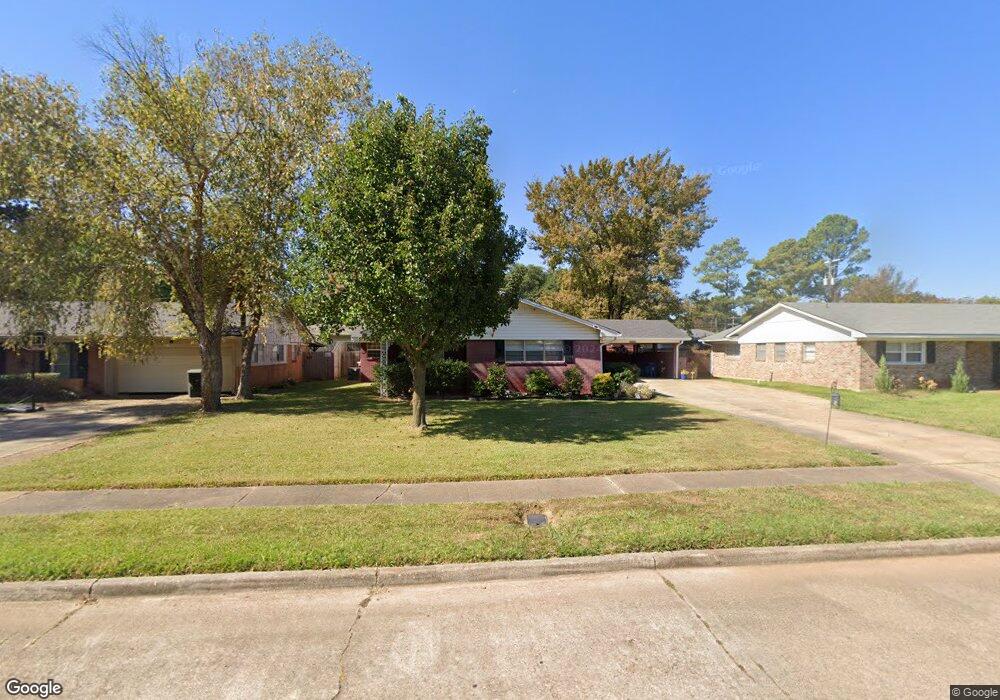
2010 Captain Shreve Dr Shreveport, LA 71105
Broadmoor/Anderson Island/Shreve Isle NeighborhoodEstimated Value: $36,000 - $62,000
2
Beds
1
Bath
1,053
Sq Ft
$47/Sq Ft
Est. Value
About This Home
This home is located at 2010 Captain Shreve Dr, Shreveport, LA 71105 and is currently estimated at $49,750, approximately $47 per square foot. 2010 Captain Shreve Dr is a home located in Caddo Parish with nearby schools including Fairfield Magnet School, Judson Fundamental Elementary School, and Eden Gardens Fundamental Elementary School.
Ownership History
Date
Name
Owned For
Owner Type
Purchase Details
Closed on
Aug 29, 2024
Sold by
Vinetree Properties Llc
Bought by
Villeda Corona Emanuel and Dominguez Galvan Yolanda
Current Estimated Value
Purchase Details
Closed on
Jun 28, 2024
Sold by
Parish Of Caddo
Bought by
Parish Of Caddo
Purchase Details
Closed on
Jun 29, 2020
Sold by
Tittle Paul Allen and Tittle Melissa Rose
Bought by
Vinetree Properties Llc
Purchase Details
Closed on
May 18, 2018
Sold by
Caddo County Collector
Bought by
White Oak Title Llc
Purchase Details
Closed on
Jun 13, 2014
Sold by
Tittle Paul Allen and Tittle Melissa Rose
Bought by
Keithville Land Co Llc
Purchase Details
Closed on
Jun 21, 2013
Sold by
Tittle Paul Allen and Tittle Melissa Rose
Bought by
Keithville Land Co Llc
Create a Home Valuation Report for This Property
The Home Valuation Report is an in-depth analysis detailing your home's value as well as a comparison with similar homes in the area
Home Values in the Area
Average Home Value in this Area
Purchase History
| Date | Buyer | Sale Price | Title Company |
|---|---|---|---|
| Villeda Corona Emanuel | $18,000 | Bayou Title | |
| Parish Of Caddo | $1,054 | None Listed On Document | |
| Vinetree Properties Llc | -- | None Available | |
| White Oak Title Llc | $445 | None Available | |
| Keithville Land Co Llc | $369 | None Available | |
| Keithville Land Co Llc | $354 | None Available |
Source: Public Records
Tax History Compared to Growth
Tax History
| Year | Tax Paid | Tax Assessment Tax Assessment Total Assessment is a certain percentage of the fair market value that is determined by local assessors to be the total taxable value of land and additions on the property. | Land | Improvement |
|---|---|---|---|---|
| 2024 | $740 | $4,745 | $987 | $3,758 |
| 2023 | $749 | $4,698 | $940 | $3,758 |
| 2022 | $749 | $4,698 | $940 | $3,758 |
| 2021 | $737 | $4,698 | $940 | $3,758 |
| 2020 | $737 | $4,698 | $940 | $3,758 |
| 2019 | $728 | $4,504 | $940 | $3,564 |
| 2018 | $580 | $4,504 | $940 | $3,564 |
| 2017 | $740 | $4,504 | $940 | $3,564 |
| 2015 | $575 | $4,440 | $940 | $3,500 |
| 2014 | $580 | $4,440 | $940 | $3,500 |
| 2013 | -- | $4,440 | $940 | $3,500 |
Source: Public Records
Map
Nearby Homes
- 1919 Audubon Place
- 1923 Bermuda St
- 2005 E Kings Hwy
- 2013 E Kings Hwy
- 1810 Captain Shreve Dr
- 2045 Horton Ave
- 2049 River Rd
- 1836 Bryan Place
- 502 Mockingbird Ln
- 142 Lynn Ave
- 636 Pelican Place
- 1615 Captain Shreve Dr
- 156 Charles Ave
- 1601 Captain Shreve Dr
- 147 Pennsylvania Ave
- 163 Charles Ave
- 5707 Anniston Ave
- 5822 River Rd
- 1916 Anniston Ave
- 306 Oriole Ln
- 2010 Captain Shreve Dr
- 2010 Captain Shreve Dr
- 2014 Captain Shreve Dr
- 2006 Captain Shreve Dr
- 2006 Captain Shreve Dr
- 2006 Captain Shreve Dr
- 2006 Captain Shreve Dr
- 2006 Captain Shreve Dr
- 2006 Captain Shreve Dr
- 2011 Audubon Place
- 2015 Audubon Place
- 2007 Audubon Place
- 2018 Captain Shreve Dr
- 2002 Captain Shreve Dr
- 2019 Audubon Place
- 2003 Audubon Place
- 2011 Captain Shreve Dr
- 2007 Captain Shreve Dr
- 2015 Captain Shreve Dr
- 2022 Captain Shreve Dr