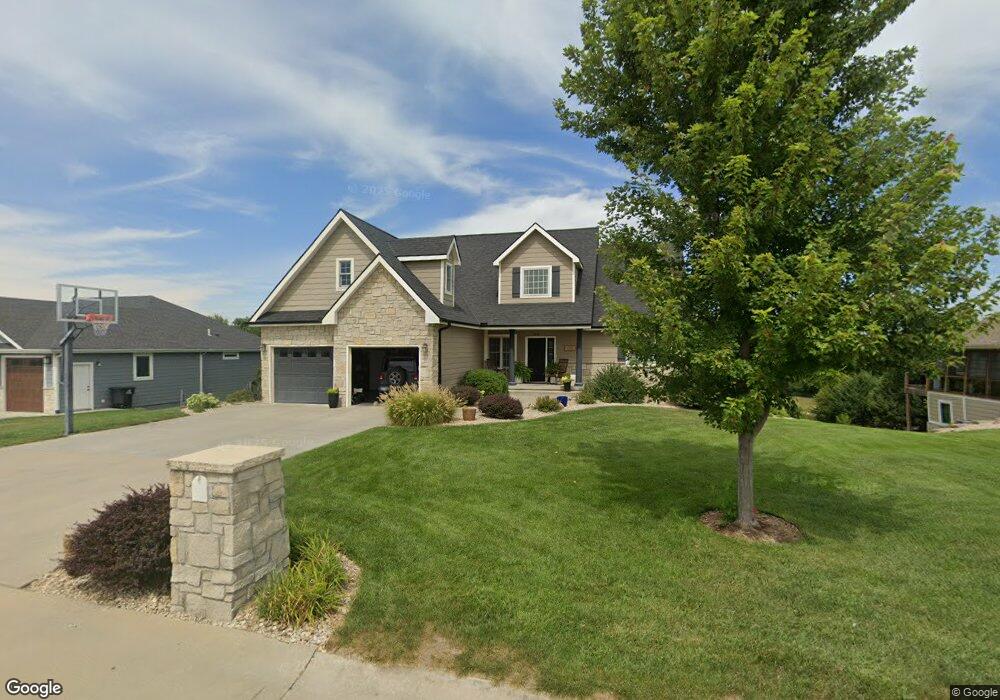
2010 Clifford Dr Wamego, KS 66547
Estimated Value: $252,000 - $609,000
5
Beds
4
Baths
3,997
Sq Ft
$122/Sq Ft
Est. Value
About This Home
This home is located at 2010 Clifford Dr, Wamego, KS 66547 and is currently estimated at $488,150, approximately $122 per square foot. 2010 Clifford Dr is a home located in Pottawatomie County with nearby schools including Central Elementary School, West Elementary School, and Wamego Middle School.
Ownership History
Date
Name
Owned For
Owner Type
Purchase Details
Closed on
Sep 9, 2011
Sold by
Brothers Eichman
Bought by
Wamego Development Co
Current Estimated Value
Purchase Details
Closed on
Sep 2, 2009
Sold by
Ebi Construction Inc
Bought by
Schoenbeck Matthew K and Schoenbeck Erika N
Home Financials for this Owner
Home Financials are based on the most recent Mortgage that was taken out on this home.
Original Mortgage
$266,267
Interest Rate
5.2%
Purchase Details
Closed on
Feb 20, 2009
Sold by
Wamego Development Company Inc
Bought by
Ebi Construction Inc
Home Financials for this Owner
Home Financials are based on the most recent Mortgage that was taken out on this home.
Original Mortgage
$250,000
Interest Rate
5.06%
Mortgage Type
Small Business Administration
Create a Home Valuation Report for This Property
The Home Valuation Report is an in-depth analysis detailing your home's value as well as a comparison with similar homes in the area
Home Values in the Area
Average Home Value in this Area
Purchase History
| Date | Buyer | Sale Price | Title Company |
|---|---|---|---|
| Wamego Development Co | -- | None Available | |
| Schoenbeck Matthew K | -- | None Available | |
| Ebi Construction Inc | -- | None Available | |
| Wamego Development Company Inc | -- | None Available |
Source: Public Records
Mortgage History
| Date | Status | Borrower | Loan Amount |
|---|---|---|---|
| Previous Owner | Schoenbeck Matthew K | $266,267 | |
| Previous Owner | Wamego Development Company Inc | $250,000 |
Source: Public Records
Tax History Compared to Growth
Tax History
| Year | Tax Paid | Tax Assessment Tax Assessment Total Assessment is a certain percentage of the fair market value that is determined by local assessors to be the total taxable value of land and additions on the property. | Land | Improvement |
|---|---|---|---|---|
| 2025 | $7,629 | $63,238 | $5,575 | $57,663 |
| 2024 | $76 | $61,051 | $4,885 | $56,166 |
| 2023 | $7,494 | $58,569 | $4,249 | $54,320 |
| 2022 | $5,814 | $52,876 | $4,049 | $48,827 |
| 2021 | $5,814 | $47,328 | $4,049 | $43,279 |
| 2020 | $5,814 | $46,448 | $4,049 | $42,399 |
| 2019 | $5,943 | $47,299 | $4,049 | $43,250 |
| 2018 | $5,882 | $46,951 | $4,049 | $42,902 |
| 2017 | $5,708 | $45,536 | $4,210 | $41,326 |
| 2016 | $5,551 | $44,862 | $3,809 | $41,053 |
| 2015 | -- | $39,181 | $3,356 | $35,825 |
| 2014 | -- | $37,731 | $3,290 | $34,441 |
Source: Public Records
Map
Nearby Homes
- 2102 Henry Dr Unit Lot 4
- 1311 16th St
- 2203 Country Club Dr
- 1403 Lilac Ln
- 1505 Lilac Ln
- 1609 Sunset Dr
- 4320 Rebecca Ln
- 1500 Grandview Dr
- 503 Parkview Dr
- 814 14th St
- 1104 8th St
- 903 Poplar St
- 0000 Highway 24
- 609 Spruce St
- 910 Poplar St
- 509 Chestnut St
- 713 Poplar St
- 5310 Ashley Rd
- 5310 Kaw Valley Rd
- 914 Ash St
- 2008 Clifford Dr
- 2100 Clifford Dr
- 2006 Clifford Dr
- 2009 Clifford Dr
- 2102 Clifford Dr
- 2101 Clifford Dr
- 2007 Clifford Dr
- 2103 Clifford Dr
- 2104 Clifford Dr
- 2005 Clifford Dr
- 2004 Clifford Dr
- 2012 Henry Dr
- 2105 Clifford Dr
- 2003 Clifford Dr
- 2207 Willow Creek Place
- 2002 Clifford Dr
- 2010 Henry Dr
- 2209 Willow Creek Place
- 2004 Henry Dr
- 2001 Clifford Dr