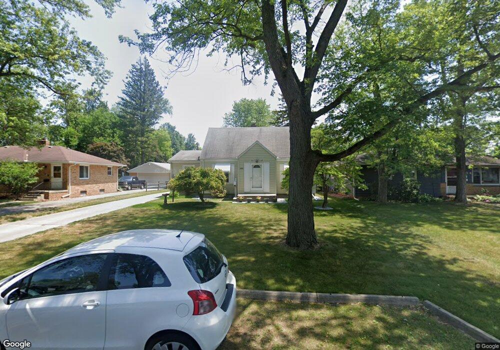
2010 Hogarth Rd Toledo, OH 43615
Reynolds Corners NeighborhoodEstimated Value: $148,933 - $172,000
3
Beds
1
Bath
1,315
Sq Ft
$124/Sq Ft
Est. Value
About This Home
This home is located at 2010 Hogarth Rd, Toledo, OH 43615 and is currently estimated at $162,733, approximately $123 per square foot. 2010 Hogarth Rd is a home located in Lucas County with nearby schools including Hawkins Elementary School, Rogers High School, and St. Benedict Catholic School.
Ownership History
Date
Name
Owned For
Owner Type
Purchase Details
Closed on
Jun 21, 2016
Sold by
Smith Jeanette M and Goodell Christina
Bought by
Smith Jeanette M and Goodwell Christina
Current Estimated Value
Create a Home Valuation Report for This Property
The Home Valuation Report is an in-depth analysis detailing your home's value as well as a comparison with similar homes in the area
Home Values in the Area
Average Home Value in this Area
Purchase History
| Date | Buyer | Sale Price | Title Company |
|---|---|---|---|
| Smith Jeanette M | -- | None Available |
Source: Public Records
Tax History Compared to Growth
Tax History
| Year | Tax Paid | Tax Assessment Tax Assessment Total Assessment is a certain percentage of the fair market value that is determined by local assessors to be the total taxable value of land and additions on the property. | Land | Improvement |
|---|---|---|---|---|
| 2024 | $696 | $30,310 | $7,735 | $22,575 |
| 2023 | $1,377 | $28,700 | $6,930 | $21,770 |
| 2022 | $1,386 | $28,700 | $6,930 | $21,770 |
| 2021 | $1,435 | $28,700 | $6,930 | $21,770 |
| 2020 | $1,278 | $23,765 | $5,740 | $18,025 |
| 2019 | $1,228 | $23,765 | $5,740 | $18,025 |
| 2018 | $1,228 | $23,765 | $5,740 | $18,025 |
| 2017 | $1,181 | $22,680 | $5,075 | $17,605 |
| 2016 | $1,199 | $64,800 | $14,500 | $50,300 |
| 2015 | $1,220 | $64,800 | $14,500 | $50,300 |
| 2014 | $877 | $22,690 | $5,080 | $17,610 |
| 2013 | $877 | $22,690 | $5,080 | $17,610 |
Source: Public Records
Map
Nearby Homes
- 2026 Pautucket Rd
- 4709 W Bancroft St
- 4515 W Bancroft St
- 4519 W Bancroft St
- 2009 Garden Ln
- 4236 S Terrace View St
- 5051 Wissman Rd
- 2222 Talmadge Rd
- 5331 Fleet Rd
- 5041 Ancil Rd
- 4057 Hillandale Rd
- 2130 Richards Rd
- 801 Hilltop Ln
- 5057 Brandon Rd
- 2720 Derby Rd
- 710 Hilltop Ln
- 5029 Kellogg Rd
- 3925 Hillandale Rd
- 1101 Sawyer Rd
- 1925 Olimphia Rd