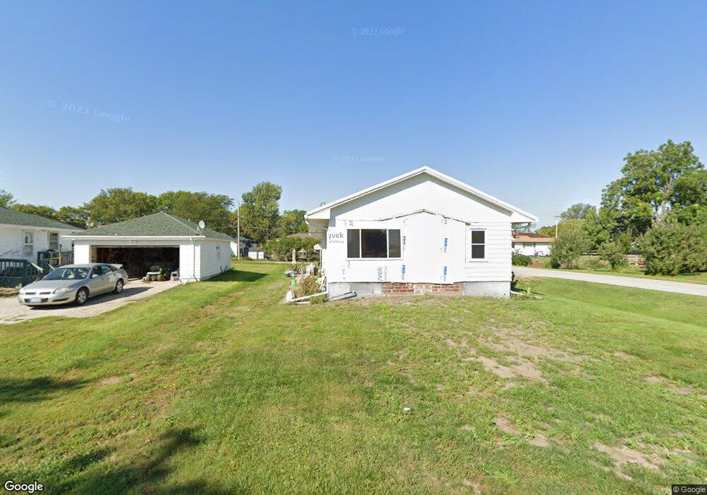
2010 Locust St Granger, IA 50109
Estimated Value: $159,000 - $258,000
3
Beds
1
Bath
1,092
Sq Ft
$187/Sq Ft
Est. Value
About This Home
This home is located at 2010 Locust St, Granger, IA 50109 and is currently estimated at $204,332, approximately $187 per square foot. 2010 Locust St is a home located in Dallas County with nearby schools including Woodward-Granger Elementary School and Woodward-Granger Middle School.
Ownership History
Date
Name
Owned For
Owner Type
Purchase Details
Closed on
Dec 8, 2021
Sold by
Kuehl Robert W and Kuehl Valerie J
Bought by
Kuehl Robert Austin
Current Estimated Value
Home Financials for this Owner
Home Financials are based on the most recent Mortgage that was taken out on this home.
Original Mortgage
$58,200
Outstanding Balance
$53,550
Interest Rate
3.14%
Mortgage Type
New Conventional
Estimated Equity
$150,782
Purchase Details
Closed on
Mar 3, 2017
Sold by
Gunderson Clarence J
Bought by
Kuehl Robert W and Kuehl Valerie J
Home Financials for this Owner
Home Financials are based on the most recent Mortgage that was taken out on this home.
Original Mortgage
$50,500
Interest Rate
4.09%
Mortgage Type
Future Advance Clause Open End Mortgage
Purchase Details
Closed on
Sep 9, 2014
Sold by
Core Carolee and Core Howard
Bought by
Gunderson Eva R
Create a Home Valuation Report for This Property
The Home Valuation Report is an in-depth analysis detailing your home's value as well as a comparison with similar homes in the area
Home Values in the Area
Average Home Value in this Area
Purchase History
| Date | Buyer | Sale Price | Title Company |
|---|---|---|---|
| Kuehl Robert Austin | $60,000 | None Available | |
| Kuehl Robert W | $36,500 | None Available | |
| Gunderson Eva R | $30,000 | None Available |
Source: Public Records
Mortgage History
| Date | Status | Borrower | Loan Amount |
|---|---|---|---|
| Open | Kuehl Robert Austin | $58,200 | |
| Previous Owner | Kuehl Robert W | $50,500 |
Source: Public Records
Tax History Compared to Growth
Tax History
| Year | Tax Paid | Tax Assessment Tax Assessment Total Assessment is a certain percentage of the fair market value that is determined by local assessors to be the total taxable value of land and additions on the property. | Land | Improvement |
|---|---|---|---|---|
| 2024 | $2,220 | $117,650 | $22,500 | $95,150 |
| 2023 | $2,220 | $117,650 | $22,500 | $95,150 |
| 2022 | $2,060 | $106,240 | $20,000 | $86,240 |
| 2021 | $2,060 | $100,860 | $20,000 | $80,860 |
| 2020 | $2,068 | $96,470 | $20,000 | $76,470 |
| 2019 | $1,888 | $96,470 | $20,000 | $76,470 |
| 2018 | $1,888 | $82,440 | $18,800 | $63,640 |
| 2017 | $2,128 | $92,940 | $18,800 | $74,140 |
| 2016 | $2,006 | $87,750 | $18,800 | $68,950 |
| 2015 | $1,616 | $73,010 | $0 | $0 |
| 2014 | $1,588 | $73,010 | $0 | $0 |
Source: Public Records
Map
Nearby Homes
- 2009 Locust St
- 1915 Locust St
- 1805 Sycamore St
- 1803 Walnut St
- 1806 Main St
- 2004 White Oak Ln
- 2103 White Oak Ln
- 2105 White Oak Ln
- 2208 White Oak Ln
- 2008 White Oak Ln
- 2403 White Oak Ln
- 2009 Oak St
- Dogwood B Plan at Oxley Creek West
- Xavier Plan at Oxley Creek West
- Hoover C Plan at Oxley Creek West
- Walton C Plan at Oxley Creek West
- Fillmore Plan at Oxley Creek West
- Hoover B Plan at Oxley Creek West
- Eisenhower Plan at Oxley Creek West
- Spencer I Plan at Oxley Creek West
- 2008 Locust St
- 2100 Locust St
- 2009 Sycamore St
- 2006 Locust St
- 2007 Sycamore St
- 2004 Locust St
- 2101 Sycamore St
- 2005 Sycamore St
- 2102 Locust St
- 2007 Locust St
- 2002 Locust St
- 2101 Locust St
- 2003 Locust St
- 2103 Sycamore St
- 2000 State St
- 2104 Locust St
- 2006 Sycamore St
- 2103 Locust St
- 2008 State St
- 2001 Locust St