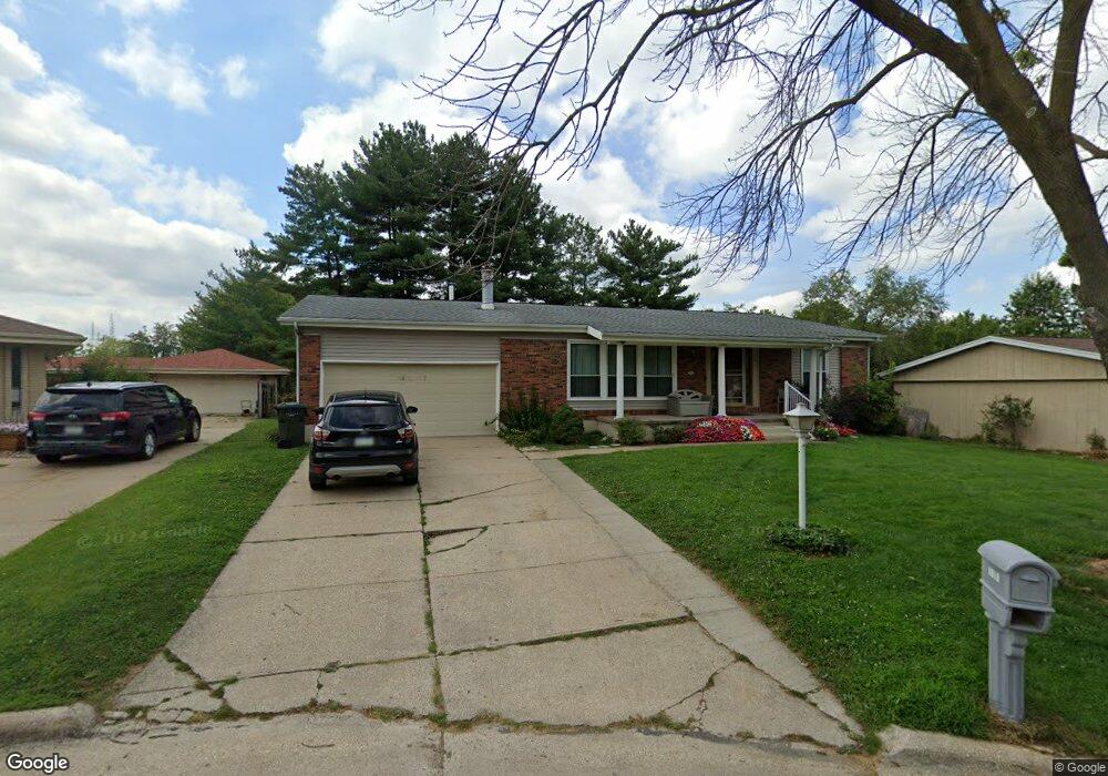
2010 Logan Dr Keokuk, IA 52632
Estimated Value: $175,000 - $227,000
6
Beds
3
Baths
1,752
Sq Ft
$118/Sq Ft
Est. Value
About This Home
This home is located at 2010 Logan Dr, Keokuk, IA 52632 and is currently estimated at $206,708, approximately $117 per square foot. 2010 Logan Dr is a home located in Lee County with nearby schools including Hawthorne Elementary School, George Washington Elementary School, and Keokuk Middle School.
Ownership History
Date
Name
Owned For
Owner Type
Purchase Details
Closed on
Aug 29, 2007
Sold by
Javier Felipe
Bought by
Wills Thomas E and Wills Ehren S
Current Estimated Value
Home Financials for this Owner
Home Financials are based on the most recent Mortgage that was taken out on this home.
Original Mortgage
$118,400
Outstanding Balance
$75,156
Interest Rate
6.71%
Mortgage Type
New Conventional
Estimated Equity
$131,552
Create a Home Valuation Report for This Property
The Home Valuation Report is an in-depth analysis detailing your home's value as well as a comparison with similar homes in the area
Home Values in the Area
Average Home Value in this Area
Purchase History
| Date | Buyer | Sale Price | Title Company |
|---|---|---|---|
| Wills Thomas E | $148,000 | None Available |
Source: Public Records
Mortgage History
| Date | Status | Borrower | Loan Amount |
|---|---|---|---|
| Open | Wills Thomas E | $118,400 |
Source: Public Records
Tax History Compared to Growth
Tax History
| Year | Tax Paid | Tax Assessment Tax Assessment Total Assessment is a certain percentage of the fair market value that is determined by local assessors to be the total taxable value of land and additions on the property. | Land | Improvement |
|---|---|---|---|---|
| 2025 | $4,992 | $245,190 | $19,550 | $225,640 |
| 2024 | $4,992 | $204,540 | $19,550 | $184,990 |
| 2023 | $4,418 | $204,540 | $19,550 | $184,990 |
| 2022 | $3,764 | $166,650 | $19,550 | $147,100 |
| 2021 | $3,764 | $166,650 | $19,550 | $147,100 |
| 2020 | $3,658 | $161,720 | $20,720 | $141,000 |
| 2019 | $3,616 | $161,720 | $20,720 | $141,000 |
| 2018 | $3,486 | $144,260 | $0 | $0 |
| 2017 | $3,486 | $144,260 | $0 | $0 |
| 2016 | $3,420 | $144,260 | $0 | $0 |
| 2015 | $3,420 | $144,260 | $0 | $0 |
| 2014 | $3,390 | $144,260 | $0 | $0 |
Source: Public Records
Map
Nearby Homes
- 716 Boulevard Rd
- 1707 Parkview Heights
- 1818 Grand Ave
- 1905 Grand Ave
- 2928 Middle Rd
- 503 Hawthorne Place
- 306 Hickory Terrace
- 723 Hazelhurst Cir
- 402 Hawthorne Place
- 11 Sun Crest Terrace
- 1528 Franklin St
- 1616 High St
- 1829 Main St
- 618 N 13th St
- 16 S 19th St
- 518 N 13th St
- 1226 Leighton St
- 1821 Johnson St
- 28 Melody Ct
- 726 N 12th St