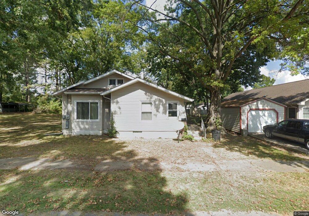
2010 Minton St Murphysboro, IL 62966
Estimated Value: $77,000 - $104,160
3
Beds
1
Bath
1,138
Sq Ft
$78/Sq Ft
Est. Value
About This Home
This home is located at 2010 Minton St, Murphysboro, IL 62966 and is currently estimated at $88,790, approximately $78 per square foot. 2010 Minton St is a home located in Jackson County with nearby schools including Murphysboro High School, Murphysboro Christian Academy, and Immanuel Lutheran School.
Ownership History
Date
Name
Owned For
Owner Type
Purchase Details
Closed on
Oct 6, 2005
Sold by
Titsworth Andrew D and Titsworth Jill Elizabeth
Bought by
Mcknezie Meagan
Current Estimated Value
Home Financials for this Owner
Home Financials are based on the most recent Mortgage that was taken out on this home.
Original Mortgage
$47,500
Outstanding Balance
$29,541
Interest Rate
8.45%
Mortgage Type
Adjustable Rate Mortgage/ARM
Estimated Equity
$59,249
Create a Home Valuation Report for This Property
The Home Valuation Report is an in-depth analysis detailing your home's value as well as a comparison with similar homes in the area
Home Values in the Area
Average Home Value in this Area
Purchase History
| Date | Buyer | Sale Price | Title Company |
|---|---|---|---|
| Mcknezie Meagan | $75,000 | None Available |
Source: Public Records
Mortgage History
| Date | Status | Borrower | Loan Amount |
|---|---|---|---|
| Open | Mcknezie Meagan | $47,500 |
Source: Public Records
Tax History Compared to Growth
Tax History
| Year | Tax Paid | Tax Assessment Tax Assessment Total Assessment is a certain percentage of the fair market value that is determined by local assessors to be the total taxable value of land and additions on the property. | Land | Improvement |
|---|---|---|---|---|
| 2024 | $2,763 | $26,933 | $1,635 | $25,298 |
| 2023 | $2,604 | $23,895 | $1,450 | $22,445 |
| 2022 | $1,850 | $16,346 | $1,329 | $15,017 |
| 2021 | $1,792 | $15,336 | $1,247 | $14,089 |
| 2020 | $1,803 | $15,153 | $1,232 | $13,921 |
| 2019 | $1,669 | $14,890 | $1,211 | $13,679 |
| 2018 | $1,395 | $19,369 | $1,211 | $18,158 |
| 2017 | $1,402 | $19,369 | $1,211 | $18,158 |
| 2016 | $1,368 | $19,369 | $1,211 | $18,158 |
| 2015 | -- | $19,369 | $1,211 | $18,158 |
| 2014 | -- | $19,370 | $1,211 | $18,159 |
| 2012 | -- | $19,370 | $1,211 | $18,159 |
Source: Public Records
Map
Nearby Homes
- 1933 Gartside St
- 1912 Hortense St
- 2112 Herbert St
- 2119 Rains St
- 2202 Illinois Ave Unit 3 & 4
- 2202 Illinois Ave Unit 1 & 2
- 2142 Herbert St
- 2130 Rains St
- 1520 Gartside St
- 2120 Logan St
- 1502 Gartside St
- 2129 Logan St
- 2004 Elm St
- 528 N 15th St
- 1935 Elm St
- 1420 Poplar St
- 1318 Olive St
- 2381 Logan St
- 1808 Pine St
- 1516 Elm St
- 1005N S 20th St
- 1005A N 20th St
- 2011 Hamilton St
- 923 N 20th St
- 1013 N 20th St
- 2024 Minton St
- 2034 Minton St
- 921 N 20th St
- 2019 Hamilton St
- 2011 Minton St
- 1010 Marlinda Ave
- 1936 Minton St
- 1010 Marlinda Dr
- 917 N 20th St
- 1014 Marlinda Ave
- 1925 Hamilton St
- 1932 Minton St
- 2012 Gartside St
- 2035 Minton St
- 1921 Hamilton St