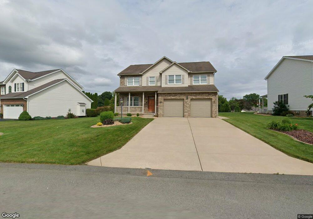
2010 Skyline Dr Latrobe, PA 15650
Estimated Value: $107,408 - $493,000
--
Bed
--
Bath
2,860
Sq Ft
$122/Sq Ft
Est. Value
About This Home
This home is located at 2010 Skyline Dr, Latrobe, PA 15650 and is currently estimated at $349,352, approximately $122 per square foot. 2010 Skyline Dr is a home located in Westmoreland County with nearby schools including Greater Latrobe Junior High School, Greater Latrobe Senior High School, and High Acres School.
Ownership History
Date
Name
Owned For
Owner Type
Purchase Details
Closed on
Jul 18, 2001
Sold by
Pellis Thomas M and Rugh Robert J
Bought by
Romanko Karen M
Current Estimated Value
Home Financials for this Owner
Home Financials are based on the most recent Mortgage that was taken out on this home.
Original Mortgage
$220,000
Interest Rate
6.25%
Mortgage Type
Purchase Money Mortgage
Create a Home Valuation Report for This Property
The Home Valuation Report is an in-depth analysis detailing your home's value as well as a comparison with similar homes in the area
Home Values in the Area
Average Home Value in this Area
Purchase History
| Date | Buyer | Sale Price | Title Company |
|---|---|---|---|
| Romanko Karen M | $37,900 | -- |
Source: Public Records
Mortgage History
| Date | Status | Borrower | Loan Amount |
|---|---|---|---|
| Closed | Romanko Karen M | $220,000 | |
| Closed | Romanko Karen M | $220,000 |
Source: Public Records
Tax History Compared to Growth
Tax History
| Year | Tax Paid | Tax Assessment Tax Assessment Total Assessment is a certain percentage of the fair market value that is determined by local assessors to be the total taxable value of land and additions on the property. | Land | Improvement |
|---|---|---|---|---|
| 2025 | $4,914 | $40,720 | $5,600 | $35,120 |
| 2024 | $4,914 | $40,720 | $5,600 | $35,120 |
| 2023 | $4,507 | $40,720 | $5,600 | $35,120 |
| 2022 | $4,507 | $40,720 | $5,600 | $35,120 |
| 2021 | $4,467 | $40,720 | $5,600 | $35,120 |
| 2020 | $4,395 | $40,720 | $5,600 | $35,120 |
| 2019 | $4,334 | $40,720 | $5,600 | $35,120 |
| 2018 | $4,314 | $40,720 | $5,600 | $35,120 |
| 2017 | $4,202 | $40,720 | $5,600 | $35,120 |
| 2016 | $985 | $40,720 | $5,600 | $35,120 |
| 2015 | $985 | $40,720 | $5,600 | $35,120 |
| 2014 | -- | $40,720 | $5,600 | $35,120 |
Source: Public Records
Map
Nearby Homes
- 113 Mount Ranier Dr
- 807 Beatty Village Rd
- 444 Meadow Spring Rd
- 1113 B St
- 1580 Lois Ln Unit Lot 11 C
- 1584 Lois Ln Unit Lot 11 A
- 1582 Lois Ln Unit Lot 11 B
- 1108 B St
- 359 Meadow Spring Rd
- 00 Frye Farm Road Clair Dr
- 434 Eton Dr
- 5634 State Route 981
- 139 Ice House Rd
- 1213 W Fir Dr
- 121 Eleanor Dr
- 227 Meadow Spring Rd
- 145 Easy St
- 3021 White Pines Dr
- 710 Greyhound Ln
- 114 Greenfield Dr
- 2014 Skyline Dr
- 2012 Skyline Dr
- 2008 Skyline Dr
- 2006 Sky Line Dr
- 755 Skyline Dr
- 1010 Blue Ridge Dr
- 2011 Skyline Dr
- 2009 Skyline Dr
- 1006 Blue Ridge Dr
- 1012 Blue Ridge Dr
- 2013 Skyline Dr
- 2015 Skyline Dr
- 2004 Skyline Dr
- 2007 Skyline Dr
- 1004 Blue Ridge Dr
- 1009 Blue Ridge Dr
- 2017 Skyline Dr
- 2005 Skyline Dr
- 2019 Skyline Dr
- 1011 Blue Ridge Dr