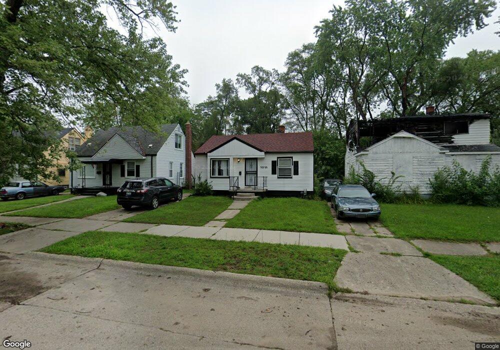
20100 Fenmore St Detroit, MI 48235
Greenfield NeighborhoodEstimated Value: $62,000 - $79,486
2
Beds
1
Bath
799
Sq Ft
$91/Sq Ft
Est. Value
About This Home
This home is located at 20100 Fenmore St, Detroit, MI 48235 and is currently estimated at $72,622, approximately $90 per square foot. 20100 Fenmore St is a home located in Wayne County with nearby schools including Bow Elementary-Middle School, Charles L. Spain Elementary-Middle School, and Edward 'Duke' Ellington Conservatory of Music and Art.
Ownership History
Date
Name
Owned For
Owner Type
Purchase Details
Closed on
Aug 27, 2013
Sold by
Benjigates Estates Llc
Bought by
The 20100 Fenmore Land Trust
Current Estimated Value
Purchase Details
Closed on
Nov 27, 2012
Sold by
Wayne County Treasurer
Bought by
Benjigates Estates Llc
Purchase Details
Closed on
Jan 21, 2009
Sold by
Bryce Peters Financial Corporation
Bought by
Paramount Land Holdings Llc
Purchase Details
Closed on
Aug 28, 2008
Sold by
Lasalle Bank Na
Bought by
Bryce Peters Financial Corp
Purchase Details
Closed on
Aug 15, 2007
Sold by
Tinsley Keith
Bought by
Lasalle Bank Na and Lehman Brothers Structured Asset Investm
Purchase Details
Closed on
Feb 26, 2004
Sold by
Brown Tia Renee and French Tia Renee
Bought by
Tinsley Keith
Create a Home Valuation Report for This Property
The Home Valuation Report is an in-depth analysis detailing your home's value as well as a comparison with similar homes in the area
Home Values in the Area
Average Home Value in this Area
Purchase History
| Date | Buyer | Sale Price | Title Company |
|---|---|---|---|
| The 20100 Fenmore Land Trust | -- | None Available | |
| Benjigates Estates Llc | $601 | None Available | |
| Paramount Land Holdings Llc | -- | None Available | |
| Bryce Peters Financial Corp | -- | None Available | |
| Lasalle Bank Na | $35,000 | None Available | |
| Tinsley Keith | $55,000 | Multiple |
Source: Public Records
Tax History Compared to Growth
Tax History
| Year | Tax Paid | Tax Assessment Tax Assessment Total Assessment is a certain percentage of the fair market value that is determined by local assessors to be the total taxable value of land and additions on the property. | Land | Improvement |
|---|---|---|---|---|
| 2025 | $1,104 | $40,200 | $0 | $0 |
| 2024 | $1,104 | $36,100 | $0 | $0 |
| 2023 | $1,071 | $28,600 | $0 | $0 |
| 2022 | $1,139 | $22,000 | $0 | $0 |
| 2021 | $1,109 | $17,400 | $0 | $0 |
| 2020 | $1,109 | $16,000 | $0 | $0 |
| 2019 | $1,093 | $13,000 | $0 | $0 |
| 2018 | $964 | $10,300 | $0 | $0 |
| 2017 | $9 | $500 | $0 | $0 |
| 2016 | $453 | $900 | $0 | $0 |
| 2015 | $87 | $900 | $0 | $0 |
| 2013 | $1,351 | $13,514 | $0 | $0 |
| 2010 | -- | $19,363 | $854 | $18,509 |
Source: Public Records
Map
Nearby Homes
- 20210 Archdale St
- 20052 Archdale St
- 20245 Archdale St
- 20051 Oakfield St
- 20014 Southfield Rd
- 20004 Southfield Fwy
- 20220 Ashton Ave
- 20510 Fenmore St
- 19925 Archdale St
- 20201 Ashton Ave
- 20200 Lindsay St
- 19950 Oakfield St
- 20542 Oakfield St
- 20542 Ashton Ave
- 20558 Oakfield St
- 20091 Biltmore St
- 20300 Gilchrist St
- 19765 Archdale St
- 19781 Oakfield St
- 19786 Oakfield St
- 20106 Fenmore St
- 20090 Fenmore St
- 20114 Fenmore St
- 20082 Fenmore St
- 20074 Fenmore St
- 20099 Archdale St
- 20091 Archdale St
- 20109 Archdale St
- 20085 Archdale St
- 20115 Archdale St
- 20066 Fenmore St
- 20077 Archdale St
- 20200 Fenmore St
- 20101 Fenmore St
- 20109 Fenmore St
- 20093 Fenmore St
- 20058 Fenmore St
- 20117 Fenmore St
- 20085 Fenmore St
- 20067 Archdale St