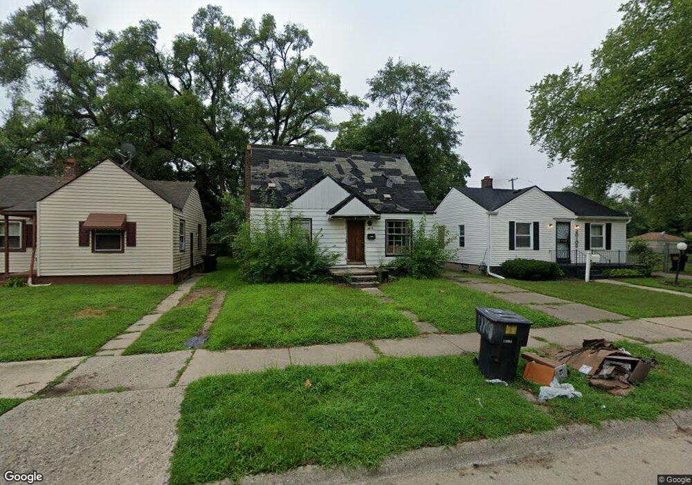
20101 Fenmore St Detroit, MI 48235
Greenfield NeighborhoodEstimated Value: $58,000 - $79,000
--
Bed
1
Bath
890
Sq Ft
$77/Sq Ft
Est. Value
About This Home
This home is located at 20101 Fenmore St, Detroit, MI 48235 and is currently estimated at $68,500, approximately $76 per square foot. 20101 Fenmore St is a home located in Wayne County with nearby schools including Bow Elementary-Middle School, Charles L. Spain Elementary-Middle School, and Edward 'Duke' Ellington Conservatory of Music and Art.
Ownership History
Date
Name
Owned For
Owner Type
Purchase Details
Closed on
Jan 12, 2017
Sold by
Sabree Eric R
Bought by
Detroit Land Bank Authority
Current Estimated Value
Purchase Details
Closed on
Aug 27, 2013
Sold by
Benjigates Estates Llc
Bought by
The 20101 Fenmore Land Trust
Purchase Details
Closed on
Nov 27, 2012
Sold by
Wayne County Treasurer
Bought by
Benjigates Estates Llc
Purchase Details
Closed on
Feb 14, 2011
Sold by
Kelley Tyson
Bought by
Ibbs Management
Purchase Details
Closed on
Jun 17, 2010
Sold by
Fisher Cynthia Key
Bought by
Kelley Tyson
Create a Home Valuation Report for This Property
The Home Valuation Report is an in-depth analysis detailing your home's value as well as a comparison with similar homes in the area
Home Values in the Area
Average Home Value in this Area
Purchase History
| Date | Buyer | Sale Price | Title Company |
|---|---|---|---|
| Detroit Land Bank Authority | -- | None Available | |
| The 20101 Fenmore Land Trust | -- | None Available | |
| Benjigates Estates Llc | $701 | None Available | |
| Ibbs Management | -- | None Available | |
| Kelley Tyson | $1,500 | None Available |
Source: Public Records
Tax History Compared to Growth
Tax History
| Year | Tax Paid | Tax Assessment Tax Assessment Total Assessment is a certain percentage of the fair market value that is determined by local assessors to be the total taxable value of land and additions on the property. | Land | Improvement |
|---|---|---|---|---|
| 2025 | -- | $0 | $0 | $0 |
| 2024 | -- | $0 | $0 | $0 |
| 2023 | $0 | $0 | $0 | $0 |
| 2022 | $0 | $0 | $0 | $0 |
| 2021 | $0 | $0 | $0 | $0 |
| 2020 | $1,437 | $0 | $0 | $0 |
| 2019 | $1,437 | $0 | $0 | $0 |
| 2018 | $0 | $6,100 | $0 | $0 |
| 2017 | $108 | $5,700 | $0 | $0 |
| 2016 | $1,041 | $10,600 | $0 | $0 |
| 2015 | $1,060 | $10,600 | $0 | $0 |
| 2013 | $1,482 | $14,821 | $0 | $0 |
| 2010 | -- | $21,236 | $856 | $20,380 |
Source: Public Records
Map
Nearby Homes
- 20014 Southfield Rd
- 20004 Southfield Fwy
- 20245 Archdale St
- 20210 Archdale St
- 20052 Archdale St
- 20220 Ashton Ave
- 20051 Oakfield St
- 20201 Ashton Ave
- 20510 Fenmore St
- 19925 Archdale St
- 19950 Oakfield St
- 20200 Lindsay St
- 20542 Ashton Ave
- 20542 Oakfield St
- 20558 Oakfield St
- 18231 Pembroke Ave
- 19765 Archdale St
- 20285 Glastonbury Rd
- 20091 Biltmore St
- 19781 Oakfield St
- 20093 Fenmore St
- 20109 Fenmore St
- 20085 Fenmore St
- 20117 Fenmore St
- 20075 Fenmore St
- 20104 Southfield Fwy
- 20094 Southfield Fwy
- 20110 Southfield Fwy
- 20088 Southfield Fwy
- 20090 Fenmore St
- 20080 Southfield Fwy
- 20067 Fenmore St
- 20082 Fenmore St
- 20201 Fenmore St
- 20072 Southfield Fwy
- 20100 Fenmore St
- 20106 Fenmore St
- 20061 Fenmore St
- 20114 Fenmore St
- 20064 Southfield Fwy