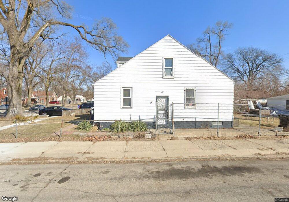
20104 Anglin St Detroit, MI 48234
Butler NeighborhoodEstimated Value: $54,000 - $70,000
3
Beds
1
Bath
981
Sq Ft
$65/Sq Ft
Est. Value
About This Home
This home is located at 20104 Anglin St, Detroit, MI 48234 and is currently estimated at $64,218, approximately $65 per square foot. 20104 Anglin St is a home located in Wayne County with nearby schools including Nolan Elementary/Middle School, Edward 'Duke' Ellington Conservatory of Music and Art, and Charles L. Spain Elementary-Middle School.
Ownership History
Date
Name
Owned For
Owner Type
Purchase Details
Closed on
Oct 9, 2023
Sold by
Mih Property Group Llc
Bought by
F A Investment And Management Llc
Current Estimated Value
Purchase Details
Closed on
Oct 6, 2023
Sold by
Graham Petius
Bought by
Pinnacle Pointe Llc
Purchase Details
Closed on
Nov 16, 2012
Sold by
Wayne County Treasurer
Bought by
Graham Petrius
Create a Home Valuation Report for This Property
The Home Valuation Report is an in-depth analysis detailing your home's value as well as a comparison with similar homes in the area
Home Values in the Area
Average Home Value in this Area
Purchase History
| Date | Buyer | Sale Price | Title Company |
|---|---|---|---|
| F A Investment And Management Llc | $690,000 | None Listed On Document | |
| Fa Investment & Management Llc | $690,000 | None Listed On Document | |
| Mih Property Group Llc | $586,590 | None Listed On Document | |
| Pinnacle Pointe Llc | -- | None Listed On Document | |
| Graham Petrius | $1,100 | None Available |
Source: Public Records
Tax History Compared to Growth
Tax History
| Year | Tax Paid | Tax Assessment Tax Assessment Total Assessment is a certain percentage of the fair market value that is determined by local assessors to be the total taxable value of land and additions on the property. | Land | Improvement |
|---|---|---|---|---|
| 2025 | $1,252 | $15,800 | $0 | $0 |
| 2024 | $1,252 | $13,300 | $0 | $0 |
| 2023 | $673 | $10,260 | $0 | $0 |
| 2022 | $708 | $10,000 | $0 | $0 |
| 2021 | $692 | $8,100 | $0 | $0 |
| 2020 | $692 | $7,000 | $0 | $0 |
| 2019 | $684 | $5,130 | $0 | $0 |
| 2018 | $617 | $4,900 | $0 | $0 |
| 2017 | $91 | $4,800 | $0 | $0 |
| 2016 | $845 | $13,300 | $0 | $0 |
| 2015 | $800 | $8,000 | $0 | $0 |
| 2013 | $1,608 | $16,084 | $0 | $0 |
| 2010 | -- | $23,580 | $1,174 | $22,406 |
Source: Public Records
Map
Nearby Homes
- 20121 Mitchell St
- 20021 Mackay St
- 19958 Harned St
- 19951 Mackay St
- 19948 Mitchell St
- 20048 Fleming St
- 20037 Gallagher St
- 20156 Gallagher St
- 20028 Gallagher St
- 20021 Fleming St
- 23421 Harned St Unit 4
- 23429 Harned St Unit 5
- 23485 Harned St Unit 10
- 23420 Harned St Unit 1
- 20209 Revere St
- 20181 Lumpkin St
- 19629 Harned St
- 19624 Anglin St
- 19665 Charest St
- 19626 Mackay St
- 20110 Anglin St
- 20101 Harned St
- 20118 Anglin St
- 20050 Anglin St
- 20126 Anglin St
- 20038 Anglin St
- 20115 Harned St
- 20134 Anglin St
- 20045 Harned St
- 20125 Harned St
- 20030 Anglin St
- 20133 Harned St
- 20037 Harned St
- 20140 Anglin St
- 20117 Anglin St
- 20022 Anglin St
- 20129 Anglin St
- 20141 Harned St
- 20029 Harned St
- 20152 Anglin St