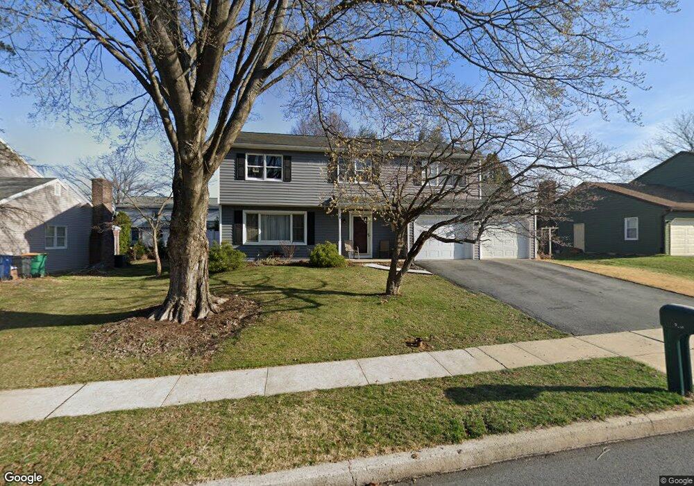
2011 Buckman Ave Reading, PA 19610
Whitfield NeighborhoodEstimated Value: $402,031 - $425,000
4
Beds
3
Baths
2,225
Sq Ft
$186/Sq Ft
Est. Value
About This Home
This home is located at 2011 Buckman Ave, Reading, PA 19610 and is currently estimated at $412,758, approximately $185 per square foot. 2011 Buckman Ave is a home located in Berks County with nearby schools including Spring Ridge Elementary School, Wilson West Middle School, and Wilson High School.
Ownership History
Date
Name
Owned For
Owner Type
Purchase Details
Closed on
Aug 26, 2002
Sold by
Leifer Michael J and Leifer Susan E
Bought by
Leifer Susan E
Current Estimated Value
Home Financials for this Owner
Home Financials are based on the most recent Mortgage that was taken out on this home.
Original Mortgage
$133,025
Interest Rate
6.27%
Create a Home Valuation Report for This Property
The Home Valuation Report is an in-depth analysis detailing your home's value as well as a comparison with similar homes in the area
Home Values in the Area
Average Home Value in this Area
Purchase History
| Date | Buyer | Sale Price | Title Company |
|---|---|---|---|
| Leifer Susan E | -- | -- |
Source: Public Records
Mortgage History
| Date | Status | Borrower | Loan Amount |
|---|---|---|---|
| Previous Owner | Leifer Susan E | $133,025 |
Source: Public Records
Tax History Compared to Growth
Tax History
| Year | Tax Paid | Tax Assessment Tax Assessment Total Assessment is a certain percentage of the fair market value that is determined by local assessors to be the total taxable value of land and additions on the property. | Land | Improvement |
|---|---|---|---|---|
| 2025 | $2,417 | $133,500 | $23,700 | $109,800 |
| 2024 | $5,712 | $133,500 | $23,700 | $109,800 |
| 2023 | $5,442 | $133,500 | $23,700 | $109,800 |
| 2022 | $5,309 | $133,500 | $23,700 | $109,800 |
| 2021 | $5,122 | $133,500 | $23,700 | $109,800 |
| 2020 | $5,122 | $133,500 | $23,700 | $109,800 |
| 2019 | $4,976 | $133,500 | $23,700 | $109,800 |
| 2018 | $4,934 | $133,500 | $23,700 | $109,800 |
| 2017 | $4,850 | $133,500 | $23,700 | $109,800 |
| 2016 | $1,690 | $133,500 | $23,700 | $109,800 |
| 2015 | $1,690 | $133,500 | $23,700 | $109,800 |
| 2014 | $1,690 | $133,500 | $23,700 | $109,800 |
Source: Public Records
Map
Nearby Homes
- 802 Apple Dr
- 1914 Andre Ct
- 2900 State Hill Rd Unit I12
- 301 Warwick Dr
- 2035 Franklin Place
- 2912 State Hill Rd Unit B-2
- 191 Hawthorne Ct Unit 191A
- 317 Warwick Dr
- 118 Laurel Ct Unit 118B
- 179 Hawthorne Ct Unit 179A
- 121 Grandview Blvd
- 125 Grandview Blvd
- 120 Laurel Ct Unit 120A
- 101 Robert Rd
- 150 Laurel Ct Unit 150A
- 204 Springmont Dr
- 12 Vista Rd
- 61 Grandview Blvd
- 117 Hickory Ln
- 2021 Noble St
- 2009 Buckman Ave
- 2013 Buckman Ave
- 2010 Cypress Ln
- 2012 Cypress Ln
- 2008 Cypress Ln
- 2010 Buckman Ave
- 2007 Buckman Ave
- 2015 Buckman Ave
- 2012 Buckman Ave
- 2014 Cypress Ln
- 820 Apple Dr
- 2006 Cypress Ln
- 2014 Buckman Ave
- 2017 Buckman Ave
- 2005 Buckman Ave
- 2016 Cypress Ln
- 816 Apple Dr
- 2016 Buckman Ave
- 2013 Cypress Ln
- 2015 Cypress Ln