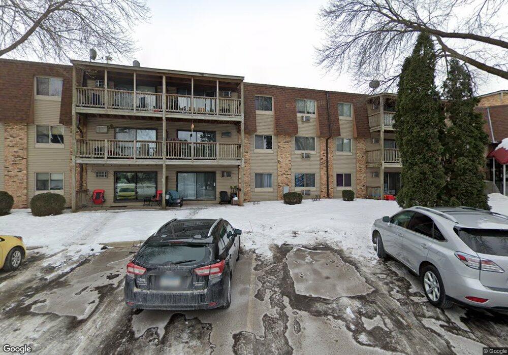
2011 E 122nd St Unit D19 Burnsville, MN 55337
Estimated Value: $122,000 - $131,000
2
Beds
1
Bath
1,010
Sq Ft
$125/Sq Ft
Est. Value
About This Home
This home is located at 2011 E 122nd St Unit D19, Burnsville, MN 55337 and is currently estimated at $126,202, approximately $124 per square foot. 2011 E 122nd St Unit D19 is a home located in Dakota County with nearby schools including William Byrne Elementary School, Burnsville High School, and Gateway STEM Academy.
Ownership History
Date
Name
Owned For
Owner Type
Purchase Details
Closed on
Apr 3, 2019
Sold by
Totall Gary T
Bought by
Starks Ryleigh Marie
Current Estimated Value
Home Financials for this Owner
Home Financials are based on the most recent Mortgage that was taken out on this home.
Original Mortgage
$99,910
Outstanding Balance
$87,839
Interest Rate
4.3%
Mortgage Type
New Conventional
Estimated Equity
$38,363
Purchase Details
Closed on
Sep 4, 2007
Sold by
Tcf National Bank
Bought by
Totall Gary T
Home Financials for this Owner
Home Financials are based on the most recent Mortgage that was taken out on this home.
Original Mortgage
$96,435
Interest Rate
6.55%
Mortgage Type
New Conventional
Purchase Details
Closed on
Oct 18, 2001
Sold by
Juran Donald C and Juran Linder J
Bought by
Halladay Howard
Purchase Details
Closed on
Nov 1, 1996
Sold by
Agovic Arif and Agovic Enisa
Bought by
Juran Donald C and Juran Linda J
Create a Home Valuation Report for This Property
The Home Valuation Report is an in-depth analysis detailing your home's value as well as a comparison with similar homes in the area
Home Values in the Area
Average Home Value in this Area
Purchase History
| Date | Buyer | Sale Price | Title Company |
|---|---|---|---|
| Starks Ryleigh Marie | $103,000 | On Site Title | |
| Totall Gary T | $97,750 | -- | |
| Halladay Howard | $105,000 | -- | |
| Juran Donald C | $38,500 | -- |
Source: Public Records
Mortgage History
| Date | Status | Borrower | Loan Amount |
|---|---|---|---|
| Open | Starks Ryleigh Marie | $99,910 | |
| Previous Owner | Totall Gary T | $96,435 |
Source: Public Records
Tax History Compared to Growth
Tax History
| Year | Tax Paid | Tax Assessment Tax Assessment Total Assessment is a certain percentage of the fair market value that is determined by local assessors to be the total taxable value of land and additions on the property. | Land | Improvement |
|---|---|---|---|---|
| 2024 | $1,092 | $122,700 | $12,000 | $110,700 |
| 2023 | $1,092 | $124,100 | $12,500 | $111,600 |
| 2022 | $914 | $121,400 | $12,200 | $109,200 |
| 2021 | $884 | $107,500 | $10,800 | $96,700 |
| 2020 | $806 | $100,800 | $10,200 | $90,600 |
| 2019 | $656 | $91,500 | $9,200 | $82,300 |
| 2018 | $637 | $77,100 | $7,800 | $69,300 |
| 2017 | $539 | $72,500 | $7,300 | $65,200 |
| 2016 | $527 | $61,300 | $6,200 | $55,100 |
| 2015 | $423 | $34,500 | $3,480 | $31,020 |
| 2014 | -- | $28,620 | $2,880 | $25,740 |
| 2013 | -- | $22,920 | $2,340 | $20,580 |
Source: Public Records
Map
Nearby Homes
- 2011 E 122nd St Unit D4
- 2009 E 122nd St Unit C9
- 2011 E 122nd St Unit D24
- 2009 E 122nd St Unit C8
- 2005 E 122nd St Unit A14
- 2007 E 122nd St Unit B15
- 12232 Oak Leaf Cir
- 2301 Connelly Cir
- 12316 Michelle Cir
- 2300 Villaburne Ct W
- 2400 E 125th St
- 1966 Skyline Dr S
- 12420 Chippewa Ln
- 1731 Riverwood Dr
- 2520 Allen Dr
- 1853 Riverwood Dr Unit 4
- 2200 Horizon Rd
- 1800 Riverwood Dr Unit 110
- 1800 Riverwood Dr Unit 323
- 12284 River Valley Dr
- 2011 E 122nd St Unit D23
- 2011 E 122nd St Unit D22
- 2011 E 122nd St Unit D21
- 2011 E 122nd St Unit D20
- 2011 E 122nd St Unit C18
- 2011 E 122nd St Unit D17
- 2011 E 122nd St Unit D16
- 2011 E 122nd St Unit D15
- 2011 E 122nd St Unit D14
- 2011 E 122nd St Unit D13
- 2011 E 122nd St Unit D11
- 2011 E 122nd St Unit D10
- 2011 E 122nd St Unit D9
- 2011 E 122nd St Unit D8
- 2011 E 122nd St Unit D7
- 2011 E 122nd St Unit D6
- 2011 E 122nd St Unit D5
- 2011 E 122nd St Unit D3
- 2011 E 122nd St Unit D2
- 2011 E 122nd St Unit D1