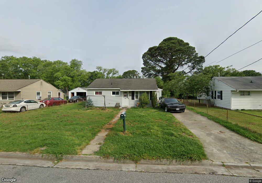
2011 Lansing Dr Hampton, VA 23663
Buckroe Beach NeighborhoodEstimated Value: $184,000 - $218,000
About This Home
This home is located at 2011 Lansing Dr, Hampton, VA 23663 and is currently estimated at $206,263, approximately $268 per square foot. 2011 Lansing Dr is a home located in Hampton City with nearby schools including Benjamin Syms Middle School, Phoebus High School, and Gloria Dei Lutheran School.
Ownership History
We collect this data history from publicly available records. To have your information removed, we recommend requesting removal directly through your county’s website.
Purchase Details
Home Financials for this Owner
Home Financials are based on the most recent Mortgage that was taken out on this home.Home Values in the Area
Average Home Value in this Area
Purchase History
We collect this data history from publicly available records. To have your information removed, we recommend requesting removal directly through your county’s website.
| Date | Buyer | Sale Price | Title Company |
|---|---|---|---|
| $104,900 | -- |
Mortgage History
We collect this data history from publicly available records. To have your information removed, we recommend requesting removal directly through your county’s website.
| Date | Status | Borrower | Loan Amount |
|---|---|---|---|
| Closed | $5,245 | ||
| Closed | $102,999 | ||
| Closed | $84,700 | ||
| Closed | $38,500 | ||
| Closed | $15,800 |
Tax History
We collect this data history from publicly available records. To have your information removed, we recommend requesting removal directly through your county’s website.
| Year | Tax Paid | Tax Assessment Tax Assessment Total Assessment is a certain percentage of the fair market value that is determined by local assessors to be the total taxable value of land and additions on the property. | Land | Improvement |
|---|---|---|---|---|
| 2025 | $2,205 | $179,900 | $55,000 | $124,900 |
| 2024 | $1,826 | $158,800 | $55,000 | $103,800 |
| 2023 | $1,639 | $141,300 | $55,000 | $86,300 |
| 2022 | $1,503 | $127,400 | $50,000 | $77,400 |
| 2021 | $1,487 | $109,400 | $42,000 | $67,400 |
| 2020 | $1,266 | $102,100 | $38,300 | $63,800 |
| 2019 | $1,271 | $102,500 | $38,300 | $64,200 |
| 2018 | $1,364 | $102,400 | $38,300 | $64,100 |
| 2017 | $1,364 | $0 | $0 | $0 |
| 2016 | $1,364 | $102,400 | $0 | $0 |
| 2015 | $1,364 | $0 | $0 | $0 |
| 2014 | $1,319 | $102,400 | $38,300 | $64,100 |
Map
- 2006 Andrews Blvd
- 1904 Nickerson Blvd
- 1903 Demetro Dr
- 2204 Rawood Dr
- 1407 Old Buckroe Rd
- 1405 Old Buckroe Rd
- 1527 Grove St
- 2023 Richard Ave
- 2022 Winfree Rd
- 637 Grimes Rd
- 2025 Nickerson Blvd
- 1532 Adams Cir
- 1607 Grimes Rd
- 442 Smiley Rd
- 445 Smiley Rd
- 714 Grove St
- 1521 Morgan Dr
- 807 Morris St
- 531 Price St
- 18 Reynolds Dr
- 2009 Lansing Dr
- 2007 Lansing Dr
- 2005 Lansing Dr
- 2013 Lansing Dr
- 2008 Kensington Dr
- 2006 Kensington Dr
- 2010 Kensington Dr
- 2004 Kensington Dr
- 2003 Lansing Dr
- 2012 Kensington Dr
- 2008 Lansing Dr
- 2015 Lansing Dr
- 2010 Lansing Dr
- 2006 Lansing Dr
- 2012 Lansing Dr
- 2004 Lansing Dr
- 2002 Kensington Dr
- 2014 Kensington Dr
- 2014 Lansing Dr
- 2002 Lansing Dr
Ask me questions while you tour the home.