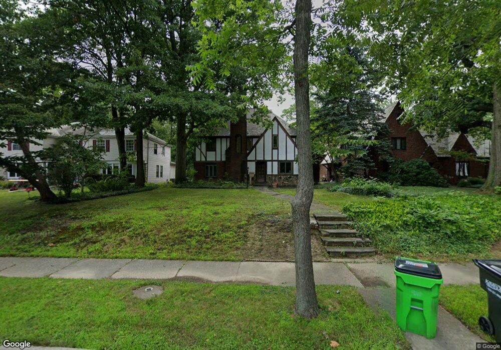
2011 Laurel Hill Dr Cleveland, OH 44121
Estimated Value: $252,000 - $323,000
5
Beds
4
Baths
2,278
Sq Ft
$125/Sq Ft
Est. Value
About This Home
This home is located at 2011 Laurel Hill Dr, Cleveland, OH 44121 and is currently estimated at $284,721, approximately $124 per square foot. 2011 Laurel Hill Dr is a home located in Cuyahoga County with nearby schools including Rowland Elementary School, Greenview Upper Elementary School, and Memorial Junior High School.
Ownership History
Date
Name
Owned For
Owner Type
Purchase Details
Closed on
Jan 10, 1997
Sold by
Ressler Gale A
Bought by
Moffat Robert B and Bergesen Carol A
Current Estimated Value
Home Financials for this Owner
Home Financials are based on the most recent Mortgage that was taken out on this home.
Original Mortgage
$147,600
Outstanding Balance
$15,241
Interest Rate
7.2%
Mortgage Type
New Conventional
Estimated Equity
$269,480
Purchase Details
Closed on
Jul 23, 1986
Sold by
Kohn Robert I
Bought by
Ressler Gale A
Purchase Details
Closed on
Jul 25, 1984
Sold by
Kohn Gal L
Bought by
Kohn Robert I
Purchase Details
Closed on
Dec 6, 1977
Sold by
Kohn Robert I
Bought by
Kohn Gal L
Purchase Details
Closed on
Sep 21, 1977
Sold by
Ernst Jack M and F E
Bought by
Employee Transfer Corp
Purchase Details
Closed on
Jan 1, 1975
Bought by
Ernst Jack M and F E
Create a Home Valuation Report for This Property
The Home Valuation Report is an in-depth analysis detailing your home's value as well as a comparison with similar homes in the area
Home Values in the Area
Average Home Value in this Area
Purchase History
| Date | Buyer | Sale Price | Title Company |
|---|---|---|---|
| Moffat Robert B | $164,000 | -- | |
| Ressler Gale A | $114,700 | -- | |
| Kohn Robert I | -- | -- | |
| Kohn Gal L | -- | -- | |
| Employee Transfer Corp | -- | -- | |
| Ernst Jack M | -- | -- |
Source: Public Records
Mortgage History
| Date | Status | Borrower | Loan Amount |
|---|---|---|---|
| Open | Moffat Robert B | $147,600 |
Source: Public Records
Tax History Compared to Growth
Tax History
| Year | Tax Paid | Tax Assessment Tax Assessment Total Assessment is a certain percentage of the fair market value that is determined by local assessors to be the total taxable value of land and additions on the property. | Land | Improvement |
|---|---|---|---|---|
| 2024 | $5,547 | $83,300 | $15,155 | $68,145 |
| 2023 | $6,242 | $76,480 | $13,130 | $63,350 |
| 2022 | $6,245 | $76,475 | $13,125 | $63,350 |
| 2021 | $6,195 | $76,480 | $13,130 | $63,350 |
| 2020 | $5,994 | $65,910 | $11,310 | $54,600 |
| 2019 | $5,460 | $188,300 | $32,300 | $156,000 |
| 2018 | $5,432 | $65,910 | $11,310 | $54,600 |
| 2017 | $4,633 | $53,030 | $10,920 | $42,110 |
| 2016 | $4,603 | $53,030 | $10,920 | $42,110 |
| 2015 | $4,462 | $53,030 | $10,920 | $42,110 |
| 2014 | $4,462 | $53,030 | $10,920 | $42,110 |
Source: Public Records
Map
Nearby Homes
- 2015 S Green Rd
- 1940 Temblethurst Rd
- 2091 S Belvoir Blvd
- 1895 Temblethurst Rd
- 2108 S Belvoir Blvd
- 4249 Wyncote Rd
- 4532 Mackall Rd
- 4237 Verona Rd
- 4206 Verona Rd
- 4194 Stilmore Rd
- 4197 Okalona Rd
- 14213 Cedar Rd
- 1884 Maywood Rd
- 4210 Stonehaven Rd
- 4586 Greenwold Rd
- 4521 Golfway Rd
- 1796 S Green Rd
- 4158 Wyncote Rd
- 4233 Bayard Rd
- 1834 Maywood Rd
- 2019 Laurel Hill Dr
- 2003 Laurel Hill Dr
- 1993 Laurel Hill Dr
- 2008 Laurel Hill Dr
- 2020 Laurel Hill Dr
- 2033 Laurel Hill Dr
- 1987 Laurel Hill Dr
- 2028 Laurel Hill Dr
- 0 Langerdale Rd
- 1994 Laurel Hill Dr
- 2032 Laurel Hill Dr
- 1979 Laurel Hill Dr
- 1988 Laurel Hill Dr
- 2036 Laurel Hill Dr
- 1980 Laurel Hill Dr
- 2007 Temblethurst Rd
- 2011 Temblethurst Rd
- 1971 Laurel Hill Dr
- 2044 Laurel Hill Dr
- 2019 Temblethurst Rd