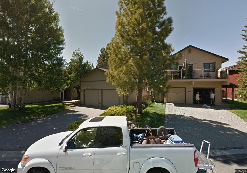
2011 Marconi Way South Lake Tahoe, CA 96150
Estimated Value: $887,911 - $1,228,000
3
Beds
2
Baths
1,648
Sq Ft
$643/Sq Ft
Est. Value
About This Home
This home is located at 2011 Marconi Way, South Lake Tahoe, CA 96150 and is currently estimated at $1,058,978, approximately $642 per square foot. 2011 Marconi Way is a home located in El Dorado County with nearby schools including Tahoe Valley Elementary School, South Tahoe Middle School, and South Tahoe High School.
Ownership History
Date
Name
Owned For
Owner Type
Purchase Details
Closed on
Nov 15, 1999
Sold by
Rosiak Edward Tr and Rosiak Linda Thom Tr
Bought by
Rosiak Edward and Rosiak Linda Thom
Current Estimated Value
Purchase Details
Closed on
Jun 11, 1999
Sold by
Rosiak Edward Tr and Rosiak Linda Thom Tr Etal
Bought by
Rosiak Edward and Roshiak Linda Thom
Home Financials for this Owner
Home Financials are based on the most recent Mortgage that was taken out on this home.
Original Mortgage
$181,900
Interest Rate
7.01%
Create a Home Valuation Report for This Property
The Home Valuation Report is an in-depth analysis detailing your home's value as well as a comparison with similar homes in the area
Home Values in the Area
Average Home Value in this Area
Purchase History
| Date | Buyer | Sale Price | Title Company |
|---|---|---|---|
| Rosiak Edward | -- | -- | |
| Rosiak Edward | -- | First American Title Guarant |
Source: Public Records
Mortgage History
| Date | Status | Borrower | Loan Amount |
|---|---|---|---|
| Closed | Rosiak Edward | $181,900 |
Source: Public Records
Tax History Compared to Growth
Tax History
| Year | Tax Paid | Tax Assessment Tax Assessment Total Assessment is a certain percentage of the fair market value that is determined by local assessors to be the total taxable value of land and additions on the property. | Land | Improvement |
|---|---|---|---|---|
| 2025 | $3,603 | $337,736 | $159,485 | $178,251 |
| 2024 | $3,603 | $331,114 | $156,358 | $174,756 |
| 2023 | $3,541 | $324,623 | $153,293 | $171,330 |
| 2022 | $3,506 | $318,259 | $150,288 | $167,971 |
| 2021 | $3,452 | $312,020 | $147,342 | $164,678 |
| 2020 | $3,403 | $308,822 | $145,832 | $162,990 |
| 2019 | $3,386 | $302,768 | $142,973 | $159,795 |
| 2018 | $3,311 | $296,832 | $140,170 | $156,662 |
| 2017 | $3,259 | $291,013 | $137,422 | $153,591 |
| 2016 | $3,194 | $285,308 | $134,728 | $150,580 |
| 2015 | $3,032 | $281,024 | $132,705 | $148,319 |
| 2014 | $3,032 | $275,520 | $130,106 | $145,414 |
Source: Public Records
Map
Nearby Homes
- 2030 Aloha Dr
- 2031 Venice Dr Unit 322
- 2031 Venice Dr Unit 313
- 1938 Marconi Way
- 552 Christie Dr Unit 307
- 552 Christie Dr Unit 303
- 1932 Kokanee Way
- 569 Lucerne Way
- 2081 Venice Dr Unit 285
- 2081 Venice Dr Unit 280
- 2071 Venice Dr Unit 294
- 2003 Aloha Dr
- 581 Alpine Dr
- 222 Beach Dr
- 2185 Morro Dr
- 276 Beach Dr
- 724 Tahoe Island Dr
- 2191 Butler Ave
- 741 Tahoe Island Dr
- 555 Tahoe Keys Blvd Unit 13
- 2015 Marconi Way
- 2005 Marconi Way
- 2001 Marconi Way
- 2019 Marconi Way
- 2023 Marconi Way
- 448 Emerald Dr
- 2008 Marconi Way
- 2025 Marconi Way
- 2006 Marconi Way
- 1989 Marconi Way
- 2012 Marconi Way
- 2020 Marconi Way
- 2028 Marconi Way
- 1992 Marconi Way
- 1985 Marconi Way
- 2022 Marconi Way
- 2016 Marconi Way
- 2027 Marconi Way
- 425 Emerald Dr
- 2026 Marconi Way