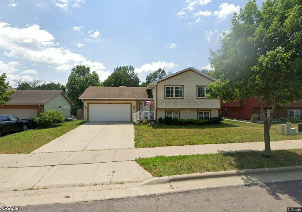
2011 Moore Dr Saint Peter, MN 56082
Estimated Value: $302,000 - $372,000
4
Beds
2
Baths
2,293
Sq Ft
$147/Sq Ft
Est. Value
About This Home
This home is located at 2011 Moore Dr, Saint Peter, MN 56082 and is currently estimated at $336,460, approximately $146 per square foot. 2011 Moore Dr is a home located in Nicollet County with nearby schools including North Elementary School, South Elementary Early Learning Center, and St. Peter Middle School.
Ownership History
Date
Name
Owned For
Owner Type
Purchase Details
Closed on
Sep 15, 2020
Current Estimated Value
Home Financials for this Owner
Home Financials are based on the most recent Mortgage that was taken out on this home.
Interest Rate
2.86%
Create a Home Valuation Report for This Property
The Home Valuation Report is an in-depth analysis detailing your home's value as well as a comparison with similar homes in the area
Home Values in the Area
Average Home Value in this Area
Purchase History
| Date | Buyer | Sale Price | Title Company |
|---|---|---|---|
| -- | $2,634,700 | -- |
Source: Public Records
Mortgage History
| Date | Status | Borrower | Loan Amount |
|---|---|---|---|
| Closed | -- | -- |
Source: Public Records
Tax History Compared to Growth
Tax History
| Year | Tax Paid | Tax Assessment Tax Assessment Total Assessment is a certain percentage of the fair market value that is determined by local assessors to be the total taxable value of land and additions on the property. | Land | Improvement |
|---|---|---|---|---|
| 2025 | $5,036 | $336,100 | $34,700 | $301,400 |
| 2024 | $4,560 | $336,100 | $34,700 | $301,400 |
| 2023 | $4,368 | $329,500 | $34,700 | $294,800 |
| 2022 | $4,218 | $303,800 | $34,700 | $269,100 |
| 2021 | $4,050 | $258,900 | $34,700 | $224,200 |
| 2020 | $3,932 | $244,100 | $30,000 | $214,100 |
| 2019 | $3,770 | $244,100 | $30,000 | $214,100 |
| 2018 | $3,620 | $234,400 | $30,000 | $204,400 |
| 2017 | -- | $223,100 | $0 | $0 |
| 2016 | $2,902 | $0 | $0 | $0 |
| 2015 | -- | $0 | $0 | $0 |
| 2011 | -- | $0 | $0 | $0 |
Source: Public Records
Map
Nearby Homes
- 1850 Macintosh Ct
- 1450 Loren St
- 1444 Howard St
- 1401 Lloyd Ln
- 1306 N Washington Ave
- 710 Upper Johnson Cir
- 808 Austin Dr
- 626 Austin Dr
- 809 W Traverse Rd
- 826 N 9th St
- 803 Churchill Ct
- 2024 Essler Dr
- 2015 Essler Dr
- 2012 Essler Dr
- 2105 Lunden St
- 1044 Cullen St
- 2113 Lunden St
- 0 Tbd Cty 20 Fields Unit 7038067
- 720 W Madison St
- 0 Tbd West Traverse Rd
- 2011 2011 Moore-Drive-
- 2011 2011 Moore Dr
- 2009 Moore Dr
- 2009 2009 Moore-Street-
- 2009 2009 Moore Dr
- 2013 Moore Dr
- 2013 2013 Moore Dr
- 2007 Moore Dr
- 2015 Moore Dr
- 2006 Moore Dr
- 2006 2006 Moore Dr
- 2020 Moore Dr
- 2020 2020 Moore Dr
- 1925 Rock Ridge Ln
- 1927 Rock Ridge Ln
- 2004 Moore Dr
- 1923 Rock Ridge Ln
- 2004 2004 Moore Dr
- 2022 Moore Dr
- 2017 Moore Dr