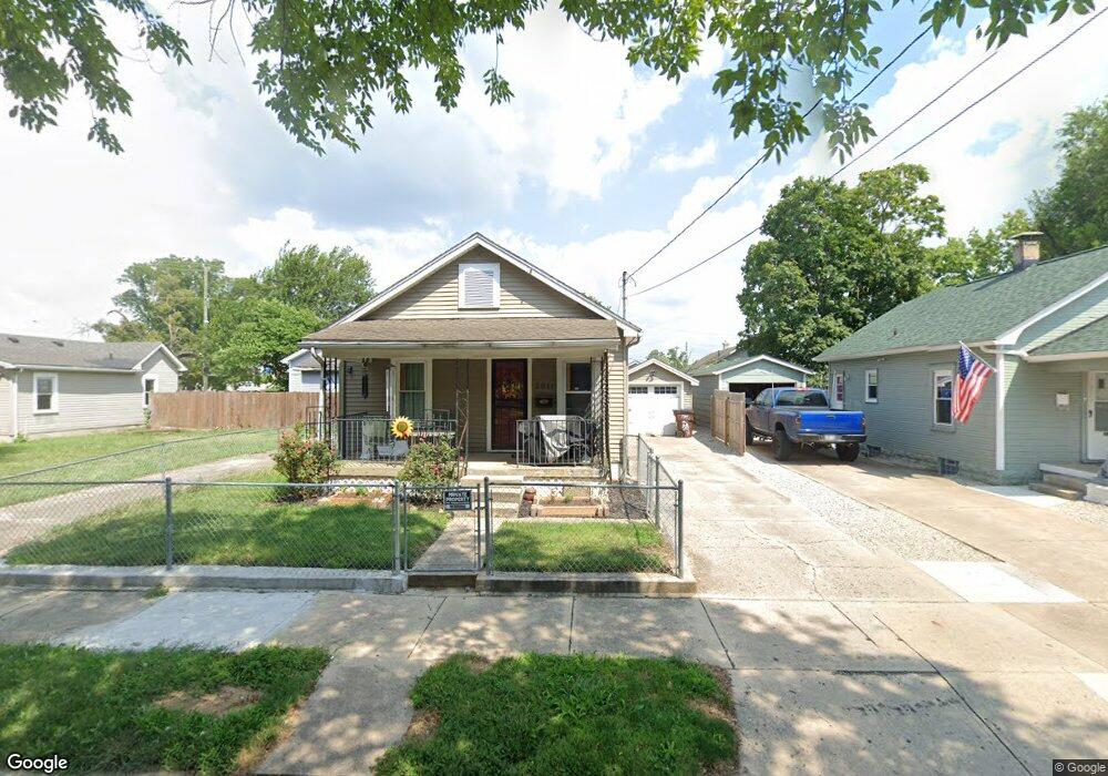
2011 Pearl St Middletown, OH 45044
Meadowlawn NeighborhoodEstimated Value: $100,000 - $120,521
3
Beds
1
Bath
816
Sq Ft
$136/Sq Ft
Est. Value
About This Home
This home is located at 2011 Pearl St, Middletown, OH 45044 and is currently estimated at $110,630, approximately $135 per square foot. 2011 Pearl St is a home located in Butler County with nearby schools including Amanda Elementary School, Highview 6th Grade Center, and Middletown Middle School.
Ownership History
Date
Name
Owned For
Owner Type
Purchase Details
Closed on
Oct 25, 2005
Sold by
Rose Dennis L and Rose Diane
Bought by
Thompson Peggy Lee
Current Estimated Value
Home Financials for this Owner
Home Financials are based on the most recent Mortgage that was taken out on this home.
Original Mortgage
$7,800
Outstanding Balance
$4,258
Interest Rate
5.98%
Mortgage Type
Fannie Mae Freddie Mac
Estimated Equity
$106,372
Purchase Details
Closed on
Feb 12, 2003
Sold by
Kimberlin Thomas A and Kimberlin Debra A
Bought by
Rose Dennis L
Home Financials for this Owner
Home Financials are based on the most recent Mortgage that was taken out on this home.
Original Mortgage
$40,700
Interest Rate
8.5%
Mortgage Type
Unknown
Purchase Details
Closed on
Nov 1, 1988
Create a Home Valuation Report for This Property
The Home Valuation Report is an in-depth analysis detailing your home's value as well as a comparison with similar homes in the area
Home Values in the Area
Average Home Value in this Area
Purchase History
| Date | Buyer | Sale Price | Title Company |
|---|---|---|---|
| Thompson Peggy Lee | $55,800 | -- | |
| Rose Dennis L | $45,200 | -- | |
| -- | $26,500 | -- |
Source: Public Records
Mortgage History
| Date | Status | Borrower | Loan Amount |
|---|---|---|---|
| Open | Thompson Peggy Lee | $7,800 | |
| Previous Owner | Rose Dennis L | $40,700 |
Source: Public Records
Tax History Compared to Growth
Tax History
| Year | Tax Paid | Tax Assessment Tax Assessment Total Assessment is a certain percentage of the fair market value that is determined by local assessors to be the total taxable value of land and additions on the property. | Land | Improvement |
|---|---|---|---|---|
| 2024 | $744 | $23,900 | $3,240 | $20,660 |
| 2023 | $756 | $27,170 | $3,240 | $23,930 |
| 2022 | $472 | $16,880 | $3,240 | $13,640 |
| 2021 | $454 | $16,880 | $3,240 | $13,640 |
| 2020 | $473 | $16,880 | $3,240 | $13,640 |
| 2019 | $728 | $10,040 | $3,190 | $6,850 |
| 2018 | $81 | $10,040 | $3,190 | $6,850 |
| 2017 | $81 | $10,040 | $3,190 | $6,850 |
| 2016 | $0 | $8,200 | $3,190 | $5,010 |
| 2015 | -- | $8,200 | $3,190 | $5,010 |
| 2014 | $386 | $8,200 | $3,190 | $5,010 |
| 2013 | $386 | $15,220 | $3,190 | $12,030 |
Source: Public Records
Map
Nearby Homes
- 2012 Pearl St
- 1713 Lafayette Ave
- 1808 Meadow Ave
- 1514 Taylor Ave
- 1511 Meadow Ave
- 1503 Brown St
- 1717 Pershing Ave
- 1702 Glenwood Ave
- 2900 Morgan St
- 1613 Sheridan Ave
- 1209 Grove St
- BELLEVILLE Plan at Stonybrook - Stonybrook Crossing
- VALE Plan at Stonybrook - Stonybrook Crossing
- SHELBURN Plan at Stonybrook - Stonybrook Crossing
- BUCHANAN Plan at Stonybrook - Stonybrook Crossing
- ALWICK Plan at Stonybrook - Stonybrook Crossing
- QUENTIN Plan at Stonybrook - Stonybrook Crossing
- BEACHWOOD Plan at Stonybrook - Stonybrook Crossing
- ASHTON Plan at Stonybrook - Stonybrook Crossing
- SAXON Plan at Stonybrook - Stonybrook Crossing