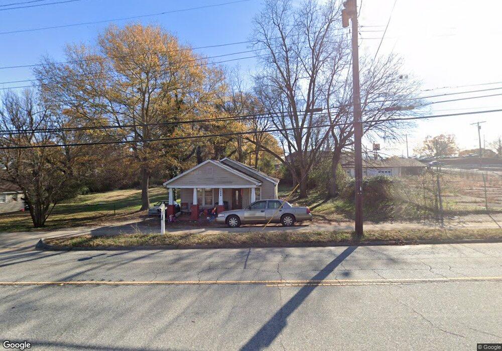
2011 W Whitner St Anderson, SC 29624
Estimated Value: $59,220 - $141,000
2
Beds
1
Bath
727
Sq Ft
$156/Sq Ft
Est. Value
About This Home
This home is located at 2011 W Whitner St, Anderson, SC 29624 and is currently estimated at $113,055, approximately $155 per square foot. 2011 W Whitner St is a home located in Anderson County with nearby schools including New Prospect Elementary School, Robert Anderson Middle School, and Westside High School.
Ownership History
Date
Name
Owned For
Owner Type
Purchase Details
Closed on
Oct 18, 2022
Sold by
Burkey Connie A
Bought by
Shultis Richard
Current Estimated Value
Purchase Details
Closed on
Sep 17, 2004
Sold by
Federal Home Loan Mortgage Corporation
Bought by
Abn Amro Mortgage Group Inc
Purchase Details
Closed on
Sep 2, 2004
Sold by
Abn Amro Mortgage Group Inc
Bought by
Wright Bennett
Purchase Details
Closed on
Dec 30, 2003
Sold by
Greenville St Props
Bought by
Vintage Homes
Purchase Details
Closed on
Dec 23, 2003
Sold by
Master In Equity
Bought by
Federal Home Loan Mtg Co
Create a Home Valuation Report for This Property
The Home Valuation Report is an in-depth analysis detailing your home's value as well as a comparison with similar homes in the area
Home Values in the Area
Average Home Value in this Area
Purchase History
| Date | Buyer | Sale Price | Title Company |
|---|---|---|---|
| Shultis Richard | $50,000 | -- | |
| Shultis Richard | $50,000 | None Listed On Document | |
| Burkey Connie A | $114,750 | -- | |
| Burkey Connie A | $114,750 | None Listed On Document | |
| Abn Amro Mortgage Group Inc | -- | -- | |
| Wright Bennett | $13,500 | -- | |
| Vintage Homes | $24,000 | -- | |
| Federal Home Loan Mtg Co | $20,700 | -- |
Source: Public Records
Tax History Compared to Growth
Tax History
| Year | Tax Paid | Tax Assessment Tax Assessment Total Assessment is a certain percentage of the fair market value that is determined by local assessors to be the total taxable value of land and additions on the property. | Land | Improvement |
|---|---|---|---|---|
| 2024 | $758 | $2,030 | $300 | $1,730 |
| 2023 | $730 | $2,030 | $300 | $1,730 |
| 2022 | $709 | $2,030 | $300 | $1,730 |
| 2021 | $706 | $1,940 | $300 | $1,640 |
| 2020 | $693 | $1,940 | $300 | $1,640 |
| 2019 | $693 | $1,940 | $300 | $1,640 |
| 2018 | $685 | $1,940 | $300 | $1,640 |
| 2017 | -- | $1,940 | $300 | $1,640 |
| 2016 | $732 | $2,130 | $270 | $1,860 |
| 2015 | $736 | $2,130 | $270 | $1,860 |
| 2014 | $721 | $2,130 | $270 | $1,860 |
Source: Public Records
Map
Nearby Homes
- 211 Richey St
- 307 Beaty Square
- 300 Strickland Ave
- 1328 Marne St
- 2521 W Whitner St
- Lot13,14,15 Wenzick St
- 0 St Unit 20291424
- 603 Booker St
- 1204 Evergreen St
- 104 Royal View Dr
- Lot 1 & 2 W Market St
- 112 K St
- 1401 Evergreen St
- 107 Brown St
- 223 K St
- 405 Fairfax St
- 102 I St
- 111 Sunrise Ct Unit SUN0006
- 600 Rogers St
- 1520 Pearman Dairy Rd
- 2009 W Whitner St
- 2007 W Whitner St
- 2005 W Whitner St
- 118 Crocker St
- 2003 W Whitner St
- 2107 W Whitner St
- 1907 W Whitner St
- 110 Crossland St
- 106 Crossland St
- 105 Barnett Cir
- 1905 W Whitner St
- 111 Crossland St
- 2113 W Whitner St
- 32 Crocker St
- 1903 W Whitner St
- 114 Crocker St
- 114 Crocker St
- 2114 W Whitner St
- 2116 W Whitner St
- 136 Barnett Cir
