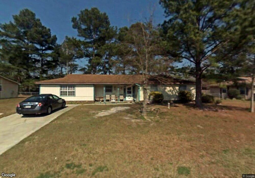
2012 Bancroft Rd Valdosta, GA 31602
Estimated Value: $145,000 - $202,000
--
Bed
2
Baths
1,796
Sq Ft
$94/Sq Ft
Est. Value
About This Home
This home is located at 2012 Bancroft Rd, Valdosta, GA 31602 and is currently estimated at $168,542, approximately $93 per square foot. 2012 Bancroft Rd is a home located in Lowndes County with nearby schools including W.G. Nunn Elementary School, Newbern Middle School, and Valdosta High School.
Ownership History
Date
Name
Owned For
Owner Type
Purchase Details
Closed on
Aug 14, 2007
Sold by
Mcgriff Monroe
Bought by
Mcgriff Patricia
Current Estimated Value
Purchase Details
Closed on
Apr 26, 2002
Sold by
Mcgriff Patricia A
Bought by
Mcgriff Patricia A and Mcgriff Ii Monroe
Purchase Details
Closed on
Oct 25, 1990
Bought by
Ridley Kenneth E Etal
Purchase Details
Closed on
May 31, 1982
Bought by
Meuleman Meuleman N and Meuleman Margaret
Purchase Details
Closed on
Jul 6, 1979
Bought by
Freeman George R Etal
Purchase Details
Closed on
Apr 13, 1979
Bought by
Rowan Ric
Create a Home Valuation Report for This Property
The Home Valuation Report is an in-depth analysis detailing your home's value as well as a comparison with similar homes in the area
Home Values in the Area
Average Home Value in this Area
Purchase History
| Date | Buyer | Sale Price | Title Company |
|---|---|---|---|
| Mcgriff Patricia | -- | -- | |
| Mcgriff Patricia A | -- | -- | |
| Mcgriff Patricia A | $81,500 | -- | |
| Ridley Kenneth E Etal | $52,900 | -- | |
| Meuleman Meuleman N | $14,500 | -- | |
| Freeman George R Etal | $47,000 | -- | |
| Rowan Ric | $7,500 | -- |
Source: Public Records
Tax History Compared to Growth
Tax History
| Year | Tax Paid | Tax Assessment Tax Assessment Total Assessment is a certain percentage of the fair market value that is determined by local assessors to be the total taxable value of land and additions on the property. | Land | Improvement |
|---|---|---|---|---|
| 2024 | $1,149 | $47,141 | $4,800 | $42,341 |
| 2023 | $1,149 | $43,553 | $4,800 | $38,753 |
| 2022 | $924 | $33,350 | $4,800 | $28,550 |
| 2021 | $951 | $33,350 | $4,800 | $28,550 |
| 2020 | $971 | $33,350 | $4,800 | $28,550 |
| 2019 | $971 | $33,350 | $4,800 | $28,550 |
| 2018 | $678 | $24,862 | $4,800 | $20,062 |
| 2017 | $683 | $24,862 | $4,800 | $20,062 |
| 2016 | $682 | $24,862 | $4,800 | $20,062 |
| 2015 | $626 | $24,862 | $4,800 | $20,062 |
| 2014 | $807 | $41,845 | $12,000 | $29,845 |
Source: Public Records
Map
Nearby Homes
- 1750 Almond Tree Place Unit A & B
- 1852 Chestnut Dr
- 1724 Eli Place
- 1739 Eli Place
- 1703 Largo Cir
- 1761 Hyssop Crossing
- 2713 Pineview Dr Unit A&B
- 2570 Marathon Dr
- 1763 Eli Place
- 2570 Forrestwood Dr
- 11 Crestwood Cir
- 1647 Fresno St
- 2400 Lowndes Dr
- 2311 Lowndes Dr
- 1 Pomona Cir
- 1703 Leone Ave
- 7.63 AC Tyndall Dr
- 2517 Deborah Dr
- 2320 Barack Obama Blvd
- 1642 Lexington Cir
- 2008 Bancroft Rd
- 2014 Bancroft Rd
- 6 Whitman Place
- 4 Whitman Place
- 2006 Bancroft Rd
- 2016 Bancroft Rd
- 2013 Bancroft Rd
- 8 Whitman Place
- 2015 Bancroft Rd
- 2017 Bancroft Rd
- 2011 Bancroft Rd
- 2004 Bancroft Rd
- 2009 Bancroft Rd
- 9 Whitman Place
- 2007 Bancroft Rd
- 2019 Bancroft Rd
- 5 Whitman Place
- 3 Whitman Place
- 2021 Bancroft Rd
- 2002 Bancroft Rd