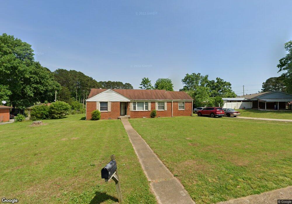
2012 Brookline Dr NW Huntsville, AL 35810
Mastin Lake Park NeighborhoodEstimated Value: $86,000 - $210,000
--
Bed
--
Bath
1,402
Sq Ft
$104/Sq Ft
Est. Value
About This Home
This home is located at 2012 Brookline Dr NW, Huntsville, AL 35810 and is currently estimated at $145,158, approximately $103 per square foot. 2012 Brookline Dr NW is a home with nearby schools including Highlands Elementary School, Ronald E. McNair Junior High School, and Jemison High School.
Ownership History
Date
Name
Owned For
Owner Type
Purchase Details
Closed on
Jun 25, 2010
Sold by
Hill Willie J and Chafford Chianti L
Bought by
Waites Luther
Current Estimated Value
Purchase Details
Closed on
Feb 9, 2010
Sold by
Waites Luther L
Bought by
Hill Willie J and Chafford Chianti L
Home Financials for this Owner
Home Financials are based on the most recent Mortgage that was taken out on this home.
Original Mortgage
$83,900
Interest Rate
5.02%
Mortgage Type
Purchase Money Mortgage
Create a Home Valuation Report for This Property
The Home Valuation Report is an in-depth analysis detailing your home's value as well as a comparison with similar homes in the area
Home Values in the Area
Average Home Value in this Area
Purchase History
| Date | Buyer | Sale Price | Title Company |
|---|---|---|---|
| Waites Luther | -- | -- | |
| Hill Willie J | -- | -- |
Source: Public Records
Mortgage History
| Date | Status | Borrower | Loan Amount |
|---|---|---|---|
| Previous Owner | Hill Willie J | $83,900 |
Source: Public Records
Tax History Compared to Growth
Tax History
| Year | Tax Paid | Tax Assessment Tax Assessment Total Assessment is a certain percentage of the fair market value that is determined by local assessors to be the total taxable value of land and additions on the property. | Land | Improvement |
|---|---|---|---|---|
| 2024 | $994 | $16,020 | $0 | $16,020 |
| 2023 | $929 | $15,240 | $0 | $15,240 |
| 2022 | $960 | $16,560 | $5,700 | $10,860 |
| 2021 | $862 | $14,860 | $4,560 | $10,300 |
| 2020 | $706 | $6,090 | $1,270 | $4,820 |
| 2019 | $659 | $5,680 | $1,270 | $4,410 |
| 2018 | $652 | $11,240 | $0 | $0 |
| 2017 | $652 | $11,240 | $0 | $0 |
| 2016 | $652 | $11,240 | $0 | $0 |
| 2015 | $594 | $10,240 | $0 | $0 |
| 2014 | $514 | $8,860 | $0 | $0 |
Source: Public Records
Map
Nearby Homes
- 1023 Club View Dr NW
- 2111 Shady Lane Cir NW
- 1114 Club View Dr NW
- 2303 Dogwood Ln NW
- 3906 Broadmor Rd NW
- 3927 Shamrock Dr NW
- 4318 Chalet Cir NW
- 1723 Laverne Dr NW
- 4503 Calvert Rd NW
- 3702 Broadmor Rd NW
- 2114 Linde St NW
- 2217 Linde St NW
- 4704 Ardmore Dr NW
- 1115 Bessemer Rd NW
- 4507 Sparkman Dr NW
- 3300 McDow Ave NW
- 2818 Gus Grissom Dr NW
- 3311 McDow Ave NW
- 3303 McDow Ave NW
- 4040 Independence Dr NW
- 2016 Brookline Dr NW
- 2004 Brookline Dr NW
- 3806 Oakwood Ave NW
- 2009 Brookline Dr NW
- 2015 Brookline Dr NW
- 2020 Brookline Dr NW
- 2013 Brookline Dr NW
- 2021 Brookline Dr NW
- 2024 Brookline Dr NW
- 3909 S Brookline Cir NW
- 2016 Morningside Dr NW
- 2010 Morningside Dr NW
- 3817 Oakwood Ave NW
- 2004 Morningside Dr NW
- 3918 Brookline Cir
- 2104 Brookline Dr NW
- 1704 Morningside Dr NW
- 2020 Morningside Dr NW
- 2005 Shady Lane Dr NW
- 2007 Shady Lane Dr NW