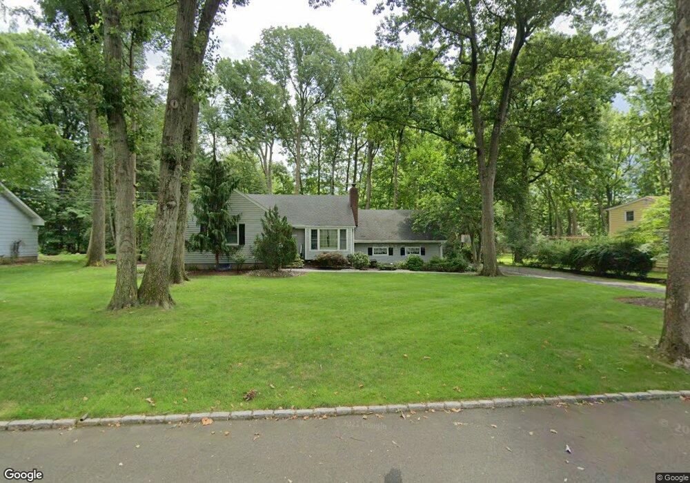
2012 Brookside Dr Scotch Plains, NJ 07076
Estimated Value: $734,994 - $1,258,000
Studio
--
Bath
1,772
Sq Ft
$570/Sq Ft
Est. Value
About This Home
This home is located at 2012 Brookside Dr, Scotch Plains, NJ 07076 and is currently estimated at $1,010,499, approximately $570 per square foot. 2012 Brookside Dr is a home located in Union County with nearby schools including William J. McGinn Elementary School, Terrill Middle School, and Scotch Plains-Fanwood High School.
Ownership History
Date
Name
Owned For
Owner Type
Purchase Details
Closed on
Oct 14, 2010
Sold by
Beh Robert and Beh Irene
Bought by
Freed Evan L and Freed Marcie E
Current Estimated Value
Home Financials for this Owner
Home Financials are based on the most recent Mortgage that was taken out on this home.
Original Mortgage
$417,000
Outstanding Balance
$275,735
Interest Rate
4.39%
Mortgage Type
New Conventional
Estimated Equity
$734,764
Purchase Details
Closed on
Jul 27, 2003
Sold by
Dachnowicz Dwight
Bought by
Beh Robert and Beh Irene
Home Financials for this Owner
Home Financials are based on the most recent Mortgage that was taken out on this home.
Original Mortgage
$150,000
Interest Rate
5.28%
Purchase Details
Closed on
Jan 30, 2001
Sold by
Karwan Stephen M
Bought by
Dachnowicz Dwight C and Dachnowicz Tara
Home Financials for this Owner
Home Financials are based on the most recent Mortgage that was taken out on this home.
Original Mortgage
$275,000
Interest Rate
5.62%
Create a Home Valuation Report for This Property
The Home Valuation Report is an in-depth analysis detailing your home's value as well as a comparison with similar homes in the area
Home Values in the Area
Average Home Value in this Area
Purchase History
| Date | Buyer | Sale Price | Title Company |
|---|---|---|---|
| Freed Evan L | $600,000 | Prestige Title Agency Inc | |
| Beh Robert | $529,500 | -- | |
| Dachnowicz Dwight C | $345,000 | Stewart Title Guaranty Compa |
Source: Public Records
Mortgage History
| Date | Status | Borrower | Loan Amount |
|---|---|---|---|
| Open | Freed Evan L | $417,000 | |
| Previous Owner | Beh Robert | $150,000 | |
| Previous Owner | Dachnowicz Dwight C | $275,000 |
Source: Public Records
Tax History
| Year | Tax Paid | Tax Assessment Tax Assessment Total Assessment is a certain percentage of the fair market value that is determined by local assessors to be the total taxable value of land and additions on the property. | Land | Improvement |
|---|---|---|---|---|
| 2025 | $16,875 | $143,400 | $52,500 | $90,900 |
| 2024 | $16,378 | $143,400 | $52,500 | $90,900 |
| 2023 | $16,378 | $143,400 | $52,500 | $90,900 |
| 2022 | $16,183 | $143,400 | $52,500 | $90,900 |
| 2021 | $15,333 | $136,100 | $52,500 | $83,600 |
| 2020 | $15,260 | $136,100 | $52,500 | $83,600 |
| 2019 | $15,147 | $136,100 | $52,500 | $83,600 |
| 2018 | $14,892 | $136,100 | $52,500 | $83,600 |
| 2017 | $14,561 | $136,100 | $52,500 | $83,600 |
| 2016 | $14,281 | $136,100 | $52,500 | $83,600 |
| 2015 | $14,047 | $136,100 | $52,500 | $83,600 |
| 2014 | $13,584 | $136,100 | $52,500 | $83,600 |
Source: Public Records
Map
Nearby Homes
- 1972 W Broad St
- 1280 White Oak Rd
- 2087 Dogwood Dr
- 119 Lamberts Mill Rd
- 4 Brandywine Ct
- 320 Highgate Ave
- 2 Dutch Ln
- 1568 Radley Rd
- 2116 Newark Ave
- 207 N Scotch Plains Ave
- 652 W Broad St
- 2065 Jersey Ave
- 645 Roosevelt St
- 608 Hort St
- 191 King St
- 187 King St
- 1510 Ramapo Way
- 741 Hyslip Ave
- 3 Herbert Rd
- 2 Unami Ln
- 2002 Brookside Dr
- 2022 Brookside Dr
- 2011 Parkwood Dr
- 2001 Parkwood Dr
- 2021 Parkwood Dr
- 2011 Brookside Dr
- 2032 Brookside Dr
- 1992 Brookside Dr
- 2001 Brookside Dr
- 2021 Brookside Dr
- 1991 Brookside Dr
- 2031 Parkwood Dr
- 1991 Parkwood Dr
- 2031 Brookside Dr
- 2042 Brookside Dr
- 1981 Brookside Dr
- 1430 Graymill Dr
- 1414 Graymill Dr
- 2041 Parkwood Dr
- 2012 Parkwood Dr
Your Personal Tour Guide
Ask me questions while you tour the home.