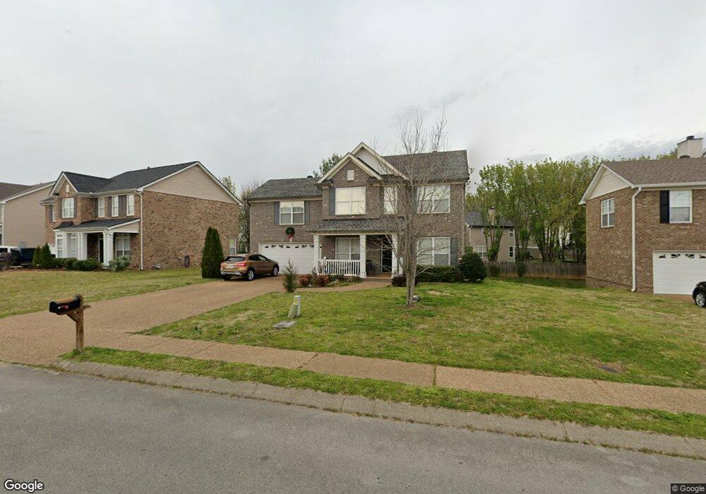
2012 Cairns Dr E Mount Juliet, TN 37122
Estimated Value: $441,334 - $506,000
Studio
3
Baths
2,118
Sq Ft
$228/Sq Ft
Est. Value
About This Home
This home is located at 2012 Cairns Dr E, Mount Juliet, TN 37122 and is currently estimated at $483,334, approximately $228 per square foot. 2012 Cairns Dr E is a home located in Wilson County with nearby schools including Mt. Juliet Elementary School, Mt. Juliet Middle School, and Green Hill High School.
Ownership History
Date
Name
Owned For
Owner Type
Purchase Details
Closed on
Jul 20, 2007
Sold by
Barringer Stephen L
Bought by
Emmetts Lesli R
Current Estimated Value
Home Financials for this Owner
Home Financials are based on the most recent Mortgage that was taken out on this home.
Original Mortgage
$157,600
Outstanding Balance
$97,413
Interest Rate
6.65%
Estimated Equity
$385,921
Purchase Details
Closed on
Aug 30, 2005
Sold by
Beazer Homes Corp
Bought by
Barringer Stephen L
Home Financials for this Owner
Home Financials are based on the most recent Mortgage that was taken out on this home.
Original Mortgage
$136,395
Interest Rate
5.71%
Purchase Details
Closed on
Jan 28, 2003
Bought by
Beazer Homes Corp Dba Phillips Builders
Create a Home Valuation Report for This Property
The Home Valuation Report is an in-depth analysis detailing your home's value as well as a comparison with similar homes in the area
Home Values in the Area
Average Home Value in this Area
Purchase History
| Date | Buyer | Sale Price | Title Company |
|---|---|---|---|
| Emmetts Lesli R | $197,000 | -- | |
| Barringer Stephen L | $194,850 | -- | |
| Beazer Homes Corp Dba Phillips Builders | $253,300 | -- |
Source: Public Records
Mortgage History
| Date | Status | Borrower | Loan Amount |
|---|---|---|---|
| Open | Beazer Homes Corp Dba Phillips Builders | $157,600 | |
| Closed | Beazer Homes Corp Dba Phillips Builders | $29,550 | |
| Previous Owner | Beazer Homes Corp Dba Phillips Builders | $136,395 |
Source: Public Records
Tax History
| Year | Tax Paid | Tax Assessment Tax Assessment Total Assessment is a certain percentage of the fair market value that is determined by local assessors to be the total taxable value of land and additions on the property. | Land | Improvement |
|---|---|---|---|---|
| 2025 | $237 | $81,800 | $18,750 | $63,050 |
| 2024 | $1,561 | $81,800 | $18,750 | $63,050 |
| 2022 | $1,561 | $81,800 | $18,750 | $63,050 |
| 2021 | $1,568 | $81,800 | $18,750 | $63,050 |
| 2020 | $1,622 | $77,675 | $18,750 | $58,925 |
| 2019 | $200 | $60,100 | $16,250 | $43,850 |
| 2018 | $1,614 | $60,100 | $16,250 | $43,850 |
| 2017 | $1,614 | $60,100 | $16,250 | $43,850 |
| 2016 | $1,614 | $60,100 | $16,250 | $43,850 |
| 2015 | $1,665 | $60,100 | $16,250 | $43,850 |
| 2014 | $1,384 | $49,971 | $0 | $0 |
Source: Public Records
Map
Nearby Homes
- 2104 Billingsham Ct
- 2107 Billingsham Ct
- 3012 Brisbane Dr
- 2403 Keeling Dr
- 3027 Cairns Dr W
- 1973 Dunedin Dr
- 1310 Queensland Way
- 3001 Dunedin Ct
- 1078 Willoughby Station Blvd
- 1107 Sydney Terrace
- 1408 Tasmania Ct
- 412 Brownstone St
- 461 Brownstone St
- 475 Brownstone St
- 482 Brownstone St
- 1155 Sydney Terrace
- 5408 Dunbar Dr
- 1172 Sydney Terrace
- 1206 Sydney Terrace
- 1184 Sydney Terrace
- 2010 Cairns Dr E
- 2014 Cairns Dr E
- 2204 S Cromwell Ct
- 2205 S Cromwell Ct
- 2008 Cairns Dr E
- 2016 Cairns Dr E
- 2009 Cairns Dr E
- 2007 Cairns Dr E
- 2011 Cairns Dr E
- 2005 Cairns Dr E
- 2202 S Cromwell Ct
- 2018 Cairns Dr E
- 2013 Cairns Dr E
- 2006 Cairns Dr E
- 2203 S Cromwell Ct
- 2003 Cairns Dr E
- 2015 Cairns Dr E
- 2106 Billingsham Ct
- 2020 Cairns Dr E
- 3028 Brisbane Dr
Your Personal Tour Guide
Ask me questions while you tour the home.