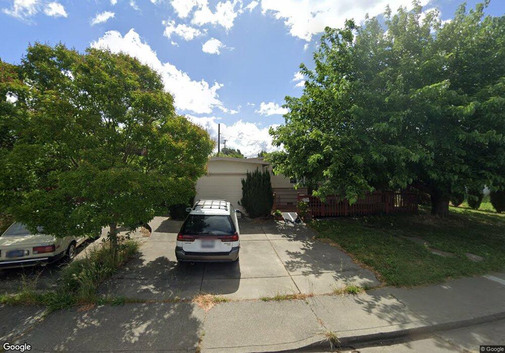
2012 Cambridge Dr Fairfield, CA 94533
Estimated Value: $443,000 - $497,729
2
Beds
2
Baths
1,314
Sq Ft
$355/Sq Ft
Est. Value
About This Home
This home is located at 2012 Cambridge Dr, Fairfield, CA 94533 and is currently estimated at $466,682, approximately $355 per square foot. 2012 Cambridge Dr is a home located in Solano County with nearby schools including David Weir Preparatory Academy, Grange Middle School, and Fairfield High School.
Ownership History
Date
Name
Owned For
Owner Type
Purchase Details
Closed on
Dec 13, 2010
Sold by
Lambrecht Dorothy L and Doris M Anderson Family Trust
Bought by
Clark Howard G and Clark Sonja L
Current Estimated Value
Home Financials for this Owner
Home Financials are based on the most recent Mortgage that was taken out on this home.
Original Mortgage
$109,500
Outstanding Balance
$72,197
Interest Rate
4.18%
Mortgage Type
New Conventional
Estimated Equity
$394,485
Purchase Details
Closed on
Oct 20, 2005
Sold by
Anderson Doris M
Bought by
Anderson Doris M and The Doris M Anderson Family Tr
Create a Home Valuation Report for This Property
The Home Valuation Report is an in-depth analysis detailing your home's value as well as a comparison with similar homes in the area
Home Values in the Area
Average Home Value in this Area
Purchase History
| Date | Buyer | Sale Price | Title Company |
|---|---|---|---|
| Clark Howard G | $146,000 | Old Republic Title Company | |
| Anderson Doris M | -- | -- |
Source: Public Records
Mortgage History
| Date | Status | Borrower | Loan Amount |
|---|---|---|---|
| Open | Clark Howard G | $109,500 |
Source: Public Records
Tax History
| Year | Tax Paid | Tax Assessment Tax Assessment Total Assessment is a certain percentage of the fair market value that is determined by local assessors to be the total taxable value of land and additions on the property. | Land | Improvement |
|---|---|---|---|---|
| 2025 | $2,109 | $187,041 | $51,240 | $135,801 |
| 2024 | $2,109 | $183,375 | $50,236 | $133,139 |
| 2023 | $2,045 | $179,780 | $49,251 | $130,529 |
| 2022 | $2,020 | $176,256 | $48,287 | $127,969 |
| 2021 | $2,000 | $172,801 | $47,341 | $125,460 |
| 2020 | $1,954 | $171,030 | $46,856 | $124,174 |
| 2019 | $1,906 | $167,678 | $45,938 | $121,740 |
| 2018 | $1,967 | $164,391 | $45,038 | $119,353 |
| 2017 | $1,877 | $161,168 | $44,155 | $117,013 |
| 2016 | $1,857 | $158,009 | $43,290 | $114,719 |
| 2015 | $1,734 | $155,636 | $42,640 | $112,996 |
| 2014 | $1,718 | $152,588 | $41,805 | $110,783 |
Source: Public Records
Map
Nearby Homes
- 2034 Cambridge Dr
- 2219 Nottingham Dr
- 1301 Sunningdale Ln
- 1300 Sunningdale Ln
- 2119 Tipton Way
- 1308 Sunningdale Ln
- 937 Pacific Ave
- 1337 Avon Way
- 751 Hillcrest Ct
- 831 Heath Ct
- 58 Del Prado Cir
- 1217 Dana Dr
- 2256 Dorset Ln
- 2292 Rutland Ct
- 519 Pacific Ave
- 1858 Barbour Dr
- 2051 Barbour Dr
- 1831 Clay St
- 1413 Maryland St
- 1500 Harrison St
- 2006 Cambridge Dr
- 2018 Cambridge Dr
- 2022 Cambridge Dr
- 2000 Cambridge Dr
- 2013 Cambridge Dr
- 2019 Cambridge Dr
- 2007 Cambridge Dr
- 2025 Cambridge Dr
- 2026 Cambridge Dr
- 2031 Cambridge Dr
- 2037 Cambridge Dr
- 2001 Cambridge Dr
- 1118 Tabor Ave
- 2038 Cambridge Dr
- 2043 Cambridge Dr
- 1112 Tabor Ave
- 2036 Bristol Ln
- 2091 Bristol Ln
Your Personal Tour Guide
Ask me questions while you tour the home.