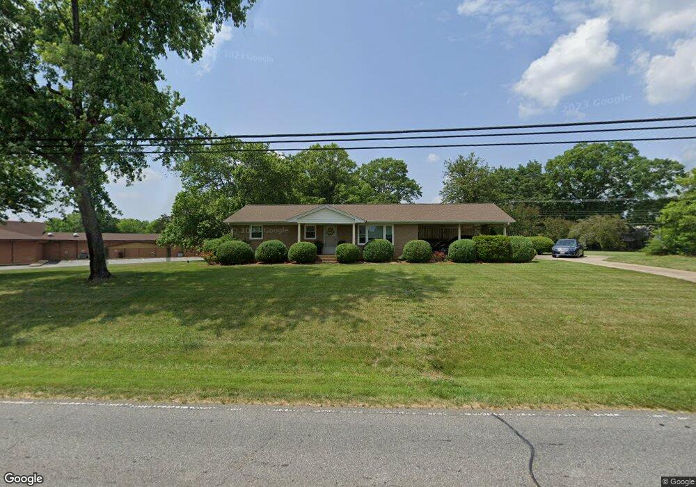
2012 E Nc 10 Hwy Newton, NC 28658
Estimated Value: $194,385 - $220,000
2
Beds
2
Baths
1,100
Sq Ft
$188/Sq Ft
Est. Value
About This Home
This home is located at 2012 E Nc 10 Hwy, Newton, NC 28658 and is currently estimated at $206,346, approximately $187 per square foot. 2012 E Nc 10 Hwy is a home located in Catawba County with nearby schools including Balls Creek Elementary School, Bandys High School, and Mill Creek Middle School.
Ownership History
Date
Name
Owned For
Owner Type
Purchase Details
Closed on
Aug 5, 2019
Sold by
Elkin Raymond and Elkin Judith K
Bought by
Phillips Lindsay Rae
Current Estimated Value
Purchase Details
Closed on
May 15, 2009
Sold by
Hoyle Martha Ann and Matheson Marcel Brandon
Bought by
Elkin Raymond and Elkin Judith K
Home Financials for this Owner
Home Financials are based on the most recent Mortgage that was taken out on this home.
Original Mortgage
$70,400
Interest Rate
4.89%
Mortgage Type
Purchase Money Mortgage
Create a Home Valuation Report for This Property
The Home Valuation Report is an in-depth analysis detailing your home's value as well as a comparison with similar homes in the area
Home Values in the Area
Average Home Value in this Area
Purchase History
| Date | Buyer | Sale Price | Title Company |
|---|---|---|---|
| Phillips Lindsay Rae | -- | None Available | |
| Elkin Raymond | $88,000 | None Available |
Source: Public Records
Mortgage History
| Date | Status | Borrower | Loan Amount |
|---|---|---|---|
| Previous Owner | Elkin Raymond | $70,400 |
Source: Public Records
Tax History Compared to Growth
Tax History
| Year | Tax Paid | Tax Assessment Tax Assessment Total Assessment is a certain percentage of the fair market value that is determined by local assessors to be the total taxable value of land and additions on the property. | Land | Improvement |
|---|---|---|---|---|
| 2025 | $934 | $187,000 | $15,100 | $171,900 |
| 2024 | $934 | $187,000 | $15,100 | $171,900 |
| 2023 | $934 | $187,000 | $15,100 | $171,900 |
| 2022 | $724 | $99,900 | $15,100 | $84,800 |
| 2021 | $704 | $99,900 | $15,100 | $84,800 |
| 2020 | $704 | $99,900 | $15,100 | $84,800 |
| 2019 | $694 | $99,900 | $0 | $0 |
| 2018 | $607 | $87,300 | $15,200 | $72,100 |
| 2017 | $581 | $0 | $0 | $0 |
| 2016 | $581 | $0 | $0 | $0 |
| 2015 | $545 | $87,250 | $15,200 | $72,050 |
| 2014 | $545 | $90,900 | $15,200 | $75,700 |
Source: Public Records
Map
Nearby Homes
- 7.03 acres 5 W Hwy 10 Hwy
- 2131 E Nc 10 Hwy
- 9737 N Carolina Highway 16
- 4148 E Ridge Dr
- 712 Mount Olive Church Rd
- 710 Mount Olive Church Rd
- 2320 Claremont Rd
- 1895 Sandy Cir
- 1592 Farmington Hills Dr
- 1502 Farmington Hills Dr
- 1925 Maius Dr Unit 30
- 1611 Mayfair Dr
- 1632 Farmington Hills Dr
- 1470 Farmington Hills Dr
- 1462 Farmington Hills Dr
- 1641 Farmington Hills Dr
- 1478 Cannan Mountain Dr
- 1502 Mulberry Ridge Dr Unit 1
- 1492 Mulberry Ridge Dr
- 932 Eastern Ridge Dr
- 2131 E Nc 10 Hwy
- 2051 E Nc 10 Hwy
- 2009 E Nc 10 Hwy
- 2069 E Nc 10 Hwy
- 00 Mount Olive Church Rd Unit 18-27/ A
- 3730 & 3744 Mount Olive Church Rd Unit 4 & 5
- 1997 E Nc 10 Hwy
- 2090 Mount Olive Church Rd
- 2068 Mount Olive Church Rd
- 2191 Mount Olive Church Rd
- 2100 E Nc 10 Hwy
- 1961 Mcree Rd
- 2089 Mount Olive Church Rd
- 2201 Mount Olive Church Rd
- 1967 E Nc 10 Hwy
- 2196 Mount Olive Church Rd
- 2144 E Hwy 10
- 1952 E Nc 10 Hwy
- 2144 E Nc 10 Hwy
- 2048 Mount Olive Church Rd