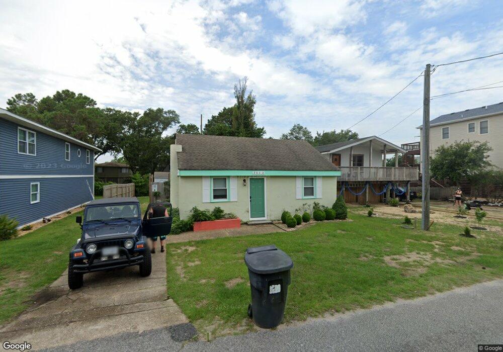
2012 Edenton St Kill Devil Hills, NC 27948
Estimated Value: $326,000 - $335,606
2
Beds
1
Bath
672
Sq Ft
$493/Sq Ft
Est. Value
About This Home
This home is located at 2012 Edenton St, Kill Devil Hills, NC 27948 and is currently estimated at $331,152, approximately $492 per square foot. 2012 Edenton St is a home located in Dare County with nearby schools including Nags Head Elementary School, First Flight Middle School, and First Flight High School.
Ownership History
Date
Name
Owned For
Owner Type
Purchase Details
Closed on
Jul 8, 2022
Sold by
Brown Sarah E
Bought by
Banuelos Luis Orlando Alta
Current Estimated Value
Purchase Details
Closed on
Mar 20, 2020
Sold by
Harrington David and Harrington Nanzy
Bought by
Brown Sarah E and Banueb Luis Orlando
Home Financials for this Owner
Home Financials are based on the most recent Mortgage that was taken out on this home.
Original Mortgage
$140,000
Interest Rate
3.4%
Mortgage Type
New Conventional
Create a Home Valuation Report for This Property
The Home Valuation Report is an in-depth analysis detailing your home's value as well as a comparison with similar homes in the area
Home Values in the Area
Average Home Value in this Area
Purchase History
| Date | Buyer | Sale Price | Title Company |
|---|---|---|---|
| Banuelos Luis Orlando Alta | -- | Gray & Lloyd Llp | |
| Brown Sarah E | $175,000 | None Available |
Source: Public Records
Mortgage History
| Date | Status | Borrower | Loan Amount |
|---|---|---|---|
| Previous Owner | Brown Sarah E | $140,000 |
Source: Public Records
Tax History
| Year | Tax Paid | Tax Assessment Tax Assessment Total Assessment is a certain percentage of the fair market value that is determined by local assessors to be the total taxable value of land and additions on the property. | Land | Improvement |
|---|---|---|---|---|
| 2025 | $1,718 | $312,300 | $206,300 | $106,000 |
| 2024 | $1,284 | $166,600 | $90,000 | $76,600 |
| 2023 | $1,282 | $169,664 | $90,000 | $79,664 |
| 2022 | $1,222 | $169,664 | $90,000 | $79,664 |
| 2021 | $1,222 | $169,664 | $90,000 | $79,664 |
| 2020 | $1,200 | $166,600 | $90,000 | $76,600 |
| 2019 | $772 | $88,700 | $61,300 | $27,400 |
| 2018 | $755 | $88,700 | $61,300 | $27,400 |
| 2017 | $755 | $88,700 | $61,300 | $27,400 |
| 2016 | $719 | $88,700 | $61,300 | $27,400 |
| 2014 | $693 | $88,700 | $61,300 | $27,400 |
Source: Public Records
Map
Nearby Homes
- 1100 W Durham St Unit lot 697
- 1208 W 5th St Unit 5
- 1005 W Avalon Dr Unit Lot 272
- 1002 W Avalon Dr Unit Lot 251
- 1208 W 4th St Unit 4
- 0 W Bay Dr Unit Lot3Lot3
- 1207 W 4th St Unit Lot 45
- 613 W Palmetto St Unit Lot 7R
- 702 W Avalon Dr Unit 206
- 705 W 4th St Unit Lot 23
- 2307 Bay Dr
- 1817 Sioux St Unit Lot 7
- 510 W Eden St Unit Lot 25 & 26
- 527 W Eden St Unit Lot 7-8
- 500 W Eden St
- 1806 Creek St Unit Lot 13
- 1317 Devonshire Rd Unit 36
- 106 W Avalon Dr Unit Lot 88
- 102 Greensboro St Unit Lot 504
- 522 W Archdale St Unit Lot 31&32
- 2010 Edenton St
- 2014 Edenton St
- 2016 Edenton St
- 2008 Edenton St
- 2019 Bay Dr
- 2021 Bay Dr
- 2017 Bay Dr
- 2018 Edenton St
- 2006 Edenton St Unit 845
- 2006 Edenton St
- 2013 Edenton St
- 2023 Bay Dr
- 2015 Bay Dr
- 2011 Edenton St
- 2009 Edenton St
- 2015 Edenton St
- 2015 Edenton St Unit Lot 838
- 2017 Edenton St
- 2004 Edenton St
- 2020 Edenton St
Your Personal Tour Guide
Ask me questions while you tour the home.