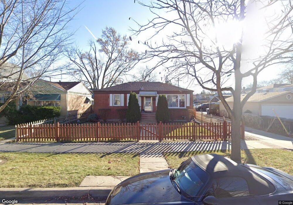
2012 Foster St Evanston, IL 60201
West Evanston NeighborhoodEstimated Value: $272,000 - $393,000
2
Beds
1
Bath
1,000
Sq Ft
$320/Sq Ft
Est. Value
About This Home
This home is located at 2012 Foster St, Evanston, IL 60201 and is currently estimated at $319,778, approximately $319 per square foot. 2012 Foster St is a home located in Cook County with nearby schools including Kingsley Elementary School, Haven Middle School, and Evanston Township High School.
Ownership History
Date
Name
Owned For
Owner Type
Purchase Details
Closed on
May 16, 2003
Sold by
Edwards Anthony and Laird Edwards Rosemarie
Bought by
Mendoza Jaime
Current Estimated Value
Home Financials for this Owner
Home Financials are based on the most recent Mortgage that was taken out on this home.
Original Mortgage
$178,600
Outstanding Balance
$75,149
Interest Rate
5.71%
Mortgage Type
Unknown
Estimated Equity
$244,629
Purchase Details
Closed on
Jun 22, 2000
Sold by
Watkins Nedra
Bought by
Edwards Anthony and Laird Edwards Rosemarie
Home Financials for this Owner
Home Financials are based on the most recent Mortgage that was taken out on this home.
Original Mortgage
$128,459
Interest Rate
8.66%
Mortgage Type
FHA
Create a Home Valuation Report for This Property
The Home Valuation Report is an in-depth analysis detailing your home's value as well as a comparison with similar homes in the area
Home Values in the Area
Average Home Value in this Area
Purchase History
| Date | Buyer | Sale Price | Title Company |
|---|---|---|---|
| Mendoza Jaime | $188,000 | Rtc | |
| Mendoza Jaime | $188,000 | Rtc | |
| Edwards Anthony | $130,000 | -- |
Source: Public Records
Mortgage History
| Date | Status | Borrower | Loan Amount |
|---|---|---|---|
| Open | Mendoza Jaime | $178,600 | |
| Closed | Mendoza Jaime | $178,600 | |
| Previous Owner | Edwards Anthony | $128,459 |
Source: Public Records
Tax History
| Year | Tax Paid | Tax Assessment Tax Assessment Total Assessment is a certain percentage of the fair market value that is determined by local assessors to be the total taxable value of land and additions on the property. | Land | Improvement |
|---|---|---|---|---|
| 2025 | $2,588 | $18,693 | $4,768 | $13,925 |
| 2024 | $2,588 | $12,352 | $3,946 | $8,406 |
| 2023 | $2,472 | $12,352 | $3,946 | $8,406 |
| 2022 | $2,472 | $12,352 | $3,946 | $8,406 |
| 2021 | $1,807 | $8,473 | $3,616 | $4,857 |
| 2020 | $1,812 | $8,473 | $3,616 | $4,857 |
| 2019 | $1,822 | $9,489 | $3,616 | $5,873 |
| 2018 | $2,333 | $10,233 | $2,959 | $7,274 |
| 2017 | $2,280 | $10,233 | $2,959 | $7,274 |
| 2016 | $2,274 | $10,233 | $2,959 | $7,274 |
| 2015 | $2,368 | $10,142 | $2,548 | $7,594 |
| 2014 | $2,352 | $10,142 | $2,548 | $7,594 |
| 2013 | $2,290 | $10,142 | $2,548 | $7,594 |
Source: Public Records
Map
Nearby Homes
- 2208 Foster St
- 1813 Dodge Ave
- 1811 Hartrey Ave
- 1915 Grant St
- 2017 Jackson Ave
- 1915 - 2 Grant St
- 2701 Noyes St
- 1813 Lincoln St
- 2356 Ashland Ave
- 2215 Wesley Ave
- 2505 Prairie Ave Unit 2K
- 2043 Asbury Ave
- 2515 Prairie Ave Unit 1E
- 1228 Emerson St Unit 304
- 1735 Asbury Ave
- 1834 Ridge Ave Unit 102
- 2810 Simpson St
- 1578 Wesley Ave
- 1460 Dewey Ave
- 1201 Noyes St
- 2012 Foster St
- 2008 Foster St
- 2008 Foster St
- 2008 Foster St Unit A
- 2004 Foster St
- 1934 Brown Ave
- 2000 Foster St
- 1939 Grey Ave
- 1945 Grey Ave
- 1932 Brown Ave
- 1937 Grey Ave
- 1935 Grey Ave
- 1941 Grey Ave
- 1941 Grey Ave Unit 1
- 2017 Foster St
- 1933 Grey Ave
- 1933 Grey Ave
- 1943 Grey Ave
- 2015 Foster St
- 2011 Foster St
Your Personal Tour Guide
Ask me questions while you tour the home.