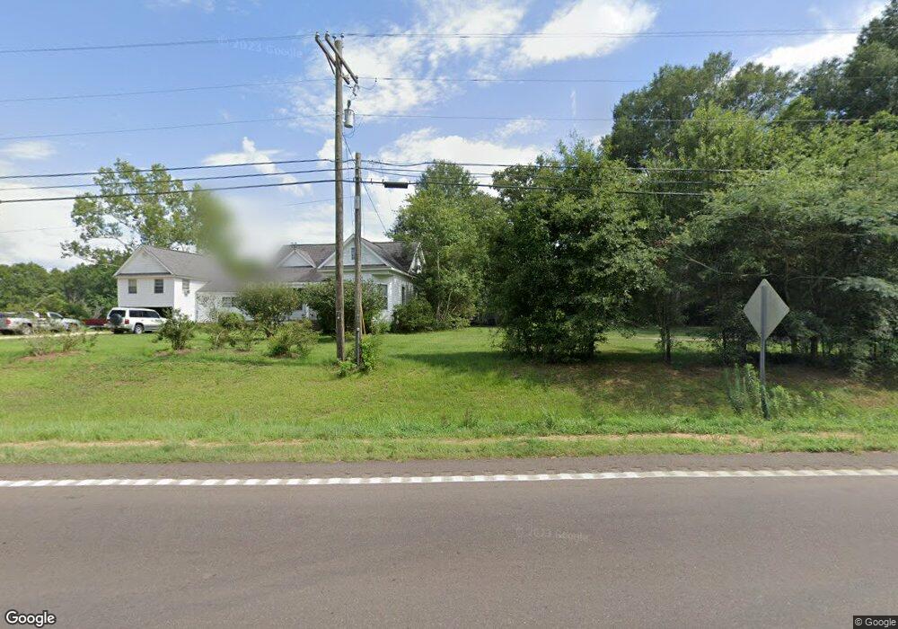
2012 Highway 44 E McComb, MS 39648
Estimated Value: $165,309 - $263,000
Studio
--
Bath
3,507
Sq Ft
$64/Sq Ft
Est. Value
About This Home
This home is located at 2012 Highway 44 E, McComb, MS 39648 and is currently estimated at $225,077, approximately $64 per square foot. 2012 Highway 44 E is a home with nearby schools including North Pike Elementary School, North Pike Middle School, and North Pike Senior High School.
Ownership History
Date
Name
Owned For
Owner Type
Purchase Details
Closed on
Feb 13, 2023
Sold by
Hughes Samuel Blake and Hughes Ruth Victoria
Bought by
Gattis Michael K and Gattis Tammy M
Current Estimated Value
Purchase Details
Closed on
Aug 15, 2008
Sold by
Alexander William Earl and Alexander Kathryn W
Bought by
Fortenberry Leslie R and Fortenberry Mary E
Home Financials for this Owner
Home Financials are based on the most recent Mortgage that was taken out on this home.
Original Mortgage
$7,200
Interest Rate
6.49%
Mortgage Type
Seller Take Back
Purchase Details
Closed on
Dec 12, 2005
Sold by
Alexander William Earl and Alexander Kathryn W
Bought by
Fortenberry Leslie R and Fortenberry Mary E
Home Financials for this Owner
Home Financials are based on the most recent Mortgage that was taken out on this home.
Original Mortgage
$90,250
Interest Rate
6.1%
Mortgage Type
New Conventional
Create a Home Valuation Report for This Property
The Home Valuation Report is an in-depth analysis detailing your home's value as well as a comparison with similar homes in the area
Purchase History
| Date | Buyer | Sale Price | Title Company |
|---|---|---|---|
| Gattis Michael K | -- | -- | |
| Fortenberry Leslie R | -- | None Available | |
| Fortenberry Leslie R | -- | None Available |
Source: Public Records
Mortgage History
| Date | Status | Borrower | Loan Amount |
|---|---|---|---|
| Previous Owner | Fortenberry Leslie R | $7,200 | |
| Previous Owner | Fortenberry Leslie R | $90,250 |
Source: Public Records
Tax History
| Year | Tax Paid | Tax Assessment Tax Assessment Total Assessment is a certain percentage of the fair market value that is determined by local assessors to be the total taxable value of land and additions on the property. | Land | Improvement |
|---|---|---|---|---|
| 2025 | $1,058 | $10,033 | $0 | $0 |
| 2024 | $878 | $8,573 | $0 | $0 |
| 2023 | $852 | $8,573 | $0 | $0 |
| 2022 | $831 | $8,538 | $0 | $0 |
| 2021 | $828 | $8,538 | $0 | $0 |
| 2020 | $828 | $8,500 | $0 | $0 |
| 2019 | $801 | $8,500 | $0 | $0 |
| 2018 | $793 | $8,500 | $0 | $0 |
| 2017 | $770 | $8,500 | $0 | $0 |
| 2016 | $645 | $8,500 | $0 | $0 |
| 2015 | $644 | $8,696 | $0 | $0 |
| 2014 | $616 | $8,626 | $0 | $0 |
| 2013 | -- | $8,626 | $0 | $0 |
Source: Public Records
Map
Nearby Homes
- 1037 Boone Rd
- 1021 Great Point Rd
- 1011 Eastover Ln
- 0 Deer Ridge Rd
- 1148 Morgantown Rd
- 1025 Clover Ln
- 1019 Pearl River Avenue Extension
- 0 Morgantown Rd Unit 4125975
- 2067 McComb Hville Rd
- 1031 Pearl River Ave
- 1011 Rolling Oaks Dr
- No Integrity Rd
- 0 Integrity Rd
- 0 Rolling Oaks Dr
- 219 S Live Oak St
- 1028 Chester Reeves Rd
- XXX Brewer Ln
- 143 N Myrtle St
- 1086 Mississippi 570
- 1002 Pershing St
- 2018 Highway 44 E
- 1038 Quail Ridge Dr
- 1182 Highway 44 E
- 1182 Mississippi 44
- 2031 Hwy 44e
- 1021 Quail Ridge Dr
- 2001 Highway 44 E
- 1180 Highway 44 E
- 2003 Highway 44 E
- 2031 Highway 44 E
- 1025 Quail Ridge Dr
- 1003 Quail Ridge Dr
- 1009 Quail Ridge Dr
- 1148 Highway 44 E
- 1029 Quail Ridge Dr
- 1174 Highway 44 E
- 1174 Highway 44 E
- 1037 Quail Ridge Dr
- 2043 Highway 44 E
- 1174 Mississippi 44
Your Personal Tour Guide
Ask me questions while you tour the home.