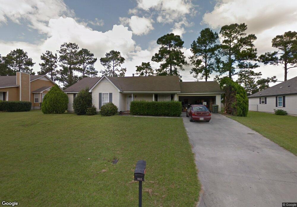
2012 Houston Ave Valdosta, GA 31602
Estimated Value: $148,000 - $173,029
3
Beds
2
Baths
1,365
Sq Ft
$119/Sq Ft
Est. Value
About This Home
This home is located at 2012 Houston Ave, Valdosta, GA 31602 and is currently estimated at $162,757, approximately $119 per square foot. 2012 Houston Ave is a home located in Lowndes County with nearby schools including W.G. Nunn Elementary School, Newbern Middle School, and Valdosta High School.
Ownership History
Date
Name
Owned For
Owner Type
Purchase Details
Closed on
Jul 27, 2022
Sold by
Barcenas Jairo R
Bought by
Bessent Leonard and Bessent Pattie
Current Estimated Value
Home Financials for this Owner
Home Financials are based on the most recent Mortgage that was taken out on this home.
Original Mortgage
$131,967
Outstanding Balance
$126,355
Interest Rate
5.7%
Mortgage Type
VA
Estimated Equity
$36,402
Purchase Details
Closed on
Jun 4, 2004
Sold by
Elliard Maurice and Elliard Paula
Bought by
Barcenas Jairo R
Purchase Details
Closed on
Aug 31, 1998
Bought by
Elliard Maurice and Elliard Paula
Purchase Details
Closed on
Jun 25, 1996
Bought by
Wright Deidre Jean
Purchase Details
Closed on
Feb 5, 1996
Bought by
Coody Tom Const Co
Create a Home Valuation Report for This Property
The Home Valuation Report is an in-depth analysis detailing your home's value as well as a comparison with similar homes in the area
Home Values in the Area
Average Home Value in this Area
Purchase History
| Date | Buyer | Sale Price | Title Company |
|---|---|---|---|
| Bessent Leonard | $129,000 | -- | |
| Barcenas Jairo R | $85,700 | -- | |
| Elliard Maurice | $82,500 | -- | |
| Wright Deidre Jean | $76,900 | -- | |
| Coody Tom Const Co | $10,000 | -- |
Source: Public Records
Mortgage History
| Date | Status | Borrower | Loan Amount |
|---|---|---|---|
| Open | Bessent Leonard | $131,967 |
Source: Public Records
Tax History Compared to Growth
Tax History
| Year | Tax Paid | Tax Assessment Tax Assessment Total Assessment is a certain percentage of the fair market value that is determined by local assessors to be the total taxable value of land and additions on the property. | Land | Improvement |
|---|---|---|---|---|
| 2024 | $1,150 | $47,171 | $4,800 | $42,371 |
| 2023 | $1,150 | $43,362 | $4,800 | $38,562 |
| 2022 | $1,086 | $32,148 | $4,800 | $27,348 |
| 2021 | $1,118 | $32,148 | $4,800 | $27,348 |
| 2020 | $1,142 | $32,148 | $4,800 | $27,348 |
| 2019 | $1,141 | $32,148 | $4,800 | $27,348 |
| 2018 | $861 | $23,944 | $4,800 | $19,144 |
| 2017 | $867 | $23,944 | $4,800 | $19,144 |
| 2016 | $866 | $23,944 | $4,800 | $19,144 |
| 2015 | -- | $24,834 | $4,800 | $20,034 |
| 2014 | $975 | $40,620 | $12,000 | $28,620 |
Source: Public Records
Map
Nearby Homes
- 11 Crestwood Cir
- TBD Jaycee Shack Rd
- 2570 Marathon Dr
- 1750 Almond Tree Place Unit A & B
- 7.63 AC Tyndall Dr
- 1703 Largo Cir
- 1647 Fresno St
- 1852 Chestnut Dr
- 1724 Eli Place
- 2713 Pineview Dr Unit A&B
- 1739 Eli Place
- 1761 Hyssop Crossing
- 3122 Tyndall Dr
- 1 Pomona Cir
- 3200 Tyndall Dr Unit A/B
- 3202 Tyndall Dr Unit A/B
- 2737 Dogwood Cir
- 2517 Deborah Dr
- 1763 Eli Place
- 2400 Lowndes Dr
- 2014 Houston Ave
- 2010 Houston Ave
- 2043 Lasalle Dr
- 2039 Lasalle Dr
- 2008 Houston Ave
- 2016 Houston Ave
- 2035 Lasalle Dr
- 2013 Houston Ave
- 2025 Lasalle Dr
- 2011 Houston Ave
- 2015 Houston Ave
- 2009 Houston Ave
- 2051 Lasalle Dr
- 2031 Lasalle Dr
- 2017 Houston Ave
- 2006 Houston Ave
- 2018 Houston Ave
- 2007 Houston Ave
- 2038 Lasalle Dr
- 2012 Northside Dr