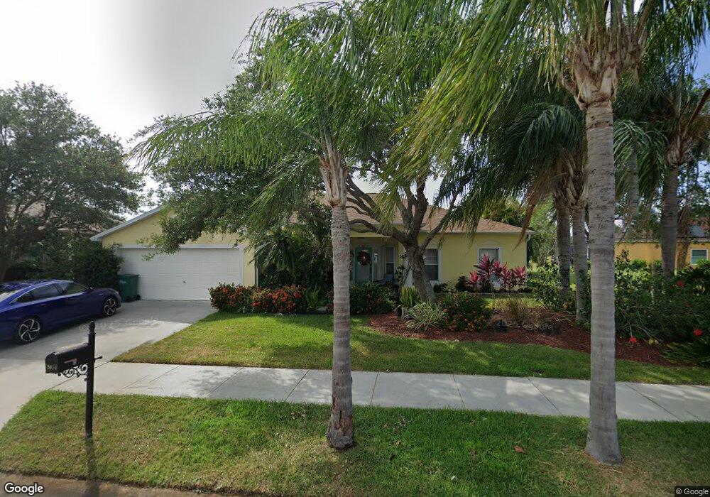
2012 Laramie Cir Melbourne, FL 32940
Estimated Value: $495,000 - $530,000
4
Beds
2
Baths
2,234
Sq Ft
$232/Sq Ft
Est. Value
About This Home
This home is located at 2012 Laramie Cir, Melbourne, FL 32940 and is currently estimated at $517,622, approximately $231 per square foot. 2012 Laramie Cir is a home located in Brevard County with nearby schools including Quest Elementary School, John F. Kennedy Middle School, and Pinecrest Academy Space Coast.
Ownership History
Date
Name
Owned For
Owner Type
Purchase Details
Closed on
Mar 18, 2020
Sold by
Roberts Rosemarie
Bought by
Chatham Charlene
Current Estimated Value
Purchase Details
Closed on
Dec 21, 2001
Sold by
Holiday Bldr Inc
Bought by
Roberts James E and Roberts Rosemarie
Home Financials for this Owner
Home Financials are based on the most recent Mortgage that was taken out on this home.
Original Mortgage
$133,980
Interest Rate
6.72%
Purchase Details
Closed on
Jul 5, 2001
Sold by
Cross Creek Land Dev Co
Bought by
Holiday Bldr Inc
Create a Home Valuation Report for This Property
The Home Valuation Report is an in-depth analysis detailing your home's value as well as a comparison with similar homes in the area
Home Values in the Area
Average Home Value in this Area
Purchase History
| Date | Buyer | Sale Price | Title Company |
|---|---|---|---|
| Chatham Charlene | -- | Attorney | |
| Roberts James E | $151,400 | -- | |
| Holiday Bldr Inc | $29,000 | -- |
Source: Public Records
Mortgage History
| Date | Status | Borrower | Loan Amount |
|---|---|---|---|
| Previous Owner | Roberts James E | $133,980 |
Source: Public Records
Tax History
| Year | Tax Paid | Tax Assessment Tax Assessment Total Assessment is a certain percentage of the fair market value that is determined by local assessors to be the total taxable value of land and additions on the property. | Land | Improvement |
|---|---|---|---|---|
| 2025 | $2,927 | $229,820 | -- | -- |
| 2024 | $2,869 | $223,350 | -- | -- |
| 2023 | $2,869 | $216,850 | $0 | $0 |
| 2022 | $2,725 | $210,540 | $0 | $0 |
| 2021 | $2,814 | $204,410 | $0 | $0 |
| 2020 | $2,747 | $201,590 | $0 | $0 |
| 2019 | $2,695 | $197,060 | $0 | $0 |
| 2018 | $2,699 | $193,390 | $0 | $0 |
| 2017 | $2,719 | $189,420 | $0 | $0 |
| 2016 | $2,763 | $185,530 | $45,000 | $140,530 |
| 2015 | $2,841 | $184,250 | $42,000 | $142,250 |
| 2014 | $2,859 | $182,790 | $39,000 | $143,790 |
Source: Public Records
Map
Nearby Homes
- 1932 Laramie Cir
- 1877 Thesy Dr
- 2264 Bayhill Dr
- 1757 Sophias Dr Unit 302
- 5663 Star Rush Dr Unit 104
- 5693 Star Rush Dr Unit 304
- 1777 Sophias Dr Unit 205
- 1747 Sophias Dr Unit 202
- 1741 Freedom Dr
- 2113 Lionel Dr
- 1320 Ambra Dr
- 1423 Independence Ave
- 2667 Deercroft Dr
- 1372 Independence Ave
- 1484 Independence Ave
- 1924 Fabien Cir
- 1766 Grand Isle Blvd
- 1635 Timacuan Dr
- 1634 Timacuan Dr
- 1614 Timacuan Dr
- 1432 Laramie Cir
- 2002 Laramie Cir
- 1442 Laramie Cir
- 1455 Knoll Ridge Dr
- 2013 Laramie Cir
- 2003 Laramie Cir
- 1452 Laramie Cir
- 1465 Knoll Ridge Dr
- 1993 Laramie Cir
- 1433 Laramie Cir
- 1423 Laramie Cir
- 1444 Knoll Ridge Dr
- 1982 Laramie Cir
- 1940 Crane Creek Blvd
- 1443 Laramie Cir
- 1413 Laramie Cir
- 1462 Laramie Cir
- 1983 Laramie Cir
- 1475 Knoll Ridge Dr
- 1454 Knoll Ridge Dr
Your Personal Tour Guide
Ask me questions while you tour the home.