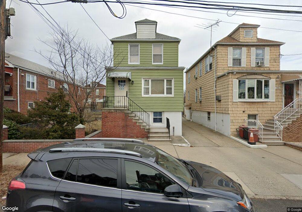
2012 Lurting Ave Bronx, NY 10461
Morris Park NeighborhoodEstimated Value: $761,000 - $944,000
--
Bed
--
Bath
2,470
Sq Ft
$353/Sq Ft
Est. Value
About This Home
This home is located at 2012 Lurting Ave, Bronx, NY 10461 and is currently estimated at $873,127, approximately $353 per square foot. 2012 Lurting Ave is a home located in Bronx County with nearby schools including P.S. 108 Philip J Abinanti, J.H.S. 144 Michelangelo, and St. Clare of Assisi School.
Ownership History
Date
Name
Owned For
Owner Type
Purchase Details
Closed on
Jul 9, 2018
Sold by
Corvasce Frank and Corvasce Nicholas
Bought by
D'Agostino Alfred
Current Estimated Value
Home Financials for this Owner
Home Financials are based on the most recent Mortgage that was taken out on this home.
Original Mortgage
$459,000
Outstanding Balance
$397,792
Interest Rate
4.5%
Mortgage Type
Purchase Money Mortgage
Estimated Equity
$475,335
Purchase Details
Closed on
Dec 23, 2016
Sold by
Corvasce Deceased Mary
Bought by
Corvasce Frank and Corvasce Nicholas
Purchase Details
Closed on
May 9, 2016
Sold by
Corvase Mary and Rutigliano Deceased, Frank
Bought by
Corvase Mary and Salvati Lisa A
Create a Home Valuation Report for This Property
The Home Valuation Report is an in-depth analysis detailing your home's value as well as a comparison with similar homes in the area
Home Values in the Area
Average Home Value in this Area
Purchase History
| Date | Buyer | Sale Price | Title Company |
|---|---|---|---|
| D'Agostino Alfred | $510,000 | -- | |
| Corvasce Frank | $6,500 | -- | |
| Corvase Mary | -- | -- |
Source: Public Records
Mortgage History
| Date | Status | Borrower | Loan Amount |
|---|---|---|---|
| Open | D'Agostino Alfred | $459,000 |
Source: Public Records
Tax History Compared to Growth
Tax History
| Year | Tax Paid | Tax Assessment Tax Assessment Total Assessment is a certain percentage of the fair market value that is determined by local assessors to be the total taxable value of land and additions on the property. | Land | Improvement |
|---|---|---|---|---|
| 2025 | $8,139 | $40,608 | $8,068 | $32,540 |
| 2024 | $8,139 | $40,522 | $7,295 | $33,227 |
| 2023 | $8,142 | $40,090 | $7,688 | $32,402 |
| 2022 | $7,550 | $52,140 | $10,920 | $41,220 |
| 2021 | $7,549 | $42,540 | $10,920 | $31,620 |
| 2020 | $7,163 | $42,780 | $10,920 | $31,860 |
| 2019 | $7,064 | $38,040 | $10,920 | $27,120 |
| 2018 | $6,989 | $33,408 | $8,194 | $25,214 |
| 2016 | $5,976 | $29,892 | $10,462 | $19,430 |
| 2015 | $3,586 | $28,200 | $12,120 | $16,080 |
| 2014 | $3,586 | $28,140 | $12,120 | $16,020 |
Source: Public Records
Map
Nearby Homes
- 1088 Lydig Ave
- 1054 Lydig Ave
- 1059 Neill Ave
- 2116 Paulding Ave
- 1963 Hone Ave
- 2166 Paulding Ave
- 1917 Lurting Ave
- 1958 Colden Ave
- - Lydig Ave
- 2037 Radcliff Ave
- 1903 Tomlinson Ave
- 1116 Rhinelander Ave
- 1193 Neill Ave
- 2129 Muliner Ave
- 1859 Hone Ave
- 1855 Williamsbridge Rd
- 1004 Rhinelander Ave
- 2080 Matthews Ave
- 1832 Haight Ave
- 1214 Pelham Pkwy S
- 2010 Lurting Ave
- 2016 Lurting Ave
- 2018 Lurting Ave
- 2020 Lurting Ave
- 1083 Neill Ave
- 2015 Haight Ave
- 2015 Haight Ave Unit 1
- 2004 Lurting Ave
- 2017 Haight Ave
- 2003 Haight Ave
- 1085 Neill Ave
- 1087 Neill Ave
- 2019 Haight Ave
- 1089 Neill Ave
- 2022 Lurting Ave
- 2021 Haight Ave
- 2011 Lurting Ave Unit 3
- 2011 Lurting Ave
- 1091 Neill Ave
- 2013 Lurting Ave