Estimated Value: $322,000 - $402,000
Studio
--
Bath
2,206
Sq Ft
$161/Sq Ft
Est. Value
About This Home
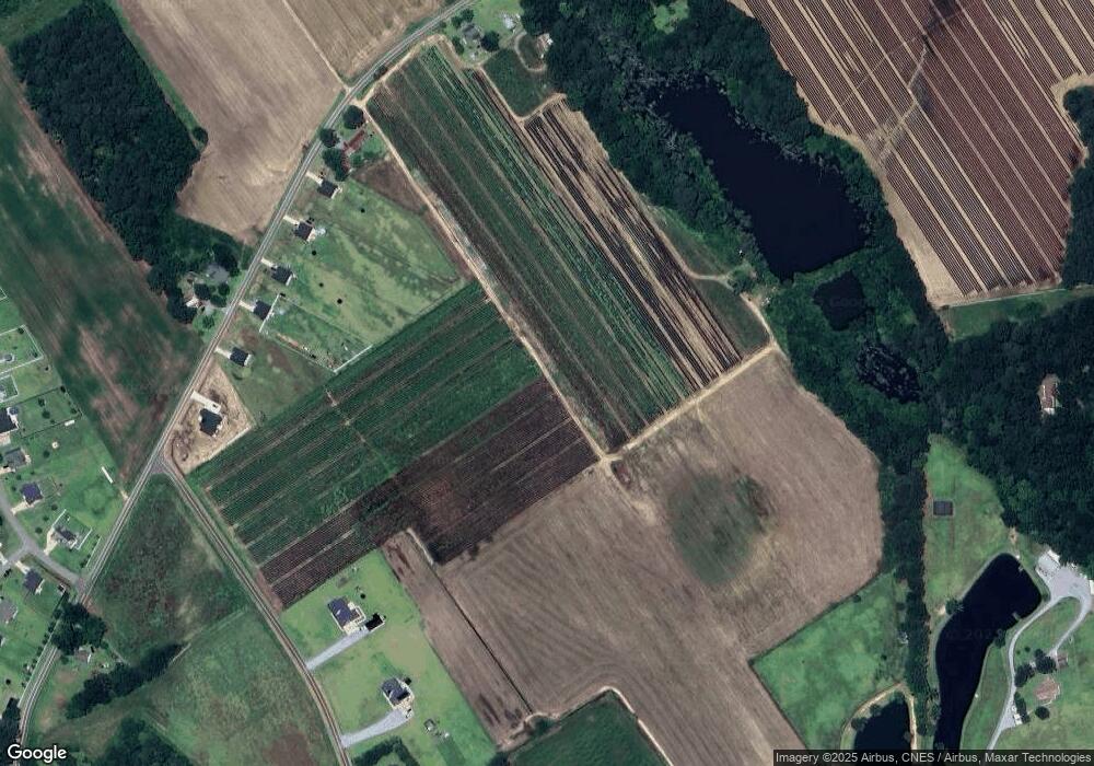
This home is located at 2012 Neighbors Rd, Dunn, NC 28334 and is currently estimated at $355,748, approximately $161 per square foot. 2012 Neighbors Rd is a home with nearby schools including Dunn Elementary School, Dunn Middle School, and Triton High School.
Ownership History
Date
Name
Owned For
Owner Type
Purchase Details
Closed on
Jun 22, 2023
Sold by
Pop Homes-Rdu Llc
Bought by
Aguilar Armando Cruz and Santos Elvis Luis
Current Estimated Value
Home Financials for this Owner
Home Financials are based on the most recent Mortgage that was taken out on this home.
Original Mortgage
$232,497
Outstanding Balance
$225,985
Interest Rate
6.35%
Mortgage Type
New Conventional
Estimated Equity
$129,763
Purchase Details
Closed on
Oct 27, 2022
Sold by
Mellot Randy A and Mellot Phyllis A
Bought by
Department Of Transportation
Purchase Details
Closed on
Mar 1, 2021
Sold by
Obriant Linda Sue and Obriant Thomas J
Bought by
Mellott Randy A and Mellott Phyllis A
Purchase Details
Closed on
May 1, 1997
Bought by
Barefoot Gladys Y
Create a Home Valuation Report for This Property
The Home Valuation Report is an in-depth analysis detailing your home's value as well as a comparison with similar homes in the area
Home Values in the Area
Average Home Value in this Area
Purchase History
| Date | Buyer | Sale Price | Title Company |
|---|---|---|---|
| Aguilar Armando Cruz | $310,000 | Fidelity National Title | |
| Department Of Transportation | -- | -- | |
| Department Of Transportation | -- | None Listed On Document | |
| Mellott Randy A | $74,000 | None Available | |
| Barefoot Gladys Y | -- | -- |
Source: Public Records
Mortgage History
| Date | Status | Borrower | Loan Amount |
|---|---|---|---|
| Open | Aguilar Armando Cruz | $232,497 | |
| Closed | Aguilar Armando Cruz | $6,974 |
Source: Public Records
Tax History
| Year | Tax Paid | Tax Assessment Tax Assessment Total Assessment is a certain percentage of the fair market value that is determined by local assessors to be the total taxable value of land and additions on the property. | Land | Improvement |
|---|---|---|---|---|
| 2025 | $2,248 | $295,833 | $0 | $0 |
| 2024 | $2,248 | $295,833 | $0 | $0 |
| 2023 | $293 | $40,030 | $0 | $0 |
| 2022 | $62 | $8,440 | $0 | $0 |
| 2021 | $398 | $44,700 | $0 | $0 |
| 2020 | $389 | $44,700 | $0 | $0 |
| 2019 | $73 | $8,570 | $0 | $0 |
| 2018 | $75 | $8,570 | $0 | $0 |
| 2017 | $75 | $8,570 | $0 | $0 |
| 2016 | $66 | $7,710 | $0 | $0 |
| 2015 | -- | $7,710 | $0 | $0 |
| 2014 | -- | $7,710 | $0 | $0 |
Source: Public Records
Map
Nearby Homes
- 115 Howards Ln
- 921 Tilghman Rd
- 4046 Fairground Rd
- 305 Chuck Wagon Way Unit 146p
- 4943 U S 301
- 1120 W Pope St
- 413 S Plentiful Way Unit 107p
- 415 W Plentiful Way
- 415 W Plentiful Way Unit 108p
- 1222 Brinkley Rd
- Lenox Plan at Benson Village
- TA4000 Plan at Benson Village
- Wakefield Plan at Benson Village
- Riley Plan at Benson Village
- TA3000 Plan at Benson Village
- Abington Plan at Benson Village
- Bedford Plan at Benson Village
- Drake Plan at Benson Village
- Kipling Plan at Benson Village
- Calgary Plan at Benson Village
- 2046 Neighbors Rd
- 1962 Neighbors Rd
- 1938 Neighbors Rd
- 1914 Neighbors Rd
- 1943 Neighbors Rd
- 2138 Neighbors Rd
- 135 Cornfield Ln
- 163 Cornfield Ln
- 52 Cornfield Ln
- 78 Cornfield Ln
- 106 Cornfield Ln
- 220 Cornfield Ln
- 214 Cornfield Ln
- 150 Cornfield Ln
- 221 Cornfield Ln
- 209 Cornfield Ln
- 189 Cornfield Ln
- 71 Cornfield Ln
- 113 Cornfield Ln
- 93 Cornfield Ln
Your Personal Tour Guide
Ask me questions while you tour the home.
