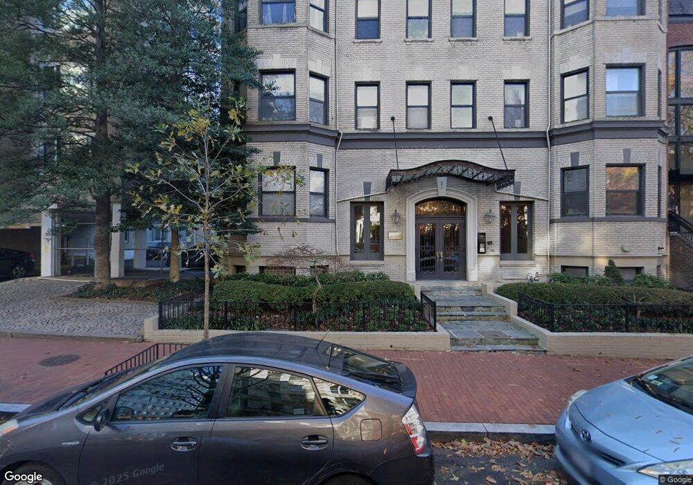
2012 O St NW Unit 44 Washington, DC 20036
Dupont Circle NeighborhoodEstimated Value: $480,000 - $568,000
2
Beds
1
Bath
716
Sq Ft
$736/Sq Ft
Est. Value
About This Home
This home is located at 2012 O St NW Unit 44, Washington, DC 20036 and is currently estimated at $527,002, approximately $736 per square foot. 2012 O St NW Unit 44 is a home located in District of Columbia with nearby schools including School Without Walls @ Francis-Stevens, Cardozo Education Campus, and Old Colony Montessori School.
Ownership History
Date
Name
Owned For
Owner Type
Purchase Details
Closed on
May 12, 2020
Sold by
Buerger Thomas S
Bought by
Bratt Eric James and Wang Tiffany
Current Estimated Value
Home Financials for this Owner
Home Financials are based on the most recent Mortgage that was taken out on this home.
Original Mortgage
$429,600
Interest Rate
3.1%
Mortgage Type
New Conventional
Purchase Details
Closed on
Mar 24, 2018
Sold by
Burger Thomas S
Bought by
Buerger Thomas S and Buerger George F
Purchase Details
Closed on
Feb 5, 2001
Sold by
Scolnick Nancy
Bought by
Buerger Thomas
Home Financials for this Owner
Home Financials are based on the most recent Mortgage that was taken out on this home.
Original Mortgage
$193,500
Interest Rate
6.89%
Create a Home Valuation Report for This Property
The Home Valuation Report is an in-depth analysis detailing your home's value as well as a comparison with similar homes in the area
Home Values in the Area
Average Home Value in this Area
Purchase History
| Date | Buyer | Sale Price | Title Company |
|---|---|---|---|
| Bratt Eric James | $537,000 | Federal Title & Escrow Co | |
| Buerger Thomas S | -- | None Available | |
| Buerger Thomas | $199,500 | -- |
Source: Public Records
Mortgage History
| Date | Status | Borrower | Loan Amount |
|---|---|---|---|
| Previous Owner | Bratt Eric James | $429,600 | |
| Previous Owner | Buerger Thomas | $193,500 |
Source: Public Records
Tax History Compared to Growth
Tax History
| Year | Tax Paid | Tax Assessment Tax Assessment Total Assessment is a certain percentage of the fair market value that is determined by local assessors to be the total taxable value of land and additions on the property. | Land | Improvement |
|---|---|---|---|---|
| 2025 | $4,027 | $489,460 | $146,840 | $342,620 |
| 2024 | $4,019 | $488,000 | $146,400 | $341,600 |
| 2023 | $3,199 | $475,030 | $142,510 | $332,520 |
| 2022 | $3,779 | $537,000 | $161,100 | $375,900 |
| 2021 | $3,467 | $497,480 | $149,240 | $348,240 |
| 2020 | $4,148 | $488,050 | $146,410 | $341,640 |
| 2019 | $3,977 | $467,900 | $140,370 | $327,530 |
| 2018 | $3,940 | $463,490 | $0 | $0 |
| 2017 | $3,828 | $450,330 | $0 | $0 |
| 2016 | $3,823 | $449,750 | $0 | $0 |
| 2015 | $3,647 | $429,060 | $0 | $0 |
| 2014 | -- | $385,240 | $0 | $0 |
Source: Public Records
Map
Nearby Homes
- 2012 O St NW Unit 12
- 1330 New Hampshire Ave NW Unit 612
- 1330 New Hampshire Ave NW Unit 215
- 1316 New Hampshire Ave NW Unit 503
- 1409 Hopkins St NW
- 1301 20th St NW Unit 316
- 1301 20th St NW Unit 901
- 2000 Massachusetts Ave NW
- 1280 21st St NW Unit 109
- 1280 21st St NW Unit 506
- 2119 N St NW Unit 6
- 1260 21st St NW Unit 107
- 1260 21st St NW Unit 1004
- 1260 21st St NW Unit 108
- 1260 21st St NW Unit 709
- 1260 21st St NW Unit 306
- 1260 21st St NW Unit 207
- 2122 N St NW Unit 1
- 2143 Newport Place NW
- 2114 N St NW Unit 32
- 2012 O St NW Unit 2012 O St NW Dupont
- 2012 O St NW
- 2012 O St NW Unit 33
- 2012 O St NW Unit 13
- 2012 O St NW Unit 35
- 2012 O St NW Unit 41
- 2012 O St NW Unit 32
- 2012 O St NW Unit 34
- 2012 O St NW Unit 52
- 2012 O St NW Unit 55
- 2012 O St NW Unit 25
- 2012 O St NW Unit 54
- 2012 O St NW Unit 53
- 2012 O St NW Unit 51
- 2012 O St NW Unit 45
- 2012 O St NW Unit 43
- 2012 O St NW Unit 42
- 2012 O St NW Unit 31
- 2012 O St NW Unit 23
- 2012 O St NW Unit 21