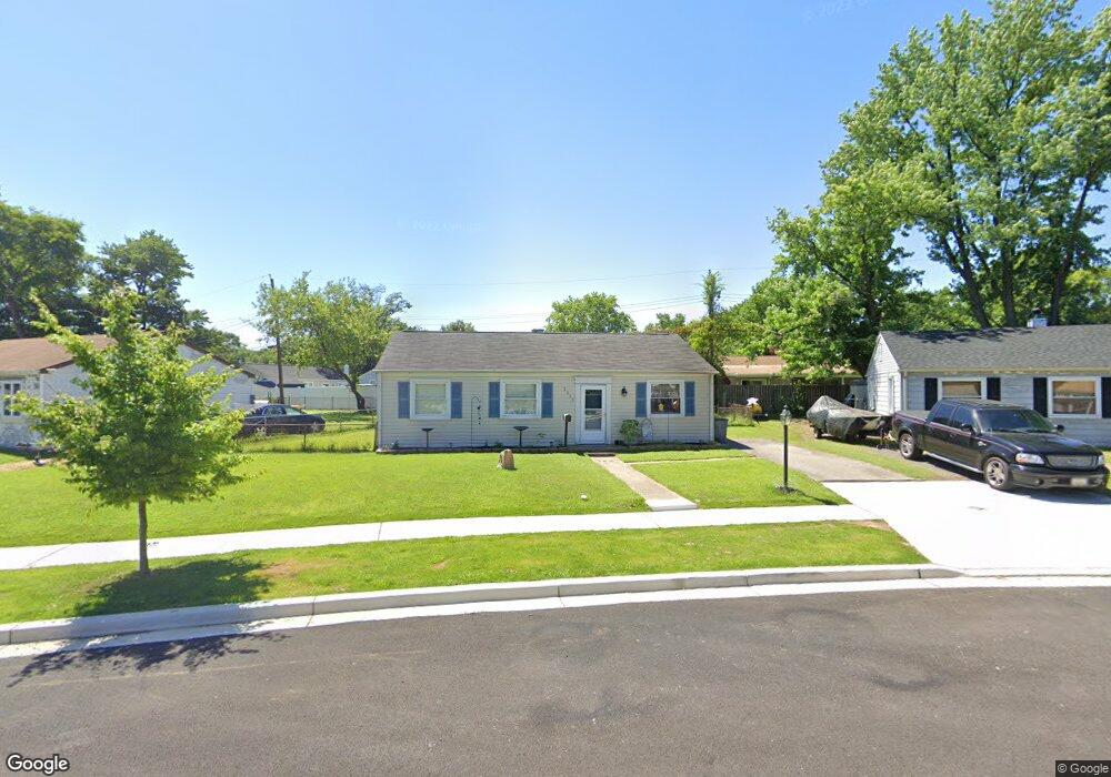
2012 Preston Rd Glen Burnie, MD 21060
Estimated Value: $296,000 - $322,000
--
Bed
1
Bath
988
Sq Ft
$312/Sq Ft
Est. Value
About This Home
This home is located at 2012 Preston Rd, Glen Burnie, MD 21060 and is currently estimated at $308,654, approximately $312 per square foot. 2012 Preston Rd is a home located in Anne Arundel County with nearby schools including Glendale Elementary School, Marley Middle School, and Glen Burnie High School.
Ownership History
Date
Name
Owned For
Owner Type
Purchase Details
Closed on
Aug 22, 2019
Sold by
Second Reversionary Partnership
Bought by
Ground Rents Llc
Current Estimated Value
Purchase Details
Closed on
Mar 11, 2005
Sold by
Tarun Wayne F
Bought by
Jordan Florence M
Home Financials for this Owner
Home Financials are based on the most recent Mortgage that was taken out on this home.
Original Mortgage
$150,000
Interest Rate
5.66%
Mortgage Type
New Conventional
Purchase Details
Closed on
Feb 15, 2005
Sold by
Tarun Wayne F
Bought by
Jordan Florence M
Home Financials for this Owner
Home Financials are based on the most recent Mortgage that was taken out on this home.
Original Mortgage
$150,000
Interest Rate
5.66%
Mortgage Type
New Conventional
Create a Home Valuation Report for This Property
The Home Valuation Report is an in-depth analysis detailing your home's value as well as a comparison with similar homes in the area
Home Values in the Area
Average Home Value in this Area
Purchase History
| Date | Buyer | Sale Price | Title Company |
|---|---|---|---|
| Ground Rents Llc | $30,352 | None Available | |
| Jordan Florence M | $187,500 | -- | |
| Jordan Florence M | $187,500 | -- |
Source: Public Records
Mortgage History
| Date | Status | Borrower | Loan Amount |
|---|---|---|---|
| Previous Owner | Jordan Florence M | $150,000 | |
| Previous Owner | Jordan Florence M | $150,000 |
Source: Public Records
Tax History Compared to Growth
Tax History
| Year | Tax Paid | Tax Assessment Tax Assessment Total Assessment is a certain percentage of the fair market value that is determined by local assessors to be the total taxable value of land and additions on the property. | Land | Improvement |
|---|---|---|---|---|
| 2025 | $2,723 | $215,600 | $143,300 | $72,300 |
| 2024 | $2,723 | $202,767 | $0 | $0 |
| 2023 | $2,548 | $189,933 | $0 | $0 |
| 2022 | $2,281 | $177,100 | $113,300 | $63,800 |
| 2021 | $2,240 | $173,200 | $0 | $0 |
| 2020 | $2,158 | $169,300 | $0 | $0 |
| 2019 | $2,119 | $165,400 | $103,300 | $62,100 |
| 2018 | $1,646 | $162,300 | $0 | $0 |
| 2017 | $1,986 | $159,200 | $0 | $0 |
| 2016 | -- | $156,100 | $0 | $0 |
| 2015 | -- | $147,733 | $0 | $0 |
| 2014 | -- | $139,367 | $0 | $0 |
Source: Public Records
Map
Nearby Homes
- 1701 Norfolk Rd
- 1613 Kimber Rd
- 1731 Saunders Way
- 1612 Lorimer Rd
- 1921 Norwich Rd
- 1702 Manning Rd
- 1909 Pagham Rd
- 206 Sandsbury Ave
- 8918 Twin Ridge Dr
- 100 Sandsbury Ave
- 201 Nina Ct
- 8903 Jeff Mar Dr
- 8906 Jeff Mar Dr
- 1003 Lee Rd
- 405 Morningside Dr
- 0 Irene Dr
- 180 Jessica Ln
- 822 Dale Rd
- 45 Chester Cir
- 1 Summit Ave
- 2010 Preston Rd
- 2014 Preston Rd
- 1911 Norman Rd
- 1913 Norman Rd
- 2008 Preston Rd
- 1909 Norman Rd
- 2016 Preston Rd
- 1915 Norman Rd
- 2015 Preston Rd
- 2013 Preston Rd
- 2018 Preston Rd
- 2017 Preston Rd
- 1907 Norman Rd
- 2006 Preston Rd
- 2011 Preston Rd
- 1917 Norman Rd
- 2009 Preston Rd
- 1905 Norman Rd
- 2004 Preston Rd
- 1919 Norman Rd