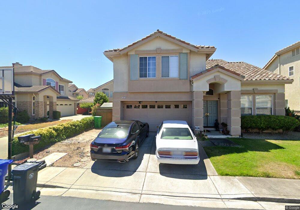
2012 Royal Wings Way San Leandro, CA 94579
Heron Bay NeighborhoodEstimated Value: $1,183,000 - $1,306,000
4
Beds
3
Baths
2,255
Sq Ft
$554/Sq Ft
Est. Value
About This Home
This home is located at 2012 Royal Wings Way, San Leandro, CA 94579 and is currently estimated at $1,248,169, approximately $553 per square foot. 2012 Royal Wings Way is a home located in Alameda County with nearby schools including Dayton Elementary School, Washington Manor Middle School, and Arroyo High School.
Ownership History
Date
Name
Owned For
Owner Type
Purchase Details
Closed on
Aug 2, 2018
Sold by
Lau Yue Edward Wing Chuen and Lau Yue Sannie
Bought by
Lau Yue Edward Wing Chuen and Lau Yue Sannie
Current Estimated Value
Purchase Details
Closed on
Nov 15, 2011
Sold by
Yue Edward W and Yue Sannie L
Bought by
Yue Edward W and Yue Sannie L
Home Financials for this Owner
Home Financials are based on the most recent Mortgage that was taken out on this home.
Original Mortgage
$220,000
Outstanding Balance
$22,045
Interest Rate
3.87%
Mortgage Type
New Conventional
Estimated Equity
$1,226,124
Purchase Details
Closed on
Dec 30, 1998
Sold by
Dover Investments Corp
Bought by
Lau Yue Edward Wing Chuen and Lau Yue Sannie
Home Financials for this Owner
Home Financials are based on the most recent Mortgage that was taken out on this home.
Original Mortgage
$264,100
Interest Rate
6.73%
Create a Home Valuation Report for This Property
The Home Valuation Report is an in-depth analysis detailing your home's value as well as a comparison with similar homes in the area
Home Values in the Area
Average Home Value in this Area
Purchase History
| Date | Buyer | Sale Price | Title Company |
|---|---|---|---|
| Lau Yue Edward Wing Chuen | -- | None Available | |
| Yue Edward W | -- | North American Title Co Inc | |
| Lau Yue Edward Wing Chuen | $354,500 | First American Title Guarant |
Source: Public Records
Mortgage History
| Date | Status | Borrower | Loan Amount |
|---|---|---|---|
| Open | Yue Edward W | $220,000 | |
| Previous Owner | Lau Yue Edward Wing Chuen | $264,100 |
Source: Public Records
Tax History Compared to Growth
Tax History
| Year | Tax Paid | Tax Assessment Tax Assessment Total Assessment is a certain percentage of the fair market value that is determined by local assessors to be the total taxable value of land and additions on the property. | Land | Improvement |
|---|---|---|---|---|
| 2025 | $6,989 | $548,094 | $166,638 | $388,456 |
| 2024 | $6,989 | $537,212 | $163,371 | $380,841 |
| 2023 | $6,956 | $533,543 | $160,168 | $373,375 |
| 2022 | $6,854 | $516,083 | $157,028 | $366,055 |
| 2021 | $6,664 | $505,828 | $153,950 | $358,878 |
| 2020 | $6,519 | $507,569 | $152,371 | $355,198 |
| 2019 | $6,531 | $497,619 | $149,384 | $348,235 |
| 2018 | $6,168 | $487,863 | $146,455 | $341,408 |
| 2017 | $5,881 | $478,299 | $143,584 | $334,715 |
| 2016 | $5,744 | $468,923 | $140,769 | $328,154 |
| 2015 | $5,618 | $461,880 | $138,655 | $323,225 |
| 2014 | $5,534 | $452,833 | $135,939 | $316,894 |
Source: Public Records
Map
Nearby Homes
- 509 Santa Ynez
- 112 Santa Teresa
- 117 Santa Teresa
- 440 Santa Monica
- 2213 Wigeon Ct
- 154 Santa Teresa
- 362 Santa Paula
- 1950 Randy St
- 2218 Charter Way
- 15102 Chapel Ct
- 1315 Mersey Ave
- 1875 Willow Ave
- 14617 Doolittle Dr
- 14587 Doolittle Dr
- 15067 Churchill St
- 14666 Wiley St
- 15382 Andover St
- 2444 Belvedere Ave
- 1803 Cedar Ave
- 2515 Galleon Place Unit 129
- 2016 Royal Wings Way
- 2010 Royal Wings Way
- 2013 Liberty Way
- 2015 Liberty Way
- 2011 Liberty Way
- 2013 Royal Wings Way
- 2015 Royal Wings Way
- 15201 Shining Star Ln
- 2017 Liberty Way
- 2011 Royal Wings Way
- 2017 Royal Wings Way
- 2020 Royal Wings Way
- 15193 Shining Star Ln
- 15205 Shining Star Ln
- 2019 Liberty Way
- 2019 Royal Wings Way
- 2016 Orion Ct
- 2012 Liberty Way
- 2018 Orion Ct
- 2016 Liberty Way