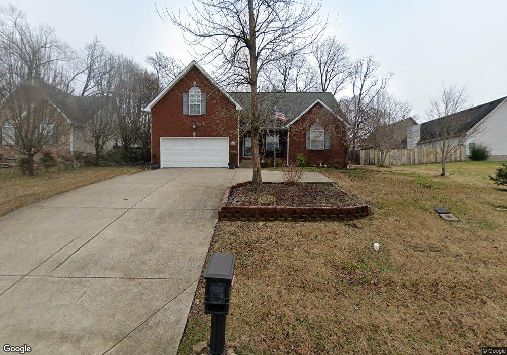
2012 Summit Ln La Vergne, TN 37086
Estimated Value: $335,000 - $393,000
3
Beds
2
Baths
1,555
Sq Ft
$237/Sq Ft
Est. Value
About This Home
This home is located at 2012 Summit Ln, La Vergne, TN 37086 and is currently estimated at $367,883, approximately $236 per square foot. 2012 Summit Ln is a home located in Rutherford County with nearby schools including Cedar Grove Elementary School, Rock Springs Middle School, and Lavergne High School.
Ownership History
Date
Name
Owned For
Owner Type
Purchase Details
Closed on
Jan 6, 2012
Sold by
Veterans Affairs Secretary
Bought by
Giannetti Bernardo J
Current Estimated Value
Home Financials for this Owner
Home Financials are based on the most recent Mortgage that was taken out on this home.
Original Mortgage
$90,500
Outstanding Balance
$62,340
Interest Rate
4.08%
Mortgage Type
Commercial
Estimated Equity
$305,543
Purchase Details
Closed on
Jul 11, 2011
Sold by
Dunn Charles H
Bought by
Veterans Affairs Secretary Of
Purchase Details
Closed on
Jun 10, 2005
Sold by
Fortress Builders Inc
Bought by
Dunn Charles H
Home Financials for this Owner
Home Financials are based on the most recent Mortgage that was taken out on this home.
Original Mortgage
$162,418
Interest Rate
5.7%
Mortgage Type
VA
Create a Home Valuation Report for This Property
The Home Valuation Report is an in-depth analysis detailing your home's value as well as a comparison with similar homes in the area
Home Values in the Area
Average Home Value in this Area
Purchase History
| Date | Buyer | Sale Price | Title Company |
|---|---|---|---|
| Giannetti Bernardo J | $128,000 | -- | |
| Veterans Affairs Secretary Of | $123,382 | -- | |
| Dunn Charles H | $159,000 | -- |
Source: Public Records
Mortgage History
| Date | Status | Borrower | Loan Amount |
|---|---|---|---|
| Open | Giannetti Bernardo J | $90,500 | |
| Previous Owner | Dunn Charles H | $162,418 |
Source: Public Records
Tax History
| Year | Tax Paid | Tax Assessment Tax Assessment Total Assessment is a certain percentage of the fair market value that is determined by local assessors to be the total taxable value of land and additions on the property. | Land | Improvement |
|---|---|---|---|---|
| 2025 | $1,768 | $73,275 | $13,750 | $59,525 |
| 2024 | $1,768 | $73,275 | $13,750 | $59,525 |
| 2023 | $1,375 | $73,275 | $13,750 | $59,525 |
| 2022 | $1,184 | $73,275 | $13,750 | $59,525 |
| 2021 | $1,096 | $49,375 | $8,625 | $40,750 |
| 2020 | $1,096 | $49,375 | $8,625 | $40,750 |
| 2019 | $1,096 | $49,375 | $8,625 | $40,750 |
| 2018 | $1,388 | $49,375 | $0 | $0 |
| 2017 | $1,299 | $35,800 | $0 | $0 |
| 2016 | $1,299 | $35,800 | $0 | $0 |
| 2015 | $1,308 | $35,800 | $0 | $0 |
| 2014 | $890 | $35,800 | $0 | $0 |
| 2013 | -- | $35,450 | $0 | $0 |
Source: Public Records
Map
Nearby Homes
- 584 Old Nashville Hwy
- 324 Chaney Rd Unit 5
- 328 Chaney Rd Unit 6
- 332 Chaney Rd Unit 7
- 336 Chaney Rd Unit 8
- 411 Wooded Valley Ct
- 150 Nelson Dr
- 522 Lydia Ashley Ln
- 518 Lydia Ashley Ln
- 0 Old Nashville Hwy Unit RTC2671318
- 486 Lydia Ashley Ln
- 482 Lydia Ashley Ln
- 200 Tyler Cornerstone Trail
- 474 Lydia Ashley Ln
- 320 Chaney Rd
- 224 Tyler Cornerstone Trail
- 473 Lydia Ashley Ln
- 470 Lydia Ashley Ln
- 421 Heath Place
- 433 Heath Place
- 2014 Summit Ln
- 1901 Champlain Dr
- 1903 Champlain Dr
- 2016 Summit Ln
- 2017 Summit Ln
- 2015 Summit Ln
- 2019 Summit Ln
- 1905 Champlain Dr
- 2013 Summit Ln
- 2021 Summit Ln
- 2011 Summit Ln
- 1900 Champlain Dr
- 1907 Champlain Dr
- 2020 Summit Ln
- 1902 Champlain Dr
- 2023 Summit Ln
- 2009 Summit Ln
- 1904 Champlain Dr
- 1909 Champlain Dr
- 1906 Champlain Dr
Your Personal Tour Guide
Ask me questions while you tour the home.