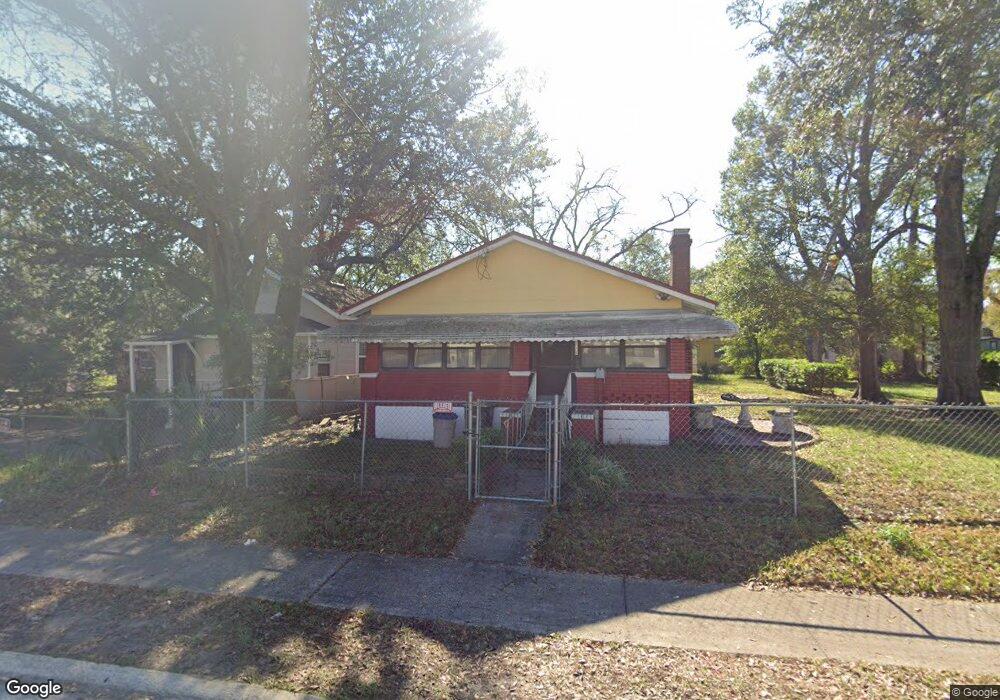
2012 W 12th St Jacksonville, FL 32209
College Gardens/Mid-West NeighborhoodEstimated Value: $63,000 - $98,000
2
Beds
1
Bath
728
Sq Ft
$106/Sq Ft
Est. Value
About This Home
This home is located at 2012 W 12th St, Jacksonville, FL 32209 and is currently estimated at $77,461, approximately $106 per square foot. 2012 W 12th St is a home located in Duval County with nearby schools including Smart Pope Livingston Elementary School, Susie E. Tolbert Elementary School, and Lake Shore Middle School.
Ownership History
Date
Name
Owned For
Owner Type
Purchase Details
Closed on
Oct 26, 2016
Sold by
Phillip King Investments Inc
Bought by
Rizea Daniel and Rizea Tina C
Current Estimated Value
Purchase Details
Closed on
Feb 24, 2006
Sold by
Simon Latrall
Bought by
Phillip King Investments Inc
Purchase Details
Closed on
Mar 22, 2005
Sold by
Simon Annie Mae and Simon Latrall
Bought by
Simon Latrall
Purchase Details
Closed on
Apr 30, 1999
Sold by
Simon Annie Mae
Bought by
Simon Annie Mae and Simon Latrall
Create a Home Valuation Report for This Property
The Home Valuation Report is an in-depth analysis detailing your home's value as well as a comparison with similar homes in the area
Home Values in the Area
Average Home Value in this Area
Purchase History
| Date | Buyer | Sale Price | Title Company |
|---|---|---|---|
| Rizea Daniel | -- | Attorney | |
| Phillip King Investments Inc | $24,000 | Gibraltar Title Services | |
| Simon Latrall | -- | -- | |
| Simon Annie Mae | $1,474 | -- |
Source: Public Records
Tax History Compared to Growth
Tax History
| Year | Tax Paid | Tax Assessment Tax Assessment Total Assessment is a certain percentage of the fair market value that is determined by local assessors to be the total taxable value of land and additions on the property. | Land | Improvement |
|---|---|---|---|---|
| 2025 | $765 | $32,869 | -- | -- |
| 2024 | $739 | $37,645 | $4,995 | $32,650 |
| 2023 | $739 | $37,891 | $4,995 | $32,896 |
| 2022 | $644 | $32,332 | $3,645 | $28,687 |
| 2021 | $578 | $23,036 | $2,565 | $20,471 |
| 2020 | $271 | $5,345 | $2,160 | $3,185 |
| 2019 | $264 | $4,830 | $2,025 | $2,805 |
| 2018 | $255 | $4,063 | $1,350 | $2,713 |
| 2017 | $255 | $3,991 | $1,350 | $2,641 |
| 2016 | $249 | $3,618 | $0 | $0 |
| 2015 | $247 | $3,439 | $0 | $0 |
| 2014 | $405 | $14,197 | $0 | $0 |
Source: Public Records
Map
Nearby Homes
- 2027 W 12th St
- 0 W 11th St Unit 2042078
- 2021 Mc Millan St
- 2031 Danson St
- 2502 Mc Millan St
- 0 W 10th St Unit 2104700
- 2126 Spires Ave
- 1904 Spires Ave
- 2133 W 15th St
- 1844 W 11th St
- 1778 Spires Ave
- 2058 W 18th St
- 1819 W 10th St
- 1916 Pullman Ct
- 1779 W 10th St
- 2229 W 10th St
- 1750 W 14th St
- 0 Ella St
- 1951 W 19th St
- 1753 W 12th St
- 2026 W 12th St
- 2116 Mcmillan St
- 2116 Mc Millan St
- 2011 W 11th St
- 2108 Mcmillan St
- 2027 W 11th St
- 2047 W 11th St
- 2102 Mcmillan St
- 2207 Mcmillan St
- 2034 W 12th St
- 2102 Mc Millan St
- 2035 W 11th St
- 2202 Mcmillan St
- 2015 W 12th St
- 2023 W 12th St
- 2034 W 11th St
- 2027 W 12th St Unit 1
- 2027 W 12th St Unit 2027 w 12th St 2
- 2027 W 12th St
- 2027 W 12th St Unit B