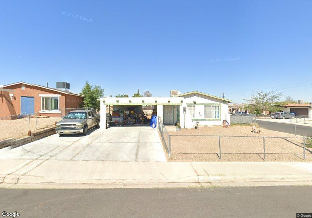
2012 Yosemite Dr Barstow, CA 92311
Estimated Value: $237,149 - $287,000
4
Beds
2
Baths
1,067
Sq Ft
$237/Sq Ft
Est. Value
About This Home
This home is located at 2012 Yosemite Dr, Barstow, CA 92311 and is currently estimated at $252,787, approximately $236 per square foot. 2012 Yosemite Dr is a home located in San Bernardino County with nearby schools including Crestline Elementary School, Barstow Junior High School, and Barstow High School.
Ownership History
Date
Name
Owned For
Owner Type
Purchase Details
Closed on
Jul 30, 2009
Sold by
Hasman Doris
Bought by
Tennort John
Current Estimated Value
Home Financials for this Owner
Home Financials are based on the most recent Mortgage that was taken out on this home.
Original Mortgage
$20,000
Outstanding Balance
$13,100
Interest Rate
5.3%
Mortgage Type
Stand Alone Second
Estimated Equity
$239,687
Purchase Details
Closed on
Jun 8, 2009
Sold by
Deutsche Bank National Trust Company
Bought by
Tennort John
Home Financials for this Owner
Home Financials are based on the most recent Mortgage that was taken out on this home.
Original Mortgage
$20,000
Outstanding Balance
$13,100
Interest Rate
5.3%
Mortgage Type
Stand Alone Second
Estimated Equity
$239,687
Purchase Details
Closed on
Jun 23, 2008
Sold by
Valencia John
Bought by
Deutsche Bank National Trust Co and Impac Secured Assets Corp Mortgage Pass
Purchase Details
Closed on
Jan 3, 2007
Sold by
Zamora Richard R and Zamora Cassandra J
Bought by
Valencia John
Home Financials for this Owner
Home Financials are based on the most recent Mortgage that was taken out on this home.
Original Mortgage
$137,600
Interest Rate
7.5%
Mortgage Type
Purchase Money Mortgage
Purchase Details
Closed on
Jun 15, 2006
Sold by
Zamora Cassandra J and Guzman Joseph M
Bought by
Zamora Richard R and Zamora Cassandra J
Purchase Details
Closed on
Mar 18, 1999
Sold by
Miller Robert E and Miller Janice L
Bought by
Rivas Cassandra J and Guzman Joseph M
Home Financials for this Owner
Home Financials are based on the most recent Mortgage that was taken out on this home.
Original Mortgage
$56,534
Interest Rate
7.1%
Mortgage Type
FHA
Purchase Details
Closed on
Dec 4, 1997
Sold by
Bankers Trust Company Of California Na
Bought by
Miller Robert E and Miller Janice L
Purchase Details
Closed on
Apr 24, 1997
Sold by
Williams Ozella L
Bought by
Bankers Trust Company Of California Na and Southern Pacific Secured Assets Corp Mtg
Create a Home Valuation Report for This Property
The Home Valuation Report is an in-depth analysis detailing your home's value as well as a comparison with similar homes in the area
Home Values in the Area
Average Home Value in this Area
Purchase History
| Date | Buyer | Sale Price | Title Company |
|---|---|---|---|
| Tennort John | -- | Landsafe Title | |
| Tennort John | $70,000 | Landsafe Title | |
| Deutsche Bank National Trust Co | $114,750 | Landsafe | |
| Valencia John | $172,000 | Stewart Title Of California | |
| Zamora Richard R | -- | Accommodation | |
| Rivas Cassandra J | $57,000 | Commonwealth Land Title | |
| Miller Robert E | $24,500 | Fidelity National Title Co | |
| Bankers Trust Company Of California Na | $45,000 | Chicago Title Co |
Source: Public Records
Mortgage History
| Date | Status | Borrower | Loan Amount |
|---|---|---|---|
| Open | Tennort John | $20,000 | |
| Previous Owner | Tennort John | $52,808 | |
| Previous Owner | Valencia John | $137,600 | |
| Previous Owner | Rivas Cassandra J | $56,534 |
Source: Public Records
Tax History
| Year | Tax Paid | Tax Assessment Tax Assessment Total Assessment is a certain percentage of the fair market value that is determined by local assessors to be the total taxable value of land and additions on the property. | Land | Improvement |
|---|---|---|---|---|
| 2025 | $2,259 | $90,358 | $38,725 | $51,633 |
| 2024 | $2,144 | $88,587 | $37,966 | $50,621 |
| 2023 | $1,745 | $86,850 | $37,222 | $49,628 |
| 2022 | $1,137 | $85,147 | $36,492 | $48,655 |
| 2021 | $1,833 | $83,477 | $35,776 | $47,701 |
| 2020 | $2,166 | $82,621 | $35,409 | $47,212 |
| 2019 | $1,885 | $81,001 | $34,715 | $46,286 |
| 2018 | $2,009 | $79,412 | $34,034 | $45,378 |
| 2017 | $1,328 | $77,855 | $33,367 | $44,488 |
| 2016 | $1,803 | $76,329 | $32,713 | $43,616 |
| 2015 | $2,131 | $75,183 | $32,222 | $42,961 |
| 2014 | $1,726 | $73,710 | $31,591 | $42,119 |
Source: Public Records
Map
Nearby Homes
- 2037 Sequoia Dr
- 2040 Yosemite Dr
- 2024 Rushmore Dr
- 2013 Rushmore Dr
- 936 Pinon Dr
- 1000 Windy Pass Unit Space 97
- 1000 Windy Pass Unit 81
- 1000 Windy Pass Unit 61
- 1000 Windy Pass Unit Spc 146
- 1000 Windy Pass Unit 130
- 1000 Windy Pass Unit 104
- 1000 Broadway Ave
- 761 Upton Dr
- 924 Condor St
- 1340 Tara St
- 1512 Solana Ct
- 2040 Princeton Dr
- 1260 Mirage Dr
- 1412 Sunset St
- 1517 De Anza St
- 2012 Yosemite Dr
- 2016 Yosemite Dr
- 2013 Sequoia Dr
- 2020 Yosemite Dr
- 2017 Sequoia Dr
- 1021 Glacier Dr
- 1017 Glacier Dr Unit 1
- 1017 Glacier Dr
- 2013 Yosemite Dr
- 2009 Yosemite Dr
- 2021 Sequoia Dr
- 2024 Yosemite Dr
- 2017 Yosemite Dr
- 2024 Yosemite Ct
- 2005 Yosemite Dr
- 2021 Yosemite Dr
- 1009 Glacier Dr
- 2025 Sequoia Dr
- 2028 Yosemite Dr
- 2001 Yosemite Dr
Your Personal Tour Guide
Ask me questions while you tour the home.